September 2018
Day one
At 9 o’clock on the morning of September 24, Bill and I were all packed and ready to roll. Question was; ‘where to?’ We both pulled out our phones and checked the weather networks. The local forecast showed several days of clouds and showers followed by a couple of days of downpour and then perhaps some more rain. Pretty depressing. We had decided last week that we both had the time to take a week and see if we could avoid this forecasted wet stuff. We wanted to head south but Pennsylvania was no better and Virginia was in the middle of their 3rd or 4th major storm this summer. ‘Hey,its not raining in Michigan’. ‘OK, lets go’. And so it was decided.
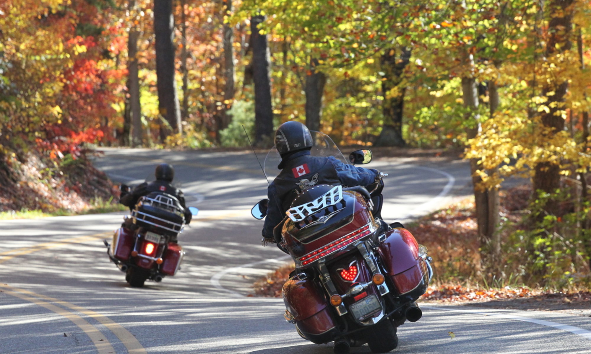
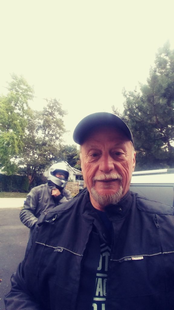
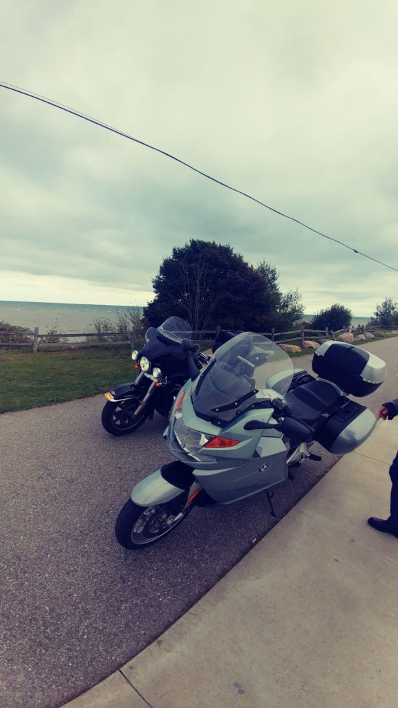
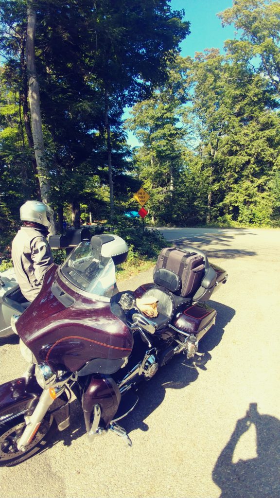
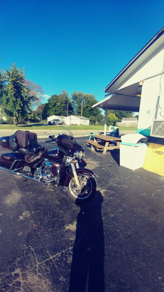
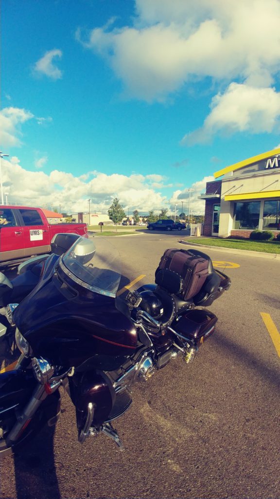
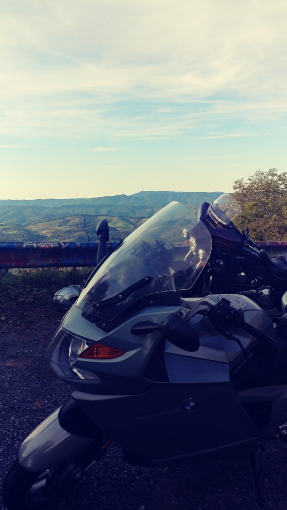
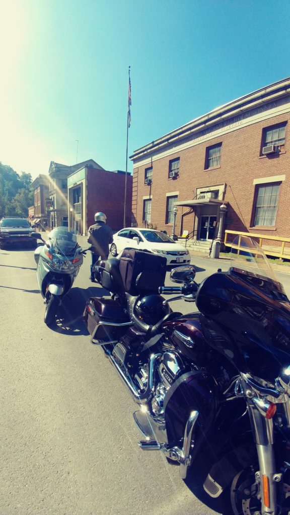
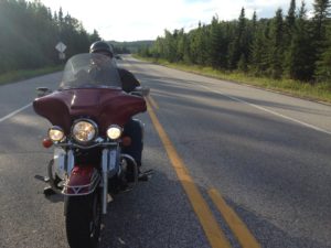
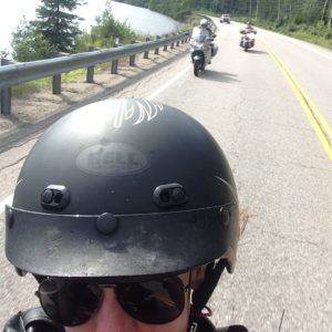
I hopped on my 2014 Harley Ultra and Bill jumped onto his 2008 BMW 1200. Both bikes were packed, luggage strapped down and fuel tanks full. We waved a goodbye to our wives and off we went. Bill and I have traveled together a fair bit and we rarely plan where today will end or what road we will take to get there. I preferred getting ‘lost’ on the less traveled secondary roads and Bill was content to follow along, using his GPS just so he could tell everyone where he went today.
I decided that since we knew all the local back roads, that we would hit the hiway until we crossed the border at Sarnia. The 403, 401 and 402 are the most boring roads in Ontario, but they get you somewhere quickly. By 11:15am we were at the border, sitting in that dreaded long line-up on the Blue Water bridge. This bridge is the main route for transport trucks heading west. But the only alternative is the tunnel or bridge at Detroit, and we wanted to head northwest today.
Finally in Port Huron, we stopped at Tim Horton’s. Bill rarely eats breakfast until noon, and Tims serves breakfast late, and it was right there when we got off at the first Michigan exit. Neither of us had ever really explored Michigan and decided to just take route 25 up the coast of Lake Huron. Route 25 is a fairly commercial and busy road, not exactly what we were looking for, but not entirely a waste, there are some very nice views over the lake and several ‘cottagey’ little towns. We cut inland on hiway 142 just so we could go thru a town called ‘Bad Axe’. Then turned north and up to Port Austin and back onto hiway 25 making a stop at a combination laundromat and coffee shop in Caseville. Excellent free-trade coffee and home made butter tarts, while listening to the dryer and washing machines rumble in the next room, the proprietor told us that this was his last week before him and the packed up and headed to Florida for 4 months. Pretty eclectic place.
Back on the road and south toward Vassar and then west to Frankenmuth. They are very proud of its large German population. The downtown is chock full of Bavarian architecture and is one of those places that sport the spirit of Christmas year round. Frankenmuth is also the birthplace of the new rock sensation ‘Greta Van Fleet’. The town centre was packed, the traffic inched along, there was no convenient place to park and it started to rain. Just a light drizzle, but it was the dreaded wet stuff we had been trying to avoid. It was only 4pm so lets just keep rolling.
We wandered around in a generally north and west direction avoiding major roads and the city of Saginaw. By 6:30 we had arrived at Mount Pleasant. Time to look for a hotel. Just after I pulled down the main street, I spotted a Comfort Inn with a restaurant attached. Perfect. We checked in, got a decent rate ($115usd) and were told that the manager was hosting a small reception in the breakfast area until 7pm, here are 2 tickets for wine or beer. Munchies are free as well. We tarped the bikes, threw the luggage in the room and went down to take advantage of the free goodies.
Then it was over to the in house restaurant. I let Bill lead the way. He made a wrong turn and ended up at the swimming pool; should have used that GPS. I back tracked and found the hall leading to Bennigan’s Pub. The waitress greeted us like we were old friends and sat us in the corner so she could stand and talk to us away from the eyes of her manager. Very odd old bird, but friendly. Food was okay, I had a mediocre veggie burger; Bill seemed to enjoy his cheeseburger. After 2 beers each we were back at the room by 9pm. We flipped on the TV and sort of watched the Monday night football game, before agreeing to switch off the lights about 10:30. All in all a good start to this road trip. About 610kms.
Day two
At the free breakfast we checked out the weather networks and google maps. The sun was getting ready to peek out from behind the clouds and forecast was for 20c and sunny in north-central Michigan. It was still raining in Indiana and Virginia; so north it was. But not too far north, the forecast in Sault Ste Marie was only for a high of 14C.
We hit the road about 9am and headed north thru town. Mount Pleasant appeared to be a very pleasant little university city, but I never did see the ‘Mount’. At the downtown intersection I decided to head west on what turned out to be a real nice bendy back road. Route 20 wandered around a bit thru farms and small towns. I headed north on Rte 37 and then east on Hwy 10 to a pretentiously named Kings Hiway which meandered around and lead us back to Rte 37. We headed north and into Traverse City. Nice place.
Downtown Traverse City has a wonderful waterfront park where we stopped for a photo op. A couple of older gents in a beat up Ford pick up parked beside us and started to chat. The driver told us of his rickety old Road King sitting in his son’s garage for several years now. When they found out we were from Burlington they acted like we had ridden around the world to get here. Wow. When I told them we had no particular plans for today’s ride,‘just avoiding the rain’; they suggested hwy 22 up to Northport and down to Leland. Why not…..
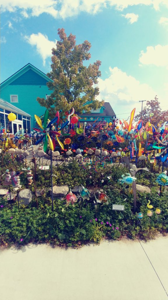
Just up hwy 22 we passed thru the village of Sutton’s Bay. The main street is chock-a-block with eclectic touristy shops, galleries and cafes. I had to stop and take a few photos of a shop with about 1000 garden variety windmills out front. Totally awesome. Good thing we were on the bikes and not in the SUV, we would have purchased several.
Hwy 22 was a lovely little road that followed along the coast and up a peninsula, thru several small cottage towns and old fishing villages. Most of the villages had that ‘off-season’ feeling and were almost deserted. The cutest of which was Peshawbestown. Not much there, but it was pretty and the view over the lake was great. We did find a small mom and pop café. Nothing special but the coffee was hot.
We carried on up hwy 22 thru Northport and up hwy 201 to Lelanau State Park. We were disappointed to discover that access to the park was limited and required payment of a parking fee to get past the gate. We had hoped to at least see the point and lighthouse, but the trees along the roadblocked all views. The road dead-ended here and we had to trace our route back down to hwy 22. Oh well.
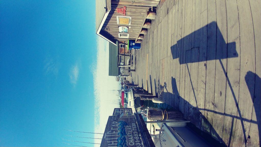
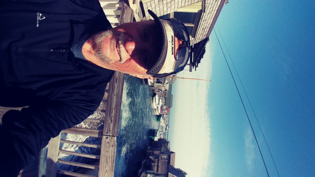
The highlite of the day was the old fishing village of Leland. Leland is kept alive by the ferry terminal and the tourists stopping for lunch at one of the 3 cafes. The ferries run twice a day and service the 2 islands offshore in Lake Michigan. The ferry terminal is shiny and new with big beautiful public bathrooms. The old fishing village, called Fishtown, has about a dozen old huts converted into touristy shops peddling beach wear, souvenirs of the fishing era, smoked fish,local beer and knic knacs. The huts are all perched along the Lelanau River which connects Lake Michigan to Lake Lelanau. There is a walking bridge leading over the river and the falls to the Falling Waters Inn. I had to check it out.The Inn looks to be about 100 years old and is perched along the river’s eastern bank. The rooms are small but all overlook the river and waterfall. The rates are rather steep in the summer, but reasonable in the fall and with the 3 local pubs, could be an interesting place to spend a day or two. But not this trip. We decided not to stop but did sit and eat the bananas we had taken from the free breakfast area at the Comfort Inn this morning. While we were sitting there a man came over to tell us about his Street Glide. His wife hated riding so he was in the car today. I did ask if he knew where the closest gas station was and he pointed us down hwy 22, turn right on E Duck Lake Road. Thanks.
After fueling up at the Duck Lake BP, we continued on down hwy 22. I pulled into a little plaza in Glen Arbour with a big sign promising local ice cream. It was closed. Very disappointed. A teenager walking past laughed and reminded us that it is September, off season. I told him that we were Canadians, ice cream is rarely ‘off season’. Oh well.
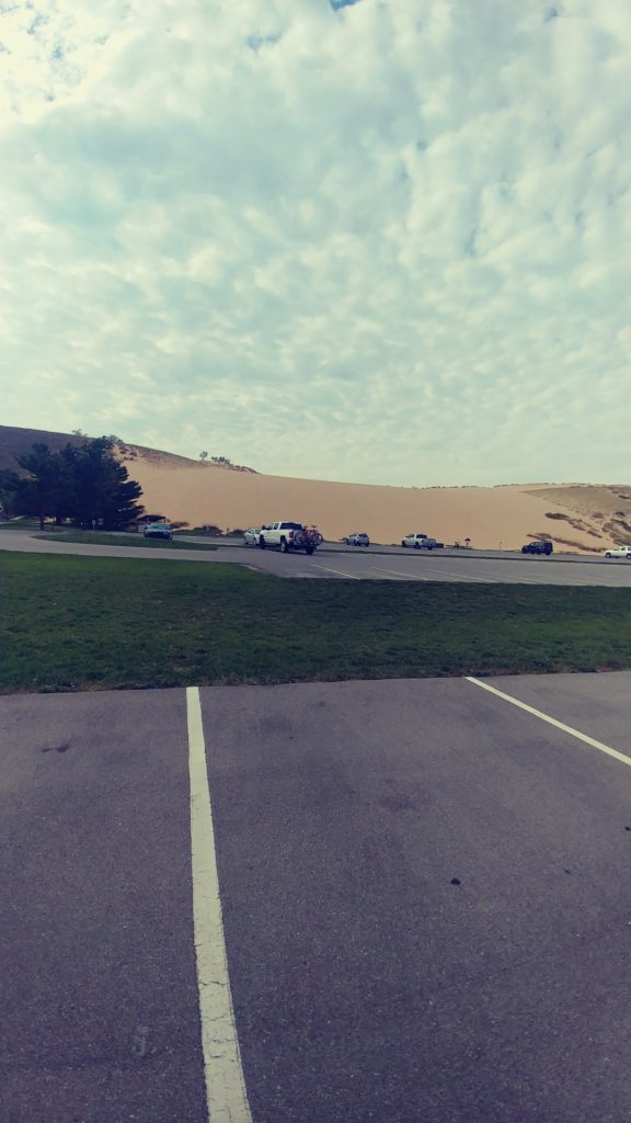
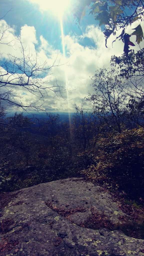
Just down the road I got tired of the same scenery and decided to take ‘Mountain Road’ running off to the left. It wound up the hill and around a golf course, past an aging resort and back down to the hwy. Oh well, a small scenic diversion at least. At Arcadia we pulled into the Dunes State Park. Again we were met by agate requiring us to pay for parking. I explained to the guard that we were not going to park, just wanted a picture of the dunes. OK, just stay in the first lot and exit that way. The ‘dunes’ are a natural phenomenon towering about 100 feet above Lake Michigan. Several people were climbing the dunes and sliding back down. Looked much like the Sand Hills near Port Rowan on Lake Erie.Obviously very popular in the summertime.
We carried on down hwy 22 til it ended at Hwy 31. We pulled off at the next road which only went about 5 miles before it dumped us back onto Hwy 31. We did this a few times before I decided that we might as well stay on the Hwy and head down to Muskegon for the night. We had discovered that most of the motels along the coastline were closed for the season; Muskegon was large enough to have a choice of hotels.
We got off Hwy 31 at the main Muskegon exit and followed it downtown past all the regular tacky shops and cafes. This is not a very prosperous looking place. We reached the downtown core without passing a single motel or hotel. Bill checked his GPS and found us a Holiday Inn. Quite pleasant with an in-house restaurant and bar. The bright sunshine of the lovely afternoon had given way to overcast skies and the threat of rain. So, Holiday Inn it is. The meal was mediocre, I don’t recall what it was, but it was not great. We had intended to check out a bar down the street but as we finished eating, it started raining. We settled on the Inn bar. It was cold and uninteresting. Back to the room by 9pm. Mr Trump had been up to his usual antics that day and it was quite interesting to watch CNN and Fox News to get the different takes on the adventure. Its amazing how a preordained view point can interpret one sentence in a tweet so differently. Quite amazing.
Day 3
The $125usd for the room did not include breakfast. We declined the $8.99 special at the restaurant and opted to find something down the road.I headed south on business 31, stopping at the Majeir Gas bar to fuel up. There was a McDonalds next door so I guess its time for breakfast. We carried on down Lake Harbour Hiway primarily to avoid Hwy 31 and the morning business traffic.I managed to keep us on the secondary roads until we reached Ferrysburg where we had to hop on to Hwy 31 to cross the Grand River.

I jumped back off the hwy as soon as we were over the bridge and entered the upscale tourist town of Grand Haven. The main street lead down to the harbor and was lined with trendy shops and cafes. Nothing that interested us and we rode to the end stopping at the waterfront park. The wind had picked up substantially,the sky was partially overcast and the temperature hovered around 15C. We parked and walked along the boardwalk. Out in the surf along with the 3 foot waves, was a one windsurfer trying to get his board out past the breakwall. He was edging along the pier attempting to avoid the severity of the near gale force winds. He was determined, but eventually gave up about 100 feet out and laid down on his board and rode back to shore. Back on the bikes, I keep us on the Lakeshore Road most of the way down the coast of Lake Michigan until we were forced to jump back onto Hwy 31, then along hwy 43 and 40 thru PawPaw and eventually into Indiana.
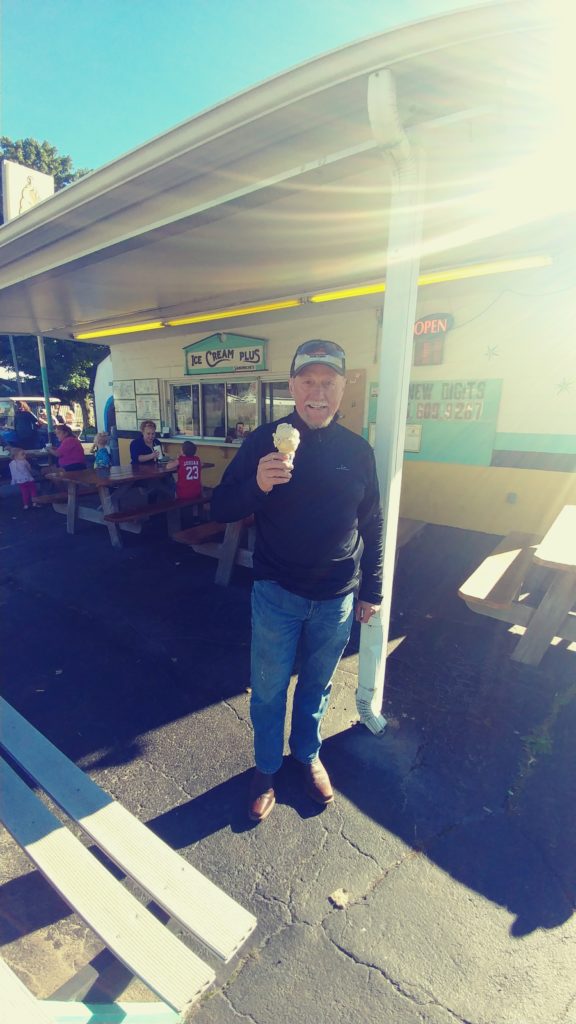
Somehow we ended up on rte 13 and managed to avoid Fort Wayne. Then rte 9 to avoid Indianapolis. Rte 9 is flat, straight and boring;resembling a miniature prairie landscape. About 3:30pm we passed thru the small village of Fountaintown where we found a delightful little ice cream shop. I’m sure it must have been the centre of this village since the 50s. The bulletin board on the outside wall proudly proclaimed that the high school football team had beaten the neighbouring school last Friday. The schedule for the rest of the season was there for all to read. The weather was now bright and sunny,about 25c and several car loads of kids freshly out of the local school were being treated to a cone by their moms. We sat at a picnic table on the side of the road with about 6 kids enjoying this special treat. Two of the boys eyeballed the bikes and wanted to inspect more closely. ‘Don’t touch’instructed Mom. We just smiled and nodded.
We headed east along 52, 43 and then 27. By 6pm the skies had become overcast again and we started looking for a hotel. We crossed over into Ohio and found a Comfort Inn in Oxford. There was a gas station across the street, fuel and beer. OK. The hotel was adequate and was full of construction workers. All friendly especially ‘Ted’, who regaled us with his tale of riding his Kawasaki to New Orleans and back last year. When the girl at the front desk found out we were from Canada, she was amazed. She has never been outside Ohio and Indiana. We asked her where we should have dinner. Definitely don’t go to that Chinese restaurant next door. (it was actually a Japanese/Thai). She said there were several places downtown, but it was 3 blocks away and we might not want to walk that much. She obviously thought it was too far. It was starting to drizzle and we didn’t want to ride, so the Bob Evans a few doors down would have to do. What a mistake. The fish was overcooked and the fries were cold.The coleslaw was fine. Back to the room, a couple of beers and to bed by 10:30.
Another great 650km day.
Day 4
Up early, free breakfast and a quick walk downtown. Oxford is a very quaint little university town. The downtown is ideally suited for the 20-something crowd and old retired people. It was not that far to walk after-all; we should have ventured over last night. The local coffee shop was packed with old guys telling each other tall tales; the cobble stoned main street was just starting to congest with young adults rushing to class or office or shop.
The forecast for today is ominous. We don’t think there is anyway to avoid the rain. There is a huge cell coming in past Chicago with a swath that is roughly aligned in a narrow path from Milwaukee to Louisville,heading toward Washington. We think that if we head east for a few hours we can stay ahead of it til about noon. Then we will make a right turn and head south trying to traverse the storm at its narrow point. Right now it looks to be about 100 miles across, so about 2 hours of nasty wet. That’s our plan, and away we go.
We traveled east along rte 73 stopping at the McDonald’s in Middletown for coffee. The sky was starting to show increased cloud cover but we were enjoying the rolling countryside and bendy roads. Rte 73 turned south and I stopped at a gas bar in Bacon Flats. The sky was looking more scary and I decided to put on the rain gear. Good timing, the drizzle started just as we pulled back on the road. By the time we got to Portsmouth it was a torrential downpour making it very difficult to see the road signs. I made an incorrect judgement turn and went south on hwy 8, which wound back around to hwy 10. I assumed that if I was going south on 8 and turned left onto hwy 10 that I was going east again.Wrong. It said west, so I turned left on hwy 7 to go south. Wrong. I ended back on hwy 23 at Portsmouth. An hour doing a circle in the pouring rain. Great. Perhaps a GPS would have helped today. But, hwy 23 is a major hwy heading south thru the Kentucky hills. It is a great ride in the sunshine, not so nice in the pouring rain. After another 3 hours of this steady downpour we still could not see any light at the end of the road. My rainsuit had started to leak at the seams and I was cold. The water was running down the road off the hillsides and pooling in huge puddles. At one point the cars in the far curb lane splashed us, 4 lanes away. 4pm. Time to find a hotel.
I saw a billboard for a Quality Inn, 11 miles ahead, with a BBQ bar. Perfect. About 20kms later I pulled off at Prestonburg, still no sign of the Quality Inn. Bill checked his GPS. It showed a Comfort Inn downtown, so off we went. We toured around the 3 blocks of the downtown area 3 times. No Comfort Inn. No inn of any kind. We did see a Super 8 at the hiway interchange.Oh well. The Super 8 was cheap, only $67, including breakfast. But it was dry and reasonably clean. There was a plaza next door with a WalMart and a Little Caesars take-out. I put on my dry little nylon shell jacket and pulled up the hood. Bill borrowed a small purple umbrella from the lady at the check in counter. Real cute Bill. We grabbed a large pizza and a 12 pack of YuengLing at the WalMart. OK, we were set for the night. Watched some dumb movie, ate the pizza, drank 3 beers each.
Only about 400kms today. And about half of them very wet.
Day 5
Breakfast was about what you might expect for a cheap inn. I had the sausage gravy and biscuits with my scrambled eggs. It was like eating salty Elmers Glue. Yummy. Bill even relented and had the scrambled eggs. They did not have any fruit for us to snag for our elevens’s.
Back onto Hwy 23. About 2 minutes down the road we passed the Quality Inn with Mosby’s Bar and Grill in the front. Oh well. I’m sure it would be more expensive.
As I said, Hwy 23 is a wonderful roadway thru the Appalacian Mountains. Just a few miles down the road from Prestonburg is Pikeville, home of the infamous Hatfields and McCoys. The weather was still unsettled and I was eager to get further south and into the promised sunshine. I made a mental note to schedule a road trip here in the near future. I peeled off at Alt58 and made my way down to Abingdon, Va where we stopped for coffee at the McDonalds. The sun was shining.Time to take off the rain gear.
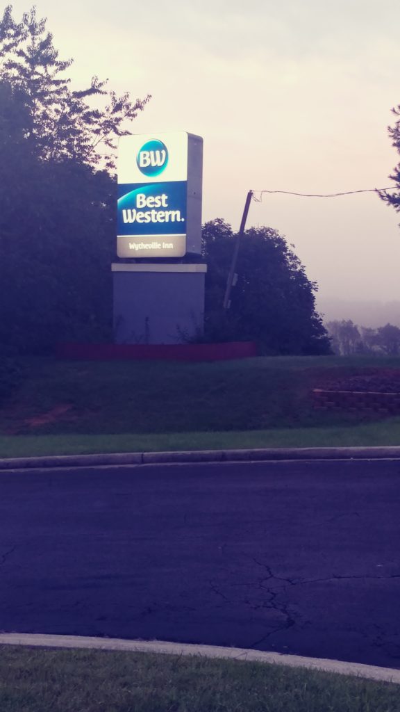
Sitting at the McDonalds, utilizing the free WiFi, we checked the weather. The next few days looked fabulous. I am very familiar with this region of Virginia and decided that we should stay in the area a couple of nights. I booked the Best Western at Wytheville. I have stayed there several times.
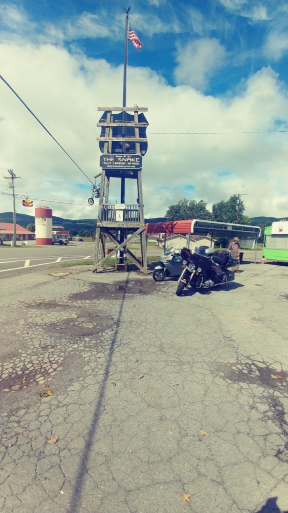
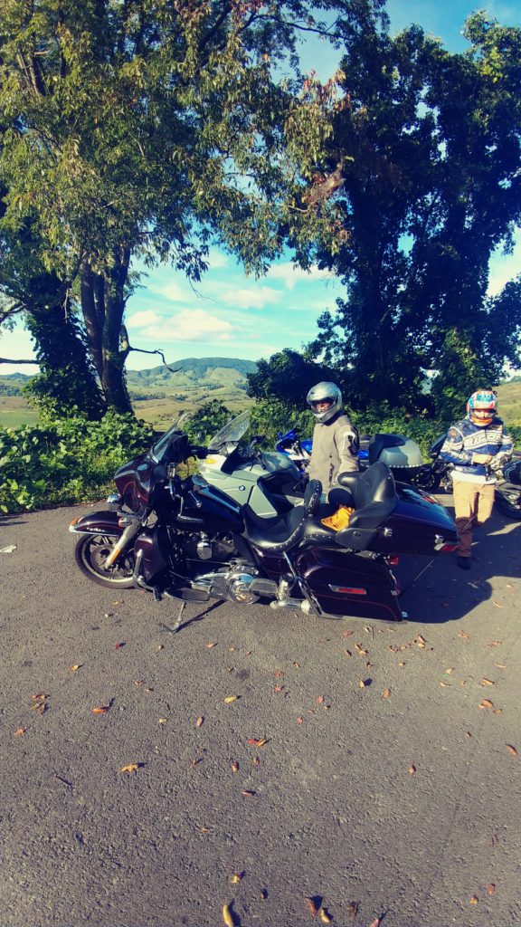
One of my favourite places in the area is Shady Valley. Rte421 thru Shady Valley is the heart of the great roadway known as the ‘Snake’.Bill had never been in the Tennessee mountains and I was thrilled to start him off on this great road. The Snake crosses a mountain on either side of Shady Valley. Make sure you stop at the General Store at the crossroads in the middle of the valley, pick up a patch, shirt or sticker. Both mountains have their fair share of switchbacks, vistas and tight turns. A good challenge for his BMW. In his youth Bill did some Moto Cross racing so I was sure he would enjoy the challenge. He was thrilled.
From there we headed along 421 to Big Laurel Road and onto Hwy 88. I don’t think there is a bad road in this whole region. Bendy Roads Rule.. It is a thrill to ride in the sunshine on these great mountain roads. WooHoo. Out thru Warrensville and onto Hwy 16 and then Hwy 58 to Independence.
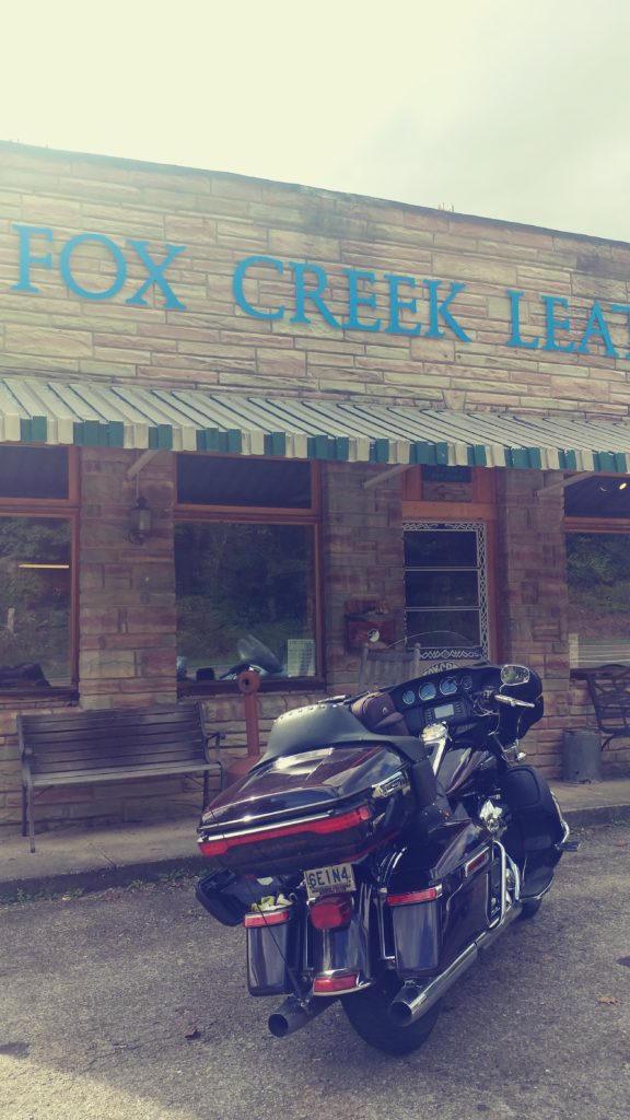
One of the things I do when here is head over to Independence and grab a new set of gloves at Fox Creek Leather. I found these deer skin gloves several years ago and now won’t wear anything else on the bike. I particularly like the tan gauntlets with frills. I wear them all the time, they are cool in the summer heat and warm in the fall and spring. And the style suits me just fine. They have become my signature gloves.
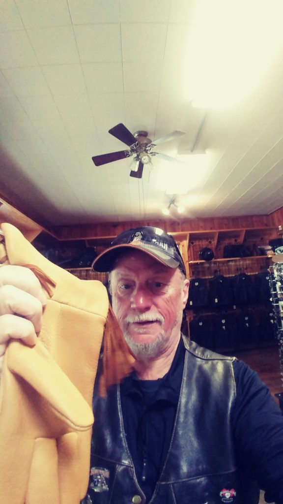
The girl at the counter was amazed that we had ridden fromBurlington to buy these gloves. She checked the computer and found that this was my 3rd visit to the store and that I had also ordered online twice. My gloves are $75us. She gave me a 15% discount. I bought my regular gauntlets as well as a pair of driving gloves for the car. Bill bought a pair of regular driving gloves and got the 15% discount as well.
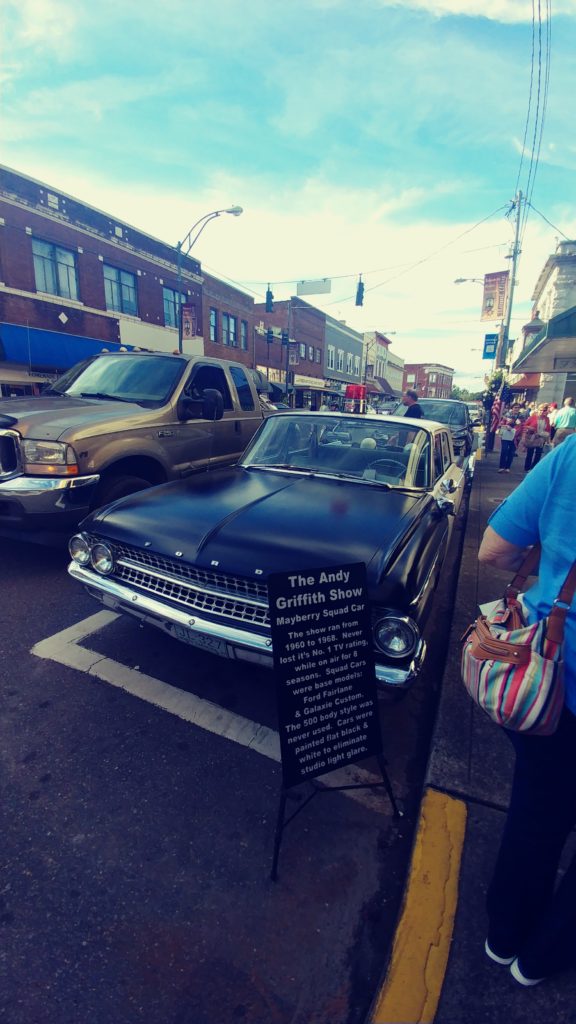
It was only 3pm and we had already booked the room for tonight so I decided to take Bill to Mayberry. Well actually Mount Airy, NC,but made famous as the set for the Andy Griffith show in the 60s. I went down Hwy 21 to rte 18 and onto Hwy 89 into Mount Airy. I parked on a side street downtown just as a 1963 Ford police car passed. Bill grabbed his phone and chased the cruiser to the corner to get a photo. Apparently his first car was a 1963 Ford Fairlane. We walked onto the main street and found 3 more old police cars. They were being used as tourist attractions and touring people around the sites, for a fee. Still cool.
We walked down the street checking out the overpriced Mayberry crap. I did buy a ‘Barney’ t-shirt from a street vendor for $10 and stopped at the Main Street café for an ice cream. On the way back to the parked bikes we ran into ‘Barney’; well actually a look alike dressed in the classic uniform. We noticed that all the tourists were our age. Makes you wonder what will happen to this town in 20 years when there won’t be anyone alive who ever watched the Andy Griffith show.
We headed north out of town intending to hit Hwy 52, but I missed the turn and stayed on N Main St. That turned into Wards Gap Road, real nice. I figure any road that is a ‘Gap’must be good. Gap means it passes thru the gap in the mountains to get to the next valley. I then turned off Wards Gap onto Orchard Gap road. Good choice.Amazing little twisty with a couple of short switchbacks. That road ended at the Blue Ridge Parkway; cool. We turned on to the parkway and followed it over to Hwy 97 and then up to Galax. It was 6pm and I decided that we should get to the hotel and check in, so over to hwy 77 and up to Wytheville.
We checked into the Best Western, put the left over beer into the fridge and headed over to El Puerto Mexican restaurant. This is a great little Tex-Mex place. Wonderful ambiance, good food, inexpensive with excellent family service. We each had a combo and a Dos Equus. Total bill was less than $30. Back to the BW by 9pm. One cold one each and into bed.
A great 650km day.
Day 6
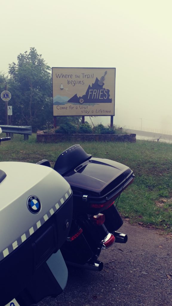
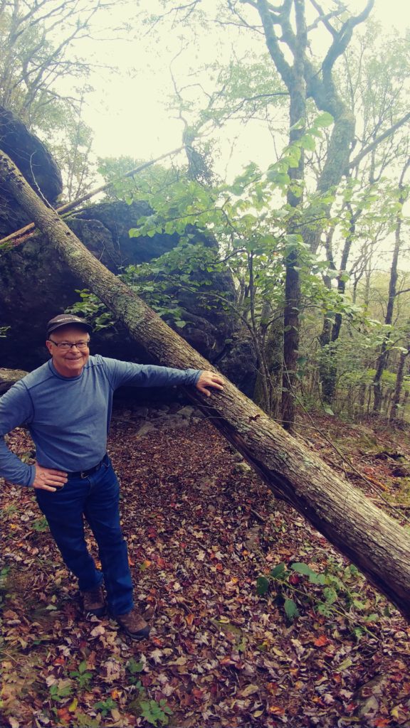
Today was just for wandering around in the mountains. So out 61 and down thru Fort Chiswell, down 94 with a quick stop at the old hydro plant in Fries. Turned right on 221/58 and over to the Grayson Highlands State Park. Time for some exercise; we hit the hiking trail. About 5km up and down the mountain. Very scenic, very strenuous. Not bad for a couple of old guys. Rested in the parking lot for a drink of water and to eat the stolen bananas. Back onto Hwy 58 and over to Damascus following a large group of bikes at a leisurely pace for the last 20 miles. At the gas station I noticed one of the guys on a new Harley examining his bike, the left side hwy peg was missing. I asked and he explained that a large cube van going the other way hit him on one of the corners. It contacted the end of the hiway peg and it snapped off. He was extremely lucky it broke instead of bouncing him sideways. His buddy who was riding behind him said that ‘Greg’ was over the centre line on the corner, it was not the trucks fault. Greg disagreed. We filled up with gas and decided to forgo the ice cream so we could get on the road in front of the group and keep a better pace.
I headed out 91 and onto 605 east. I wandered around, back and forth until I reached 601. Hwy 601 is a county road and one of several rte 601s in the state. It is one of those smaller back roads that meander around the mountains and you have to pay special attention at each intersection to make sure you follow the signs to stay on the route. It is well worth it.Wonderful scenery and twisties. Great stuff. I made my way out to Hwy 11, past Wytheville and went north on 77 to 52North and Bastian. Then west on 614 and 61 to 623 and Burke’s Garden.
Burke’s Garden is a special little hidden valley with only one access road. Hwy 623 climbs steeply up the side of the mountain with several tight switchbacks and a few outstanding vistas. Then down a steep drop into the Valley. Burkes Garden was settled by Mr Burke in the 1700s. He discovered it on a hunting trip and returned later with his family. It is now a thriving Amish community. Unknown to us, today was a special day in the valley and a festival was underway. The circular road around the valley was packed as was the General Store parking lot. We did manage to find a parking spot in front of the Telephone office but we were too late for the festival, they were tearing down the vendor tents. We had to suffer the slow ride back over the mountain with the other tourists.
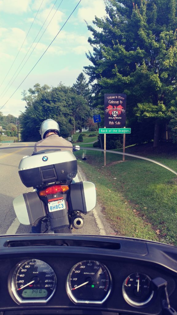
Back on Hwy 61 I turned right and over to Tazewell. Tazewellmarks the top end of the roadway known as ‘The Back of the Dragon’. The Back runs down Highway 16 from Tazewell to Marion, over 3 mountains and thru scenic valleys. Just as we entered Thompson Valley 2 sport bikes raced past us; a fairly common site here. Thompson Mountain is the furthest north and is the tallest but each mountain has its own special features. The best view is from the pull off at the top of the middle mountain. Part of that section sweeps down a bendy road with green Kudzu vines encroaching on both sides then the road climbs from the valley with sharp rock cuts on one side and the valley below on the other. Just as we were leaving the valley floor we saw one of the sport bikes parked in the Kudzu on the far side of the roadway. He waved that he was fine and we carried on. His pal had pulled over at the lookout spot half way up the hill. We pulled in beside him. A few minutes later the other bike pulled in. He claimed he simply pulled off the road to take pictures, he had never seen anything quite as amazing as this vast valley and had never ridden a road with the Kudzu encroaching like this. He was from Georgia where they have lots of this invasive vine but nothing like this.
At the top of the third mountain you enter the edge of Hungry Mother State Park. There is a pull over spot next to the sign and along a guardrail looking over the valley. A couple of other bikers were stopped here and we joined them. The view is spectacular. This is the one thing in which the Back of the Dragon excels over its more famous cousin, the ‘Tail of the Dragon’,the views. And this one is my favourite. The road down off this section of the mountain is full of switchbacks, sweeping curves and scenic views. At the bottom is the entrance to the camp grounds of Hungry Mother Park. Legend has it that the name comes from a time when a very young native boy was found alone wondering in the woods. The only words he could say were ‘Hungry’ and ‘Mother’. Hmmm. About 5kms past the park is the town of Marion. And just before you reach Hwy 11 there is an old Drive-In Theatre, arcade and Ice cream shop. Well, there used to be. The building is still there but it is closed. I was very disappointed, they had the best ice cream; Hersey’s dark chocolate raspberry truffle. Darn…
We turned right on hwy 11 and headed back toward Wytheville.The old downtown area of Wytheville is reminiscent of the typical 1920 architecture that many of the boom towns of that era enjoyed. It now shows signs of gentrification and renewal, but like all old towns has suffered. There is a museum here that displays the peak of the 1950s, before the super expressways, when hwy 21 was one of the main corridors for travelers from Cleveland/Detroit enroute to Florida. We stopped at Black Bear Harley just because and I purchased the mandatory long sleeve T-shirt. I don’t know why I bother, they are all overpriced and I have at least 20 in the closet. Were turned to the BW for a quick freshen up then decided to head back over to El Puerto for dinner. You just can’t beat good and inexpensive. Back to the room by 9pm, a quick beer and into bed. Tomorrow starts the long trek home.
Another great 620km day.
Day 7
Well, today we had to admit that the vacation is nearly over. Time to head back north. Heartbreaking, the weather is forecast to be nothing but sunshine and near 25C; and we are in one of the most amazing biking areas around. Oh well, as Bill said ‘it means we have to return next year’. Deal.
I decided we should treat ourselves to another ride up the Back of the Dragon. Like all great roadways, it presents itself quite differently going north than the trip you rode yesterday southbound. Today, its Bill’s turn to lead. I have been running the Harley pretty hard and am experiencing some slight noise from the front brakes when they get heated. So I will take it a little easier today just to make sure I make it home. Let Bill have some fun and ride at his own pace. So, over to Marion, past the closed ice cream shop and Hungry Mother Park. The Back did not disappoint. It was spectacular.
In Tazewell I took the front position again and lead us over to the official ‘Back of the Dragon’ store. Danny and his wife have purchased the rights to the name and over the past few years have been actively promoting the road and biking in the area. Plans are nearing the final stages for a café and inn in the vacant parking lot out front. Hopefully they will break ground in the spring of 2019. Danny is full of info and knows all the inns and cafe sin the area as well as all the repairs shops. If you need anything while in the area, just give him a call.
Hwy 16 is not just the Back, it stretches for several hundred miles from Ohio to North Carolina. Danny has promoted his section in Virginia,attracting biking enthusiasts from all over, but the hwy is just as spectacular for most of its length. So we decided to carry on and explore some of the northerly route. It is great. Hwy 16 continues up thru the mountains, down thru valleys, twisting and meandering along rivers, thru small towns. One of my favourite sections is the approach to the City of War, WV. The road is carved from the rock overlooking the river in the valley below. The best part is about 2 miles of sweeping twisties with that rock cut on one side and the guardrail over the river one the other. The view down the road is like a picture postcard demanding that you just let her loose and enjoy. The rolling twisties are gentle enough that you can see the whole 2 miles, so you know where each apex is and that no one will be in your way. I pushed the Harley hard. I am quite used to this type of riding and drag the floorboards on each side as I rock back and forth around the turns; but I surprised myself when I went past the floorboard on one turn, hit the mounting bracket and lifted the back tire.High-sided. Bill says I left a 2 foot gouge in the road surface. It was a bit of a shock but I gave the Harley a quick nudge and she responded with both tires on the blacktop without slowing down. WooHoo.
The City of War used to be the hub of the very prosperous coal mining industry in the 1920s. The old downtown core is pretty decrepit these days and because it is Sunday, nothing is open. I was hoping to stop by the War Café and chat with Obine again. Obine claims to have the best coffee in the area (not) and refuses to admit that she is a closet Democrat even though she has several pictures of John Kennedy on the walls. Oh well, next trip.

We stayed on Hwy 16 heading north, passing thru several small, old coal mining towns. Most were in a sad state. Many of the houses appeared to be abandoned, none of the shops were open. Extreme poverty has taken over most of the area since the coal mines ceased operations and most of the younger people have moved away to the cities. A few of the homes were obviously enjoyed by retired people with pensions; the well tended gardens stood out in sharp contrast to the crumbling structures next door. Sad.
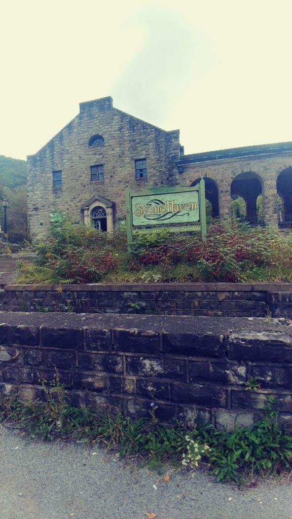
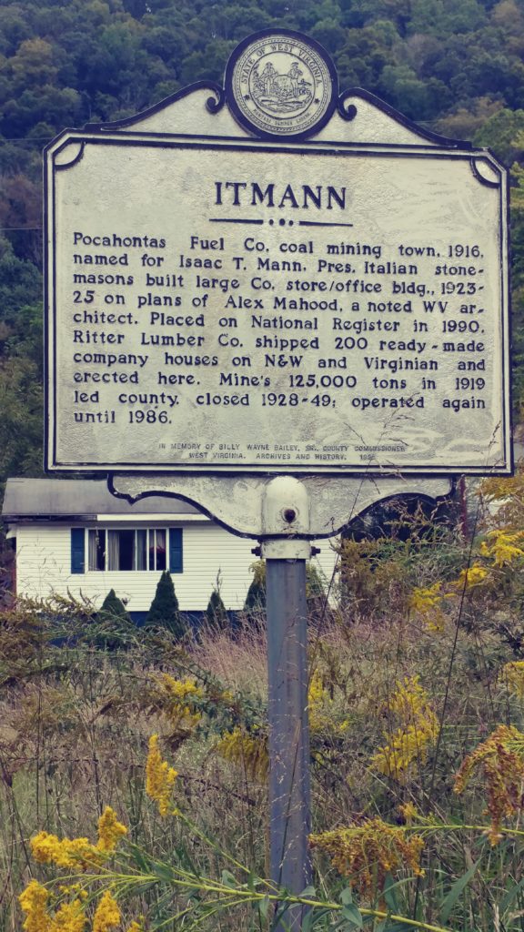
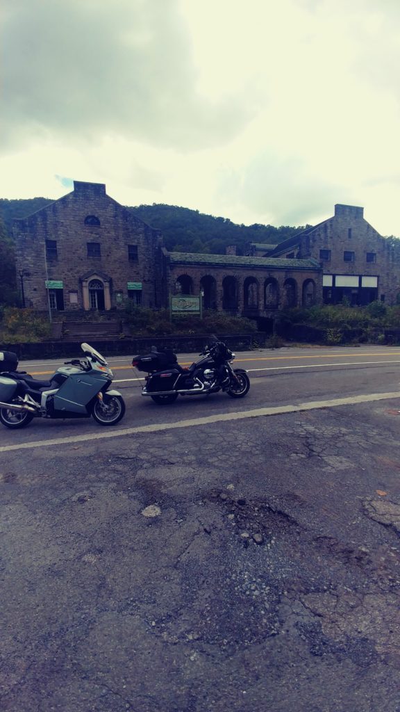
We stopped in the village of Itmann, WV drawn by the massive old building on the side of the road. This huge structure was at least 25,000 sqft with a drive-in courtyard and arched-covered walkway. The sign posted at the foot of one of the two massive staircases proclaimed that it was built as a company store/offices by the Pocahontas Coal company in 1916. It was easy to imagine this impressive stone structure as being the centre of a thriving, booming industry. The doors were open and we took some time to stroll around, absorbing the atmosphere.
Back on the bikes and northward. At the first bump my phone flew from its ram mount and down the road. I guess I forgot to tighten it. I stopped and ran back picking up the pieces. The screen was scratched, the back panel bent, but when I put the battery back in, it seemed to work fine. But the back plate was bent too far to secure properly and the scratch was right across the face. Oh well, it was time for a new one anyway.
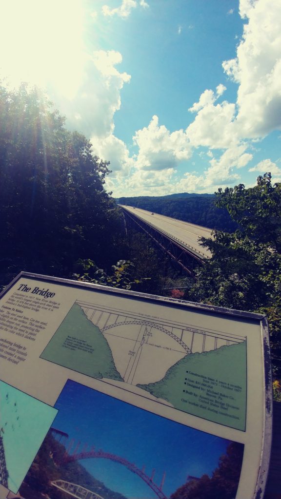
We carried on up Hwy 16, enjoying all the twisties and vistas. Well, until we got to Beckley and got stuck in the traffic. I veered off at hwy 19 and ran over to the New River Gorge bridge. It is spectacular and marvelous piece of engineering. The largest single span bridge in North America.Wow. On the tourist map in the parking lot Bill spotted a road leading down under the bridge and crossing the river in the valley. OK, but first a stop at the souvenir shop across the street for an ice cream.

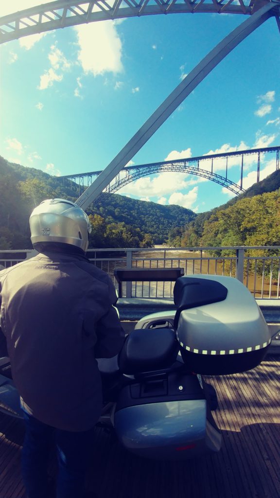
The valley road was posted for travel in one direction,luckily we were headed the right way. It twisted as a single lane most of the way along the valley rock cuts, thru some maintained forests and under the massive steel structure. Very impressive view of the bridge from down there. At the bottom was a new looking Bailey type bridge spanning the river. We stopped and asked a young tourist to take our photo. Thanks Conchita from Cleveland.The road continued on the west side of the valley up thru the state park,exiting onto hwy 19. I turned right and then right again onto hwy 16 north again.

A few miles down the road I pulled into a parking lot crowded with other people enjoying a Sunday drive in this great fall weather,to view the Cathedral Falls. Truly stunning. Back onto hwy 16, then right at Gauley Bridge onto hwy 39 meandering our way back to hwy 19 at Summersville. It was after 5pm and I thought it best to run the highway for awhile; didn’t want to leave too many miles for the last leg home. North on 19 and east on 79 to Flatwoods. We decided to check into the Days Inn conference centre with its in-house bar and restaurant. Unfortunately this is Sunday, the restaurant is closed. There is a Mexican restaurant in the plaza across the street. Oh well,Tex-Mex and Dos Equus again. We can do that.
Day 8
The final leg….
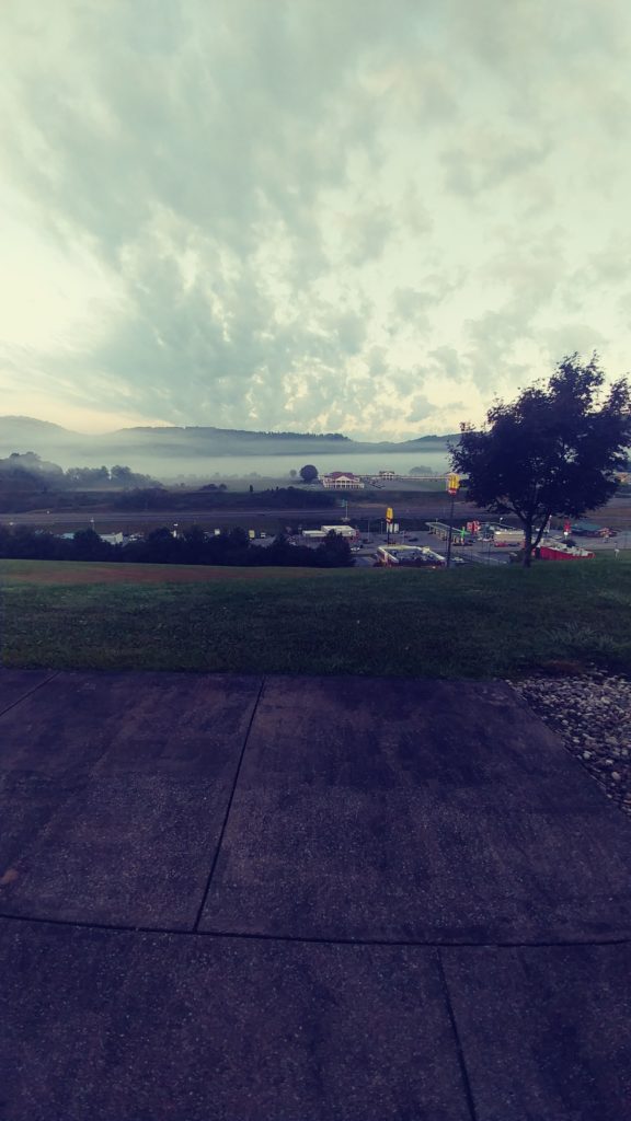
At 7am the Flatwoods Valley was shrouded in fog, very pretty but not good for riding; so a relaxed free breakfast and on the road about 9am. For safety we agreed to stick to Hiway 79 until the fog lifted. About 10am the sun came out and I grabbed the next exit heading east. I thought perhaps Hwy 50 thru Grafton, then maybe onto hwy 219 and north.
Hwy 219 is a good reliable roadway with some nice riding and it goes directly North toward Buffalo. Just follow the road and we will be nearing home in a few hours. But I get bored easily and have been up that road many times. So, off onto Rte 72, then meandered and twisted north onto 26/982/286 stopping at a McDonalds in Indiana for lunch. Indiana is the hometown of Jimmy Stewart and the Indiana of Pennsylvania University. Instead of sticking to Hwy 119 I decided to ride the 954 north. A wonderful little track thru Pennsylvania Amish country, finally rejoining 119 just south of Punxsutawney. It was mid afternoon 26C and sunny. A quick check on the Weather network showed rain and cold at home. Damn. Oh well, north on 119 to Dubois and finally north on 219. We stopped at the Sheetz in Rockway for fuel and a coffee break. And to put on a jacket. It was still sunny but was down to about 20C. We could see the cloud bank on the horizon.
At Ellicottville we had to pull over and don the rain gear and extra layer. It was just a light drizzle but the temperature was down to about 15C. Onward up 219 and onto I-90 and I-190 to the border. There was very little traffic on the bridge and we sailed thru. The Canada Customs guard asked me ‘Purpose of trip, how long were you away and where have you been?’ I smiled and recited ‘8 days, 4000kms thru Michigan, Indiana, Ohio, Kentucky, Tennessee, North Carolina, Virginia, West Virginia, Pennsylvania and New York states. Just cause’. She smiled and handed me my passport.
We arrived home about 8pm. Today was about 700 kms, thru fog,sunshine and rain. But still a great ride.
8 days and about 4100kms. Good times.
Thanx Bill.
 Avoid the rain tour 1, 2018
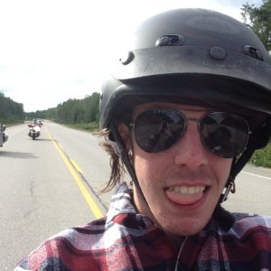 on August 7. As usual, I lead the way with Aric on the back seat of my Ultra, Rob on his Kawasaki Nomad and Bill on the BMW following. The day was a pleasant 25C and mostly sunny. I was determined not to take any major hiways and lead the gang up past Georgetown, out along Mayfield Road and thru Bolton to King City then north to Hwy40. Then along 47 to Goodwood and 21 to Port Perry. I followed hwy 7A to Blackstock then up 57 and over toward Omemee.
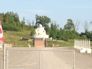 About 500 meters from the roadway a massive stone Buddha sits on the hillside surveying the driveway. I was telling the guys what I knew of the statue and the Buddhist temple being built in the valley beyond when a car pulled in and an Asian gentleman stepped out. He introduced himself as Michael, the gatekeeper. He had a very monk-like appearance even in t-shirt and blue jeans. He explained that the Buddha had been built in China from a single stone
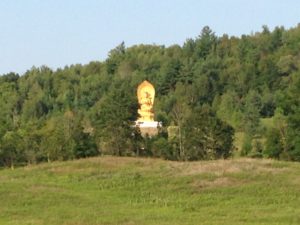 slab mined from a quarry owned by the Buddhists. It weighed over 75 tons and was shipped in 3 pieces to be reassembled on this hillside. The temple was being built in this valley chosen from several sites around the world for its beauty and serenity. The Buddhists hoped to make this a special, peace garden for all to enjoy. In fact, there will be a ceremony next Sunday to bless the placing of the final roof timber. Michael extended a personal invitation and told us to be here about 8:30 when he would open the gate. If we were here, he would personally escort us in. The ceremony was scheduled to start at 10am and would be attended by several thousand. Amazing. We agreed to try to be there and left. I continued south down Rte 38 to Hwy 7a, onto hwy 115 and into Peterborough at the B-W about 7pm. A very pleasant afternoon’s ride.
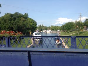 Trent-Severn lift locks. I asked for 2 rooms on the river side. These rooms have a walk-out to little decks over-looking the river. It is very picturesque and sitting on the deck you can pretend you are at someone’s cottage in the Kawartha’s. I rode over to the beer store, about 5 minutes west on hwy 7, returned,
 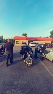 popped the beer into the fridge and lead the gang over to
  The severe weather was south of us, but not far, so we decided to head east and north. There are plenty of interesting roads in the area, so not a concern about that. I kept an eye on the clouds and tried unsuccessfully to avoid the rain. It was just a drizzle, but unrelenting. We rode around in circles for an hour or so, stopping at the Tim Hortons in Lakefield for coffee. Hmm, what now? I was hoping to ride the highlands today, but this drizzle was not going away, so let’s go further north.
 Hwy 17 from Deep River to North Bay is one of the more scenic ‘highways’ in the area. Most of the way you have the Ottawa River on the east and rocky crags of the Canadian Shield on the west side of the roadway.
 We each had one of the specials, about $10 each; all were very good. Back to the rooms, a cold beer and bed. Another good day on the road.
 Very north-quaint. We continued up hwy 101 stopping at a small pull off in the National Park to stretch our legs. Bill parked his bike under a sign warning that this was Black Bear country so we didn’t wander away and didn’t stay long.
 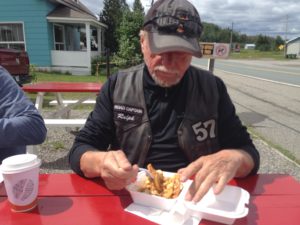 We turned onto hwy 382 at Ville Marie and over to Lorraineville where we stopped at a roadside take-out for lunch. We all ordered poutine, just because. It was OK, but not great. We turned onto 391 and headed up to Rouyn Noranda.
  The town of Rouyn Noranda is surprisingly successful looking for a northern city, very shiny and clean, with congested traffic everywhere. I stopped at the Cdn Tire to get some Lucas Oil; the Harley was starting to make some strange engine noises again, sometimes this helps to quiet it down. We then rode around the corner to the local Harley dealer so I could by a T-shirt to prove I actually came here. This dealership also sells Hondas and snowmobiles. I guess you do what you have to do in a small centre.
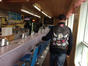 The café is a combination store, post office and poutinerie. The waitress was talking to another patron as we entered and with a casual wave invited us to sit at the counter. The café was just one long Formica topped counter with about a dozen blue Naugahyde stools lining it. The menu was written on a large white board on the wall, all in French. Our 15 year old high school student became our translator although we all knew what ‘Poutine’ meant. The man of the house came over and asked, in French, if we wanted coffee, ‘yes please’. He immediately apologized and switched to broken English. His wife laughed and came over to assist. Her English was heavily accented but quite good and clear. Yes, poutine was their specialty, fresh cut fries with homemade gravy and local curds. 4 orders please. When Bill asked if the fries were really fresh cut he was invited to the back of the café where there was a bag of potatoes, a bucket and a knife. ‘If you want them fresher, you can cut them yourself’. We all laughed.
  Now this was real poutine, the way I remember from my first visits to Quebec many years ago. And the servings were immense, 2 orders to share would have sufficed, but we managed to polish them off with the bottomless coffee flowing. Very nice, Merci Beaucoup.
 We managed to find a gas station before Rob ran out of gas and stopped to look for a hotel. Rob found a listing on Hotels.com for an inn in Maniwacki. The
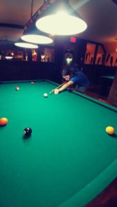 The desk clerk, hotel manager and bartender only spoke French and Aric’s high school language class wasn’t quite up to the local patois.
  The pub was small with a large deck overlooking the Maniwacki River. Very scenic. We taught Aric how to play pool, imagine 15 years old and never held a pool cue; what is the youth of today coming to. I guess its up to Grandpa to educate the boy…..
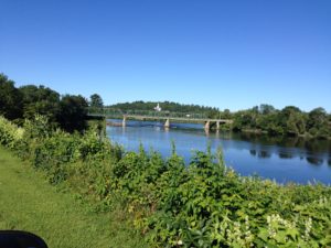
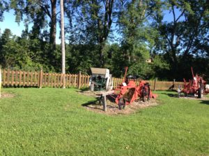 Just before the bridge was this curious display of farm equipment. The little park was well manicured, the equipment well tended, but there was no sign to say, why. We passed thru Nigger Falls, onto 105 then west on hwy 301 stopping at Otter Lake for lunch. As we made the turn over the river on Hwy 105, we passed thru a small town. The
 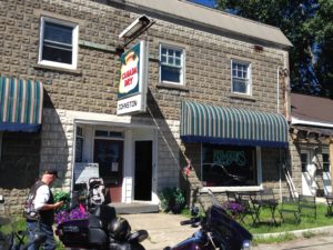 We were surprised that everyone in the café spoke English, no accent. Apparently this whole area is Anglais, who knew. Rob ordered something called a breakfast poutine. It was a mass of home fries covered in gravy and cheese, topped with a fried egg. Oh my. He said it was good, I just had coffee and toast. The service and atmosphere were wonderful. A very pleasant surprise indeed.
 I turned around as quick as I could and stopped on the gravel shoulder to peer into the brush along the river’s edge. She was long gone. We continued down the ‘Calabogie’ into Perth and stopped at the Dairy Queen. It was about 25c and sunny, an ice cream was in order. Time to find lodging for the night. Nothing was available anywhere near here at a reasonable rate.
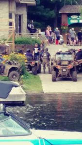 Dorset is one of those little villages that has become a very trendy tourist trap. There are a few restaurants, the old General store and of course the lift lock. We squeezed the bikes into the gravel parking lot and headed into the first café. They were closing the doors so they could clean up after the ATV crowd that was just leaving. The waitress was not pleased with all the mud tracked in. We walked out onto the street just as about 20 ATVs roared past. Across the bridge was another, larger bar with a guy playing guitar on the deck; but the lineup was out onto the street. Oh well, across the street to the bakery and a sandwich to go. We sat on a bench next to the river enjoying our lunch, the sunshine and the atmosphere.
 No problem, a turn onto rte 36 and there we are. Bobcaygeon is one of those very picturesque little towns that has managed to survive long enough to become trendy. The 2 blocks of the main street are chock full of tourist shops and cafes. Bigley Shoes owns about half the stores downtown and sells everything from beach wear to ice cream. We parked, grabbed an ice cream and walked over to watch a few very expensive boats go thru the locks on the Trent Canal which bisects the town.
 ear Omemee so we could visit the Buddha in the morning. Rob found us a Knights Inn in Lindsay. Fine.