Maggie Valley 2019

To Maggie Valley

September 22 to October 1, 2019


Day 1

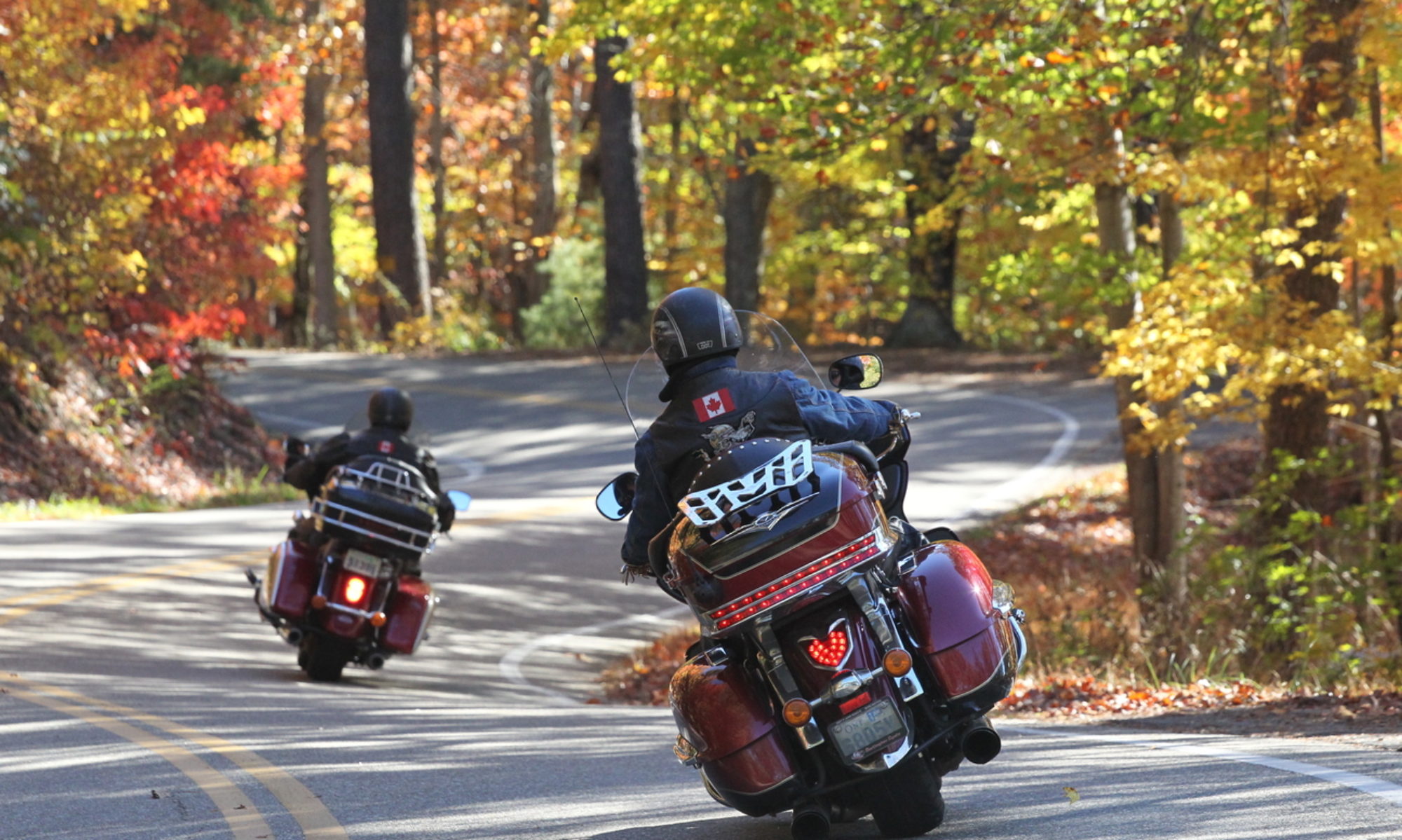
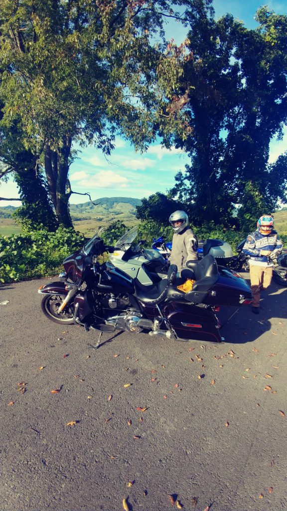
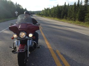
As usual day one is meant to get as far away 
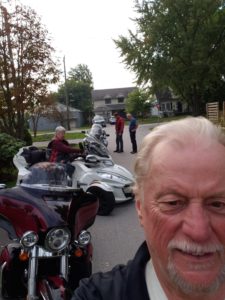
from home as possible, without too much hassle. This trip there are four of us, Roz on her Spyder, Bill & Ryan on BMWs and me on the Harley. Because none  of us enjoy hiway travel, the plan was to utilize rte 219 as much as possible. Destination today is Somerset, PA; about 525kms.

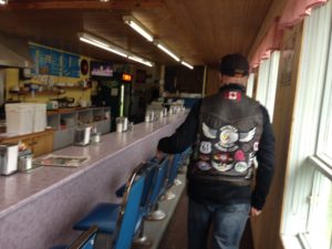
After the effortless run thru the border, our first stop was the fashionably trendy Ellicottville, NY. Fuel up and brunch at Katy’s Café. Roz and I had the breakfast burrito called a Kool Kat; mostly veggie with just a little bacon crumble and lots of spinach. Quite tasty. The boys had regular breakfast, all good, and for less than $10 each with very good bottomless coffee.

As I found on a previous road trip, Ryan can be a little anxious so to keep him busy I asked him to lead. This also gives him the opportunity to rush thru the occasional twisty without running up someone’s ass. I reminded him that Roz does not like to ride for more than 2 hours without a bathroom break and his first stop was a roadside gas station/convenience store/Subway just north of Ridgeway. Not classy, but timely. As we were dismounting, an old WV Jetta parked next to us. A 20 year old football player type gets out and strides into the Subway; leaving his car idling. The car rattled, banged and spewed smelly exhaust. I pointed this out to Bill who suggested that perhaps he left it running to keep the air conditioning on; I pointed out that all the windows were down. Well, maybe he has trouble starting the old beast. Perhaps. We went in, used the facilities and grabbed a cold drink. Back outside the VW was still running; the young man came out, reached into the car, retrieved his cell phone and headed back inside. I asked him why he left the car running; ‘I’m just grabbing a Sub, be out in a minute’; .. That does not explain why the car is running..; ‘Hey, I’m just gonna be a minute’;.. You were inside talking to your friends for 10 minutes and the car is still running. Its noisy and stinking up the environment; ‘OK, I’ll shut it off’. He scowled, turned it off and he headed back inside. As we were mounting up to leave he came out. He slowed down as he drove in front of us, gave me the one finger salute and gunned the engine, spewing a nasty black fog as he turned onto the roadway. KIDS…

About an hour later, just after we had turned off 553 and 22 back onto 219, Ryan signaled and pulled over onto the shoulder. His bike had just quit, no warning as if it ran out of fuel. We ran the necessary restart and roadside tests. Nothing. I called AAA and arranged for a tow truck to at least get him to the hotel; it was Sunday, no place to take it today. Roz and I waited with them for about 45 minutes then left so she could get to a washroom. We got gas and arrived at the Sure Stay Inn in Somerset about 7:30. Ryan and Bill arrived about 15 minutes later and unloaded Ryan's BMW into the parking area. We spent another 30 minutes trying to diagnose the problem before deciding to have dinner.

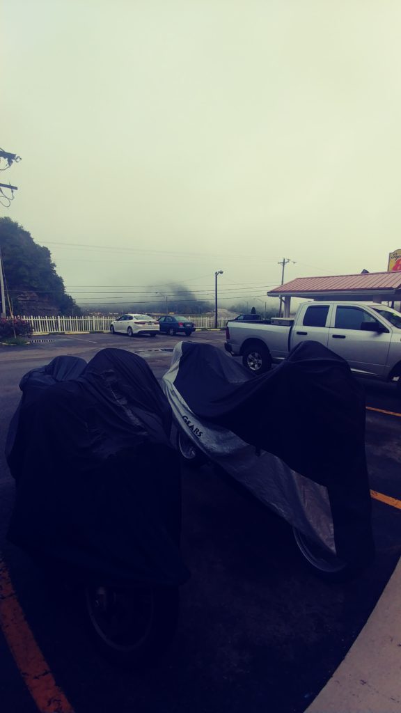
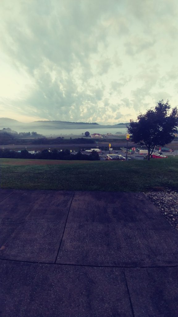
This hotel is inexpensive; $60 a night and is much like any other BW.; clean and comfy; nothing fancy. The crowning feature, other than the price, is the covered parking area; the full basement area is open and accessible for parking, great for the bikes. There are several restaurants to choose in the area; we went to Ruby Tuesday, a short walk out the back door. Excellent.

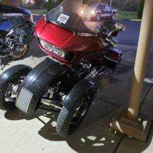
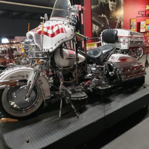
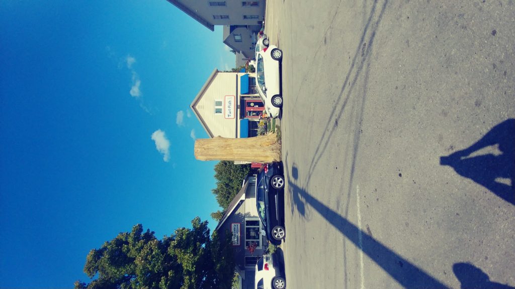
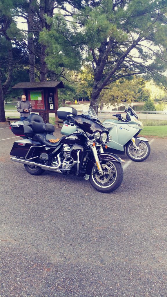
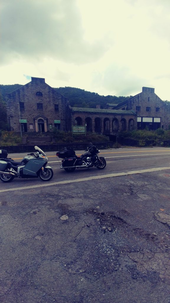
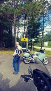
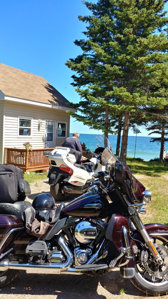
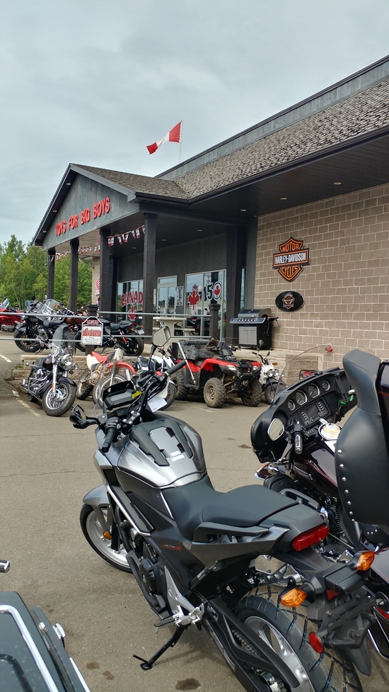
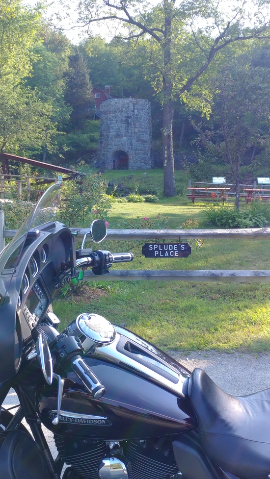
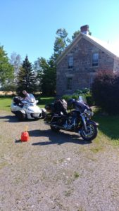
As we were returning to the rooms we spotted a Harley RoadGlide in the parking area with a trike kit mounted to the front end. I had seen them online before but never in person. Kinda weird.


Day 2

The plan for the day was to meander down 219/160/36/28/220. Well that was the plan, but of course there were several deviations. To start the day we had to get Ryan going. He had spent much of the previous evening searching the internet for solutions. His research suggested that the fuel pump or perhaps the fuel regulator was the obvious problem. Ryan walked over to the local Napa, grabbed some wire, clips, tape and tester. After pulling the side panel and disconnecting the fuel controller, he hooked up bypass wires and the fuel pump ran just fine. So it must be the controller, so detach the controller plug, splice the wires and connect a solid bypass. But still it would not start. By now it was after 9am so he called a BMW dealer and the AAA and towed it to Tyrone for repairs. Roz and I decided to carry on our way, Bill stayed with Ryan.

The hilite of our day was rte 160. Although I had been in this area many times, I don’t think I had ever turned down rte 160 before. What a surprise!!. Rte 160 ran up into a mountain and followed along a ridge with terrific vistas for about 15 miles then twisted and turned for another 5 miles down into the valley to connect to hwy 36. If you are in the area, do it.

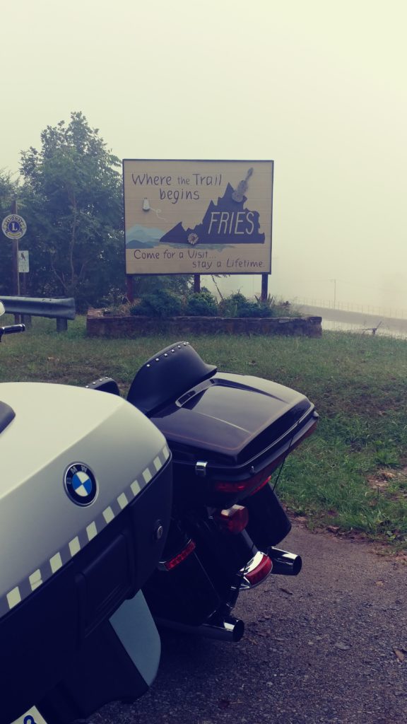
We traveled thru LaVale, MD stopping for brunch at the Cracker Barrel. T
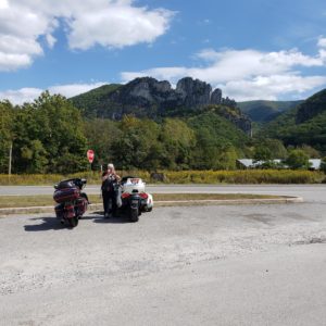
hen down rte 28 with a stop at Seneca Rocks and a visit into Yokum's General store.

The temperature had reached 24C and sunny;  time to discard the heavy jackets. A little further down 28 I was planning on taking off down Snowy Mountain pass but when I asked Roz she was below a quarter tank of gas, so we stayed on 28 finally finding a small gas bar about 30 minutes later; just in time to avoid a discussion about my choice of backroads.

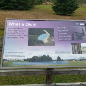
Just down rte 28 at rte 92 is the fabulous Green Bank telescope and observatory. We made a quick stop but did not have time to go into the centre; perhaps next time. Staying on rte28 put us about 50km further west than the original plan, but it was still a good forested, bendy road; so ok. The only problem was that it was thru the state forest for almost 200 kms, no café, no bathroom. When we finally found a roadside store/diner at the front of a hillbilly trailer park, it was not exactly what the boss ordered. The bathroom was an oversized outhouse complete with running water and a shower. Oh well. Then on to Warm Water Springs and a Hardee’s for lunch, about 3:30. It had started to drizzle and when I checked the radar I could see rain in the forecast. I aborted the backroads plan and headed for the hiway. It was the longer way around but would get us to the hotel about a half hour quicker. Good plan, it started to rain just as we pulled onto the ramp into Radford, our prebooked BW for the night.

I booked in, then went down the road to the Food Lion, grabbed some snacks and beer and headed back to the room. Not a bad day, some great roads, about 600kms and still dry.

Bill and Ryan arrived about 9pm, fully rain geared up. They rode the last 3 hours in the rain, some of it torrential. I offered them snacks and beer in return for an exchange of the days activity. The BMW dealer in Tyrone lent Ryan a bike so the boys could go for a ride instead of standing around waiting for the mechanic to have a look. Turns out the fuel problem on Ryans bike was the fuel controller. But apparently he must have disconnected a wire while putting it back together. Just bad luck. Took the dealer 10 minutes to fix. But they had a nice lunch and short ride anyway.


Day 3

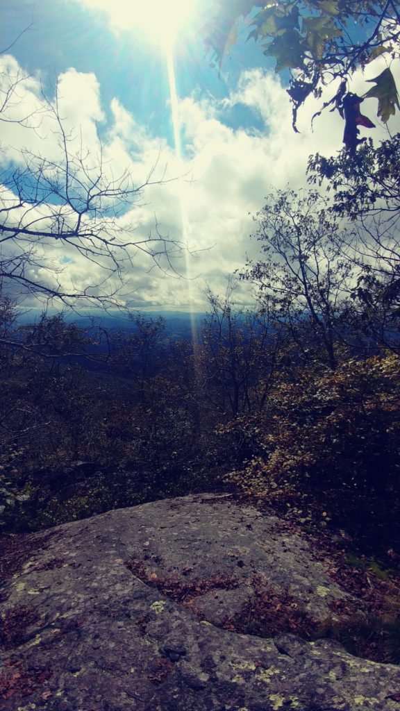
Wow… what a fantastic day for riding; nothing but blue sky in the forecast, mid 20's. And it almost went totally according to plan, which was quite simple; get on the interstate to a local Blue Ridge access point, ride the Parkway as much as possible, stop at Little Switzerland for lunch, ride the Diamondback and be in Maggie Valley by 6pm.

Well, like I said, it was almost according to plan; the first hour was perfect. We left the BW about 9am in beautiful sunshine and 20C, hit hwy 81 then 77 south, exit at Fancy Gap, took the ramp up to the Parkway and ….whoops; the BRP is under construction. A huge roadside sign flashed a warning to us that there was loose gravel on the Parkway and travel by motorcycle was not recommended. Damn. So a quick turnaround and reroute down rte 52 into Mt Airy.

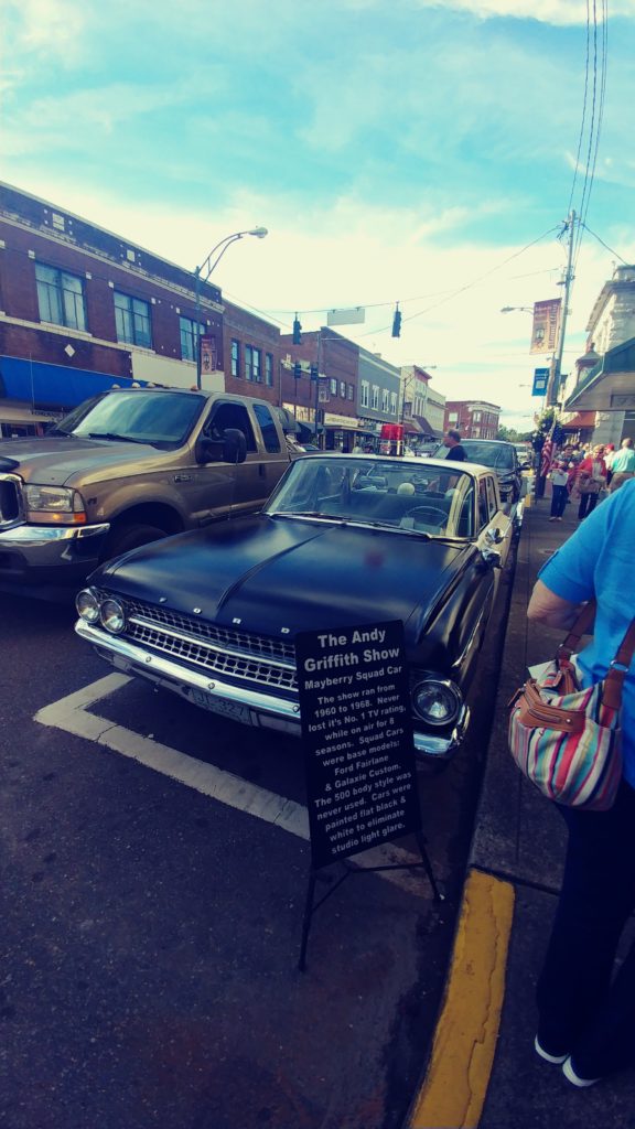
At 10:30 it was time for a pee break anyway and there is a convenient McDonalds in Mt Airy. We have been there many times but this was Ryan’s first trek in this direction. He is too young (only 53) to remember the Andy Griffith Show but has seen reruns and recalls the name of Mayberry. Mt Airy no longer has an active Mayberry display downtown but a few of the old Ford police cars still roam around escorting tourists to the hilites of the old TV set. Using the free wifi at McD I decided on an alternate access point, hoping that the construction was not extensive. So, a ride down Main St and out on rte 89 to rte 18 and on to the BRP.

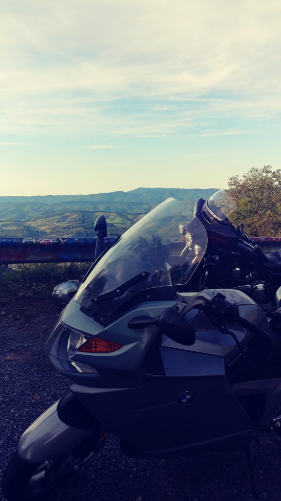
There was no sign greeting our entrance 
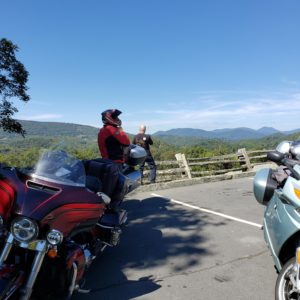
and just a few hundred yards along we saw a sign that stated ‘end of work zone’. Haha, did it. We pulled into the first lookover and revelled in the spectacular scenery. The BRP is truly a wonderful and beautiful roadway. It winds and bends for hundreds of miles along the top of the mountains. The only problem is that it meanders, a lot. If you really have to get somewhere quickly, it will take quite a long time to get there if you stay on the Parkway. The other issue is that there are very few services on the BRP, if you need gas or want lunch, you have to exit. We rode along for about 2 hours, stopping at a few look outs to take pictures and stretch our legs. About 12:30 we came to one of those annoying warning signs; damn. Oh well, turn around and take the Aho Road exit down into Blowing Rock; we needed gas anyway.

From previous experience I knew that rte 221 south from Blowing Rock was an excellent mountain gap road and would put us back onto the BRP about 50 miles further on, so off we went. It is truly an amazing road, full of twists and turns; quite challenging in places and even a few vistas if you chance to take your eyes off the road for a few seconds. I knew Roz would be struggling to guide her Spyder thru all these turns so I decided to get back on the BRP for a more relaxing ride.

We arrived at Little Switzerland at 3pm; unfortunately the café at the Lodge stops serving lunch at 3pm, so we had to ride over to the other smaller café in the village for lunch. It was excellent, but without the view offered at the Lodge. I did stop at the Lodge store and grab another T-shirt and patch, just because. I told Ryan and Bill to go ahead and charge down the Diamondback so they could get the full experience. Roz and I followed at a slower pace. At the bottom of the hill I took the lead and headed out to Hwy 40 for the 90 minute ride into Maggie Valley.

The Maggie Valley BW is near the west end of town so we got a good look at the whole town before checking in. Quite a nice hotel but we were disappointed that the pool and hot-tub were closed for maintenance. After a long day in the saddle with near 30C sunshine, a little soak would have been relaxing.

Bill and I walked the mile down to Dollar General to grab some beer packs, threw them into the fridge and we all walked over to GuayaBito Mexican for dinner. Quite good and not expensive.

Another great day. 550kms, great roads and plenty of sunshine.


Day 4


Yessiree, this is why we ride. What a perfect day, nothing but sunshine and fantastic roads. Out 19 to Cherokee, thru Franklin, up 28 to 129, run the Dragon, across the Foothills and south on 441 to BRP and back on 19 to Maggie. 450kms in 8.5 hrs.

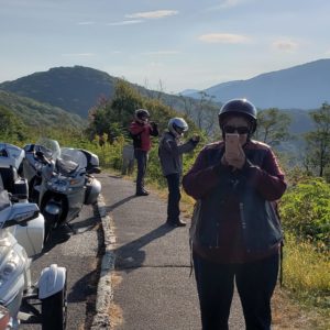
It was a very chilly start to the day and we had to pull over to put on an extra layer 5 minutes after leaving the BW. It was only 13C. But that ride down 19 into Cherokee is enough to put a warm, good morning smile on any rider’s face. Woowee. At Cherokee switch over to the 23 and onto the 4 lane to Franklin. Stop in Franklin for gas and a McD brunch then onto the 28 north.

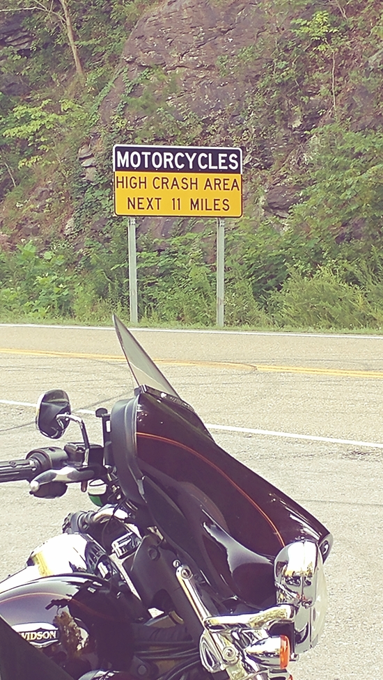
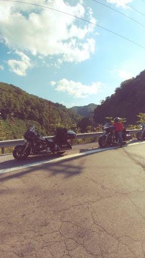
28 is often referred to as the Moonshiner and supposedly in the 20-30’s it was used to evade the revenuers during prohibition but today it is a favourite of riders and motor sports enthusiasts. The twists and turns seem to never end. Unfortunately as we neared the 74 we fell in behind an empty dump truck which of course slowed us down. Thankfully he turned right into Bryson City and we went left to carry on up the 28 north. On previous trips we had stopped at the Iron Horse Lodge (well worth an overnite if you are ever in the area), but today I was in a hurry to cover more miles so onward. And we did not stop at the famous Fontana Dam but carried right on to Deal’s Gap.

Ryan had never been here before and this was Bill’s second trip, so I told them to get out onto the Dragon, run it both ways while Roz and I took a break at Deals Gap 
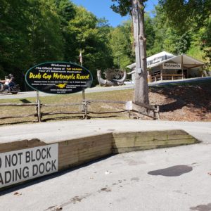
restaurant. It was hot, about 33c and a cold beer was just what the mechanic ordered.  While we were waiting i stood outside and watched the wide and weird assortment of rides that show up at Deals Gap. 
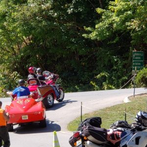
The boys returned in about 45 minutes and Roz and I left, agreeing to wait at the parking lot at the north end. I decided to take off and do a floor board scraping run thru the Dragon. I may be old and not as quick as in years past, but it is still a thrill to see how much I can push the Ultra thru this famous twisty.

From there we turned onto the Foothills Parkway, probably the second best scenic roadway in the region. 
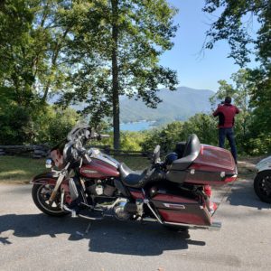
The new section with its beautiful blacktop and special scenic vistas is a real treat. The Parkway ends at Wears Valley, where we turned right and headed into Pigeon Forge. I am not a fan of this hectic, madhouse of a crowded tourist hotspot. Heavy traffic and many stoplights; yuck. We grabbed lunch at TGIF, slow service and mediocre food.

Down the parkway onto the Gatlinburg bypass and onto the 441 south. 
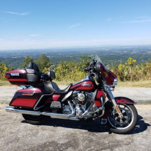
The 441 is probably the best road in the area with lots of twisties, exceptional vistas and a climb up the highest mountain in the region. The ride and views are absolutely stunning, but the traffic can be intense and very slow in places. As we passed the info centre we spotted several Elk and some wild turkeys in the field; as did about 100 cars that had stopped on the narrow shoulder to take pics. Awh, the beauty of nature!!! We turned onto the BRP and enjoyed the ride up the mountain thru the many tunnels, including one that is part of a total 360 turn where the road goes thru the tunnel and you swing around over the tunnel to complete the circle. Neat. From there it was a quick ride down the 19 and back to the BW.

Dinner was at the Italiano Café. Very good food, but just too much of it. With very fair prices and a decent selection of local beers, we'll be back next trip.

Everyone had a  great day. Again.


Day 5

The forecast for today is potential thunder storms in the afternoon, so a short ride and a visit to the Wheels Thru Time museum seems in order. Well that was the plan and we pretty much stuck to it despite the faulty forecast.

I decided that since we rode the 441 in a hurry yesterday, not stopping for any photos and with no time for Clingman’s Dome that we would retrace that part of the route. 
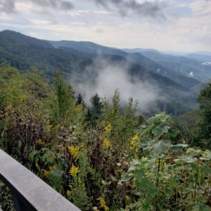
The sunshine that encouraged us in Maggie Valley left as soon as we headed down the mountain on the BRP. We did stop to take photos and I had the GoPro working most of the way, but the overcast turned to light rain as we stopped at the info centre in Ocotunafee. Oh well, it was still warm and it was very light rain, so carry on. As we started to climb up to the Dome the overcast became fog (low lying cloud) and the temperature dropped from 20C at the info centre to 13C at the top. And it was windy, visibility about 100 yards. Certainly not worth the ride and definitely not worth the walk up the hill to the Dome. We waited around for about 30 minutes to see if it might clear; no luck. But the plan was to ride down to the Chimneys, so lets try. Nope, still foggy and the parking lots (on the upside only) were jambed and the opposing traffic was heavy so, no stopping for photos today. Gatlinburg was its normal hectic place, but the sun had returned and the temp was up to 28C. Everytime I ride thru Gatlinburg I am amazed at how commercial and crass it is, especially when compared to the natural beauty of the Smokey Mtns. Yuck. And even if you wanted to stop and walk around with all the other tourists, there is no easy parking.

My plan was to ride up 321 and down 32 but 32 was under construction so it was north on 32 and then down 40 back to Maggie Valley. We dropped Roz and Ryan at the Mexican restaurant while Bill and I went to the motel to eat our Italian leftovers. 
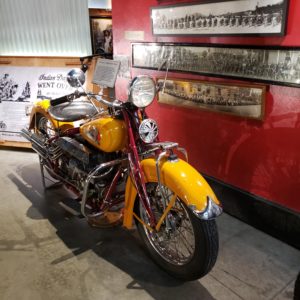
Then we walked down to the WTT museum to meet Ryan and Roz. The WTT amazed as always and the 2.5 hours we spent with all the vintage machines was not enough, but more than our tiny brains could handle.

On our walk back up to the BW, it was sunny and 30C forcing us to stop for a beer at the Salty Dog. This old tavern is a gem of local southern hospitality and charm. Nothing fancy and the fixtures look like they have been there for 100 years. We were greeted by Heather and escorted to the bar. They do keep a decent stock of beers; so a local IPA called Green Man. Nice and hoppy, and cold.

We had another beer at the BW with Ryan and Roz before heading back down the hill to the Mexican for dinner. It was overflowing with a 30 minute wait. Oh well, over to the Salty Dog. Heather greeted Bill and I by name and found us a comfy booth away from the overly energetic air conditioning fan. Danielle was our waitress, very bubbly and enthusiastic but not all that clever. When Roz asked her how the black-eyed peas were cooked, she had that funny vacant look and responded, quite seriously, ‘In a pot, on the stove’… The catfish was quite good, the hush puppies excellent, the cole slaw a little too creamy and the service very slow. But the local atmosphere was very memorable.


Day 6

After 3 nights in Maggie Valley it was time to start the trek north. The destination today was Johnson City, only about 150 kms if we went directly; but that was not the plan. There are many special roads in the area, lets see how many we can find on the way. First breakfast at the BW, Cherry and Mandy, (the BW staff) were at their cheery, bubbly selves cajoling the guests and telling local stories. They do their best to make sure all feel more like family than tourists. And they did make this somewhat run down old BW feel like home for a few days, many of the guests we talked to had stayed here several times.

From Maggie Valley we took the 276 thru Waynesville and up to the BRP, stunning ride; and of course the BRP is its own special place, that view from our first pullover was stunning. 10km on the BRP and we dove down the aptly named Devil’s Drop. I let Bill and Ryan charge ahead so they got the full experience, I tried to keep up but the lumbering heavy Harley just couldn’t keep up with the lighter more nimble BMWs; and my brakes heated up quite severely.

As usual I had programmed in a route on Google Maps but planned on deviating whenever the mood struck me. Such was the case when we got to hwy 23 and instead of turning left I went straight and meandered around the foothills until we came out to hwy 19. Up thru Canton and a stop at a Waffle House for an early lunch. I decided to take off on the first sideroad which turned into Crabtree Mountain Road. Very special. This road is an old rural road that obviously does not see much traffic, it is narrow, paved, no shoulders and almost no banking. The road is very steep and twisty as it climbs up and over Crabtree Mountain. Whewy. I pulled onto an unused grassy driveway at the peak and managed to get the Harley turned around before I lost my footing in a tire rut and dropped

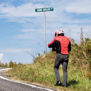
the beast. No problem, soft dirt and 2 buddies to help pick her up. The view down the valley from ‘Hawk Holler’ was worth the brief embarrassing moment.

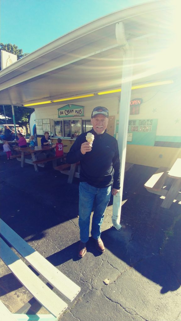
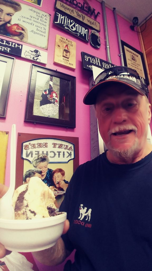
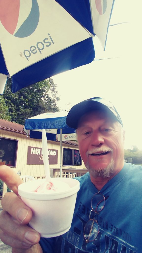
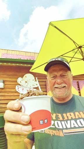
Down the hill and right onto rte 209 into Fines Creek and the start of the Rattler. I charged off with Ryan and Bill in pursuit enjoying the sunshine and ride. 
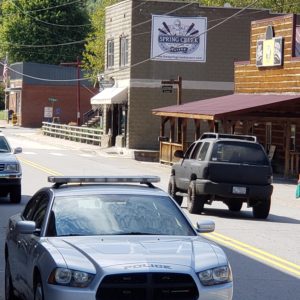
We waited for Roz at Trust then proceeded into Hot Springs for an ice cream stop. And it was hot, 32C and sunny. Then onto rte 70 to 19.

After a stop at the McD in Burnside for a cold drink and bathroom break I saw a sign for Mt Mitchell. I have never been down this road but had seen the sign off the BRP and heard from fellow riders about the great run. 
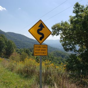
Ok, plan deviated again. And it was well worth the extra kms. Great twisty, next time we do it from the other direction.

It was now about 4pm and time to start the trek in a more direct route to Johnson City. We stopped for gas and I reset the map to keep us off highways but get us to the BW before 6pm. Well it almost worked, I had to abandon one of the turns, the road looked like it would lose its pavement shortly, and I missed another quick turn and ended up going thru Elizabethton. Oh well, we still got to the hotel about 630.

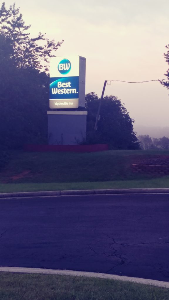
We have stayed at this BW in Johnson City, Tn before, its fine and the onsite Thai restaurant has a very lively, and noisy bar. Just fine to review the day, unwind and plan for tomorrow.

400kms of very hot riding along some of the finest twisties in the area.


Day 7

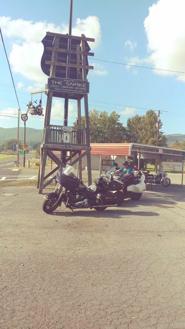
Gonna be another hot one today. Forecast is for 32C and sunny. Our destination today is Wytheville, VA, only about 250kms but somehow we’ll make it over 400km. Basically, 19/421/67/19e/91/133/58/21., kinda like a figure 8 which includes the Snake, BackBone Tunnel and the Crooked Roadway.

On our way across to the top of the Snake I stopped on WhiteTop Road for a photo-op of the Bristol Speedway, quite a site sitting there in the hillside. 
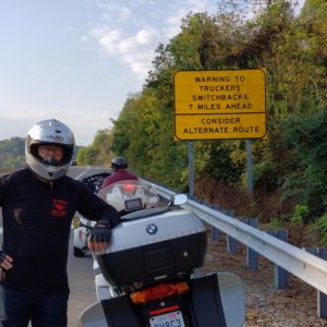
At rte 421 I let Ryan and Bill charge ahead after warning them that it had rained in some places overnite and it is September, leaves would be on the roadway. I followed Roz and hopefully got some good footage on the G0Pro. Bill and Ryan were waiting for us at the General Store and let me lead from there, the roads were too wet to run quickly, we might as well stay together.

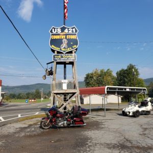
At Mountain City I turned west along 67 and enjoyed the sunshine heating up the meandering valley road. After a quick stop at the Mobil/McD in Elizabethton we were off on 19E to 91, over the mountain again and thru Shady Valley. 91/133 are not named but are just as pleasant a run as the Snake.

In Damacus I stopped at the Wicked Chicken for ice cream and they indeed had my absolute favourite, Hershey’s dark chocolate raspberry truffle; yummy. Damascus is famous for its access to the Andirondack trail and caters to hikers and mountain bikers. You can rent a mountain bike here which they will shuttle to the top of the trail and you ride back down; very popular with families.   I quite like this little spot, very quaint with a nice café and outdoor patio. There was even a one man band playing on the porch.

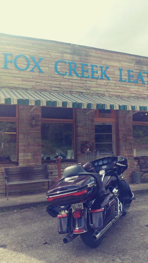
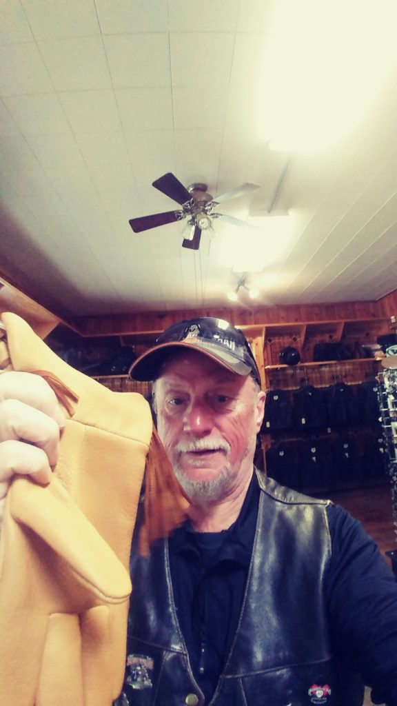
Then it was off onto rte 58 and one of my very favourite rides in this area, the Crooked Road (musical trail). This road bends and climbs thru some gorgeous countryside including the Graystone Highlands. Not a difficult road but still full of bends and twisties. I just love it every time; and I’ve been here at least 10 times. There is of course the ice cream stop at one end and my favourite leather shop, Fox Creek at the other end in Independence. I have been ordering their deer skin gauntlets for many years. From here it is a short run up hwy 21 into Wytheville, late lunch at the Mexican and over past Black Bear Harley to the BW.

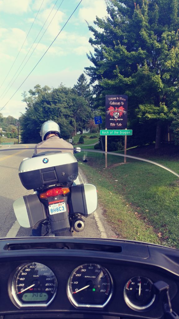
It was only 4pm when we checked in and it was sunny and 27C so Bill and I decided to head out for a quick tour; Ryan grudgingly agreed to join us; he was glad he did. I headed up I-77 and exited at rte 42, west almost to Saltman, up 91 and east along 601 then down rte 16 to Marion and back along I-81 to Wytheville. A nice circle 8 that included part of the Claw of the Dragon and most of the Back of the Dragon, about 120km. 
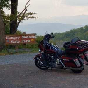
We have visited this area many times so I know my way around and always love just wandering.

Total for the day was almost 500km, no rain and lots of great riding.


Day 8

The plan is simple, ride the Back of the Dragon, continue up hwy 16, then 52 and into Barboursville. Great plan with a stop at the Back of the Dragon store to buy another T-shirt; because after a week on the road in 30C plus sunshine, I only had one clean shirt left. Well that’s my excuse this time. Linda at the store told us about the new construction taking place on the lot next to the temporary trailer/store. It will be finished in time for next spring and include a new store, lounge and hopefully wash bay and café. A beautiful, large, spread wing Dragon is already in position protecting the building. 
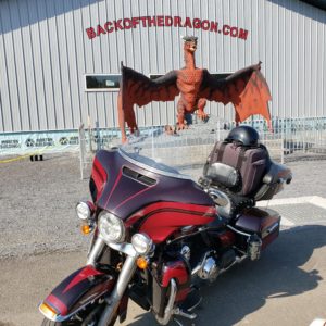
Great for photo opts. Ryan decided that he needed to be home tomorrow so left us at Tazewell.

Riding on hwy 16 is always a treat and I never can decide which section I enjoy more, but today I think the part from War to Welch wins. The only sad part is the condition of some of the towns along the way. The closing of the coal mines has impoverished many in this region. I don’t think that reopening the coal mines is the answer, someone needs to encourage newer industries into the region and train young people so they will stay and reinvigorate the region.

We wound our way up hwy 52, enjoying the bendy road and marvellous scenery, stunning. But just past Mingo the traffic came to a standstill on rte 10. Cars were backed up as far as I could see and after 15 minutes in the 34C sunshine I decided to follow other drivers and turn around and find an alternate route. Hwy 52 up to 5 and onto 119 into Logan. I found the Mexican restaurant where I had stopped before, and Roz loves Mexican.

I then followed 119 to rte 10 and then onto hwy 60 to the BW in Barbourville. While waiting at a stoplight my temperature gauge reached 37C. wow… Across the parking lot from the hotel was a pub called ‘Bill’s Grille’. Bill couldn’t resist and offered to buy a cold one to celebrate another great ride day. The bartender wore a T-shirt emblazoned with the logo and an outline of WV. Bill tried to buy one but all they had in stock were small and 2x; too bad. Bright side, we’ll have to make another trip to WV so Bill can get a T-shirt.

Back to the room and a dinner of cold beer and tortilla chips. Oh well….


Day 9

The forecast today was hot, hot, hot. Record breaking temperatures were spreading across the mid west and heading north, right in our path. Well I guess its better than the rain and cold they have at home. Today we have to reach Morgantown, WV. The route is simply along hwy 60 and up 19.

After the usual quickie breakfast at the BW we were off toward Charleston, WV and would probably hit the morning rush as hwy 60 went right thru the downtown core. Well that’s what we were expecting, but there was no heavy traffic at all, in fact when we stopped for gas near the Capital Building we all commented on the fact that the downtown streets were empty, the indoor parking lot nearby was near vacant. This is Monday morning at 930am; maybe it’s a local holiday??

From Charleston hwy 60 follows along the Kanawha River and is known as the Midland Trail. It is a combination of 4-lane hwy past some huge, ugly factories and small 2 lane meandering roadway past several faltering towns. We stopped at one of those towns, Montgomery, looking for a café for our late morning snack. What a depressingly ugly place. The town is crambed between the mountain and the river on the opposite side of the hwy. We had to cross a wonderful old arcing steel bridge to get to the town and then follow the rail tracks thru town. 
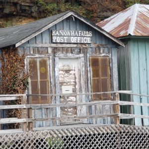
The tracks divide the town with three streets of the downtown stringing along between the tracks and the river; the houses and old apartments on the wrong side of the tracks looked as if they may have been stylish at some point but were now showing decades of neglect. The downtown was similar in its decay. The only café we saw was closed with a for sale sign hung awkwardly across the doorway. No place to stop here, but I did see a McD sign around the river bend out on the hwy. OK.

One of the reasons I chose hwy 60 is that 
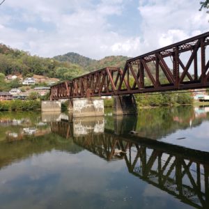
part of it has recently been branded as The Talon and advertised as the next best ‘dragon’. At Gauley Bridge I pulled over, just past the bridge, where I saw a big sign announcing ‘The Talon’, your adventure starts Here’. Now, as I 
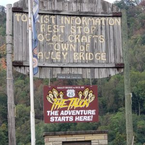
said, this is a newly branded road; but I was expecting more than just a sign. The old building next to the roadway still carried the faded sign for an ancient post office and the adjoining shack promised a ‘Snack Shack’ coming soon. That’s it. 
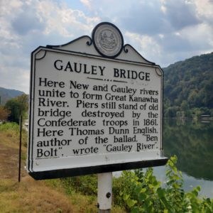
But other than it was disappointing not to find a store where I could add to my collection of patches, stickers and t-shirts, Gauley Bridge is in a gorgeous setting at the confluence of two rivers and the site of a Civil War battle. There were 3 historic signs posted on the roadsides telling the story of the famed battle. 
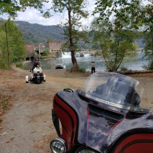
I am always amazed to note that parts of West Virginia consider itself part of the southern states. Geographically it does not make sense.

So, off along hwy 60 and then soon to be famous Talon; well maybe not. After spending several days in the Smokie Mountains and 2 days riding up hwy 16 and 52, this aint no great shakes as a spectacular roadway. It does have a few nice twisties at Chimney corners, one sizable mountain and a great view off Hawk’s Nest, but even the waterfall at Cathedral Falls was dry. Oh well.

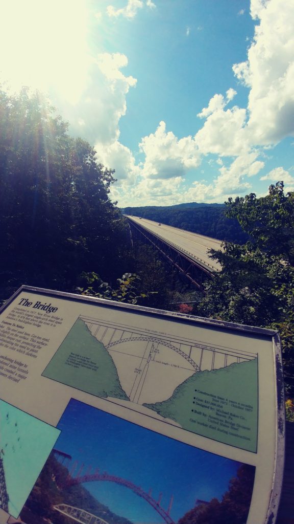
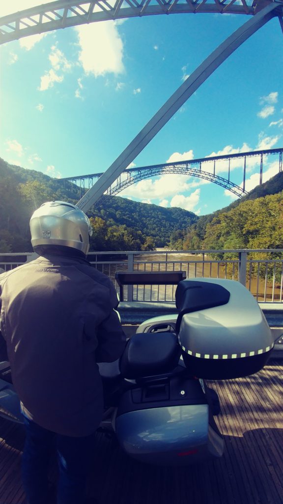
From there I stopped at the New River 
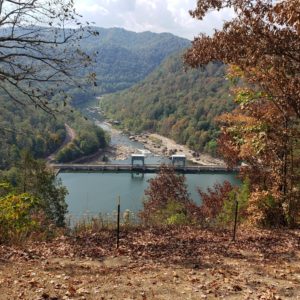
Gorge bridge and we walked over to the store for an ice cream. We were going to take the road down the gorge but the road was under construction and a sign said the bridge was closed at the bottom. Oh well. Onto Hwy 19, a boring 4 laner that leads thru the commercial crassness of Summersville. It was too hot to be travelling on a 4-lane road but if we wanted to get to Morgantown in a reasonable time, it was necessary. Just before we got to the exit to I-79, I turned off onto Herold Road. Herold is a paved, single lane local road; and I mean single lane. When a pick-up truck came from the opposite direction he had to put half his vehicle off the road to get past us. The road twists and turn past several houses along a creek; it feels like you are heading down someone’s driveway with every turn. But well paved and eventually ends at rte 4. Up rte 4 into Flatwoods and over to the Mexican Restaurant in the plaza. I have stopped here a few times, very good food at very reasonable prices. And cold Dos Equus on tap. It was 34C outside.

Back onto rte4 and then rte19 which unfortunealtely is much more open than we wanted and with the heat, I decided to avoid the stop and go traffic thru towns and hit the I-79 for awhile. At least the breeze helped somewhat. I got off the hwy at Fairmont and took the back way into Morgantown along hwy 250 and 19. Very pleasant. I did not know that Fairmont claims to be the first place that celebrated Father’s Day, or so said a sign outside a church in midtown. This part of the ride up hwy 19 was much more pleasant and was treed lined for most of the way, providing much appreciated shade.

We arrived at the BW about 6:30, perfect timing. The place has been painted and partially renovated since my last visit. Much nicer. WE decided to walk over to the Texas Roadhouse for dinner. Very disappointed, my ribs were dry and tasteless and they only had the cheap regular assortment of beer on tap. Not great for our last dinner on the road this trip. Next time maybe the little pub down the hill  by the river.


Day 10

OK, time to head home; time to bring this fantastic voyage to an end. Damn, but been a good one. Forecast today is 30C, mostly sunny until we get to northern PA, rain forecast at home. Oh well.

Theoretically we could ride straight up hwy 119 to 219 to Buffalo and Qew home, but that would be quite boring; we aint in that much of a hurry, but I wont wander too much. So, around Morgantown by back roads then onto a very rural rte119, thru the mountains and down a very nice twisty. Then onto the beautiful 982, rte 30 and up 217 into Indiana. Indiana, PA is home to the Indiana University of Pennsylvania (IUP) and also the birthplace of Jimmy Stewart. We made a quick stop for a snack at the McD then thru town to rte 954 and north thru Amish country. I have ridden this route many times and always enjoy the pleasant countryside ride, especially on such a beautiful day; sunshine and 28C. Glorious.

We rode 954 onto rte210 then 119 thru Punxsutawney, but we didn’t stop to say Hi to Phil. Then 310 and onto 219 just north of DuBois. We stopped for a bathroom break at the Skeetz north of Ridgeway. Then it was onward up 219 and into Ellicottville and a stop at the Tim’s for a late lunch. Of course we have been into many Tim’s on our travels but I have never been in one where the country rock music assaulted you as you walked in the door. It was so loud it was difficult to place our order and when I asked to have it turned down, the young clerk looked at me like I was some kind of alien, well perhaps a very old alien. She finally managed to turn it down a notch, but even though we sat at the far end of the room, we still had trouble carrying on a reasonable conversation. I checked the weather again, not good; violent storm running across the Niagara peninsula and now centered on Buffalo. Yuck. So, don the raingear and head out. Make sure you have money and passport easily accessible for the border. Damn; cant find my passport; strip down everything; not there.

At the border I explained my dilemma to the border guard; she asked to see my driver’s license; lucky for me it is an enhanced licence. Carry-on. She did tell my wife that perhaps it would be best if she held onto the important documents in the future.

We rode home in the rain not too bad, brief periods of rain, nothing heavy but the wind was very gusty. When I checked the phone messages at home, there was a call from Mary at the general store in Seneca Rocks; someone found my passport and gave it to her. She mailed it to me.


All in all; a great trip.

Next time…..


Avoid the Rain, 2

September 2018

Day one

At 9 o’clock on the morning of September 24, Bill and I were all packed and ready to roll. Question was; ‘where to?’ We both pulled out our phones and checked the weather networks. The local forecast showed several days of clouds and showers followed by a couple of days of downpour and then perhaps some more rain. Pretty depressing. We had decided last week that we both had the time to take a week and see if we could avoid this forecasted wet stuff. We  wanted to head south but Pennsylvania was no better and Virginia was in the middle of their 3rd or 4th major storm this summer. ‘Hey,its not raining in Michigan’. ‘OK, lets go’. And so it was decided.

I hopped on my 2014 Harley Ultra and Bill jumped onto his 2008 BMW 1200. Both bikes were packed, luggage strapped down and fuel tanks full. We waved a goodbye to our wives and off we went. Bill and I have traveled together a fair bit and we rarely plan where today will end or what road we will take to get there. I preferred getting ‘lost’ on the less traveled secondary roads and Bill was content to follow along, using his GPS just so he could tell everyone where he went today.

I decided that since we knew all the local back roads, that we would hit the hiway until we crossed the border at Sarnia. The 403, 401 and 402 are the most boring roads in Ontario, but they get you somewhere quickly. By 11:15am we were at the border, sitting in that dreaded long line-up on the Blue Water bridge. This bridge is the main route for transport trucks heading west. But the only alternative is the tunnel or bridge at Detroit, and we wanted to head northwest today.

Finally in Port Huron, we stopped at Tim Horton’s. Bill rarely eats breakfast until noon, and Tims serves breakfast late, and it was right there when we got off at the first Michigan exit. Neither of us had ever really explored Michigan and decided to just take route 25 up the coast of Lake Huron. Route 25 is a fairly commercial and busy road, not exactly what we were looking for, but not entirely a waste, there are some very nice views over the lake and several ‘cottagey’ little towns. We cut inland on hiway 142 just so we could go thru a town called ‘Bad Axe’. Then turned north and up to Port Austin and back onto hiway 25 making a stop at a combination laundromat and coffee shop in Caseville. Excellent free-trade coffee and home made butter tarts, while listening to the dryer and washing machines rumble in the next room, the proprietor told us that this was his last week before him and the packed up and headed to Florida for 4 months. Pretty eclectic place.

Back on the road and south toward Vassar and then west to  Frankenmuth. They are very proud of its large German population. The downtown is chock full of Bavarian architecture and is one of those places that sport the spirit of Christmas year round. Frankenmuth is also the birthplace of the new rock sensation ‘Greta Van Fleet’. The town centre was packed, the traffic inched along, there was no convenient place to park and it started to rain. Just a light drizzle, but it was the dreaded wet stuff we had been trying to avoid. It was only 4pm so lets just keep rolling.

We wandered around in a generally north and west direction avoiding major roads and the city of Saginaw. By 6:30 we had arrived at Mount Pleasant. Time to look for a hotel. Just after I pulled down the main street, I spotted a Comfort Inn with a restaurant attached. Perfect. We checked in, got a decent rate ($115usd) and were told that the manager was hosting a small reception in the breakfast area until 7pm, here are 2 tickets for wine or beer. Munchies are free as well. We tarped the bikes, threw the luggage in the room and went down to take advantage of the free goodies.

Then it was over to the in house restaurant. I let Bill lead the way. He made a wrong turn and ended up at the swimming pool; should have used that GPS.  I back tracked and found the hall leading to Bennigan’s Pub. The waitress greeted us like we were old friends and sat us in the corner so she could stand and talk to us away from the eyes of her manager. Very odd old bird, but friendly. Food was okay, I had a mediocre veggie burger; Bill seemed to enjoy his cheeseburger. After 2 beers each we were back at the room by 9pm. We flipped on the TV and sort of watched the Monday night football game, before agreeing to switch off the lights about 10:30. All in all a good start to this road trip. About 610kms.

Day two

At the free breakfast we checked out the weather networks and google maps. The sun was getting ready to peek out from behind the clouds and forecast was for 20c and sunny in north-central Michigan. It was still raining in Indiana and Virginia; so north it was. But not too far north, the forecast in Sault Ste Marie was only for a high of 14C.

We hit the road about 9am and headed north thru town. Mount Pleasant appeared to be a very pleasant little university city, but I never did see the ‘Mount’. At the downtown intersection I decided to head west on what turned out to be a real nice bendy back road. Route 20 wandered around a bit thru farms and small towns. I headed north on Rte 37 and then east on Hwy 10 to a pretentiously named Kings Hiway which meandered around and lead us back to Rte 37. We headed north and into Traverse City. Nice place.

Downtown Traverse City has a wonderful waterfront park where we stopped for a photo op. A couple of older gents in a beat up Ford pick up parked beside us and started to chat. The driver told us of his rickety old Road King sitting in his son’s garage for several years now. When they found out we were from Burlington they acted like we had ridden around the world to get here. Wow. When I told them we had no particular plans for today’s ride,‘just avoiding the rain’; they suggested hwy 22 up to Northport and down to Leland. Why not…..

Just up hwy 22 we passed thru the village of Sutton’s Bay. The main street is chock-a-block with eclectic touristy shops, galleries and cafes. I had to stop and take a few photos of a shop with about 1000 garden variety windmills out front. Totally awesome. Good thing we were on the bikes and not in the SUV, we would have purchased several.

Hwy 22 was a lovely little road that followed along the coast and up a peninsula, thru several small cottage towns and old fishing villages. Most of the villages had that ‘off-season’ feeling and were almost deserted. The cutest of which was Peshawbestown. Not much there, but it was pretty and the view over the lake was great. We did find a small mom and pop café. Nothing special but the coffee was hot.

We carried on up hwy 22 thru Northport and up hwy 201 to Lelanau State Park. We were disappointed to discover that access to the park was limited and required payment of a parking fee to get past the gate. We had hoped to at least see the point and lighthouse, but the trees along the roadblocked all views. The road dead-ended here and we had to trace our route back down to hwy 22. Oh well.

The highlite of the day was the old fishing village of Leland. Leland is kept alive by the ferry terminal and the tourists stopping for lunch at one of the 3 cafes. The ferries run twice a day and service the 2 islands offshore in Lake Michigan. The ferry terminal is shiny and new with big beautiful public bathrooms. The old fishing village, called Fishtown,  has about a dozen old huts converted into touristy shops peddling beach wear, souvenirs of the fishing era, smoked fish,local beer and knic knacs. The huts are all perched along the Lelanau River which connects Lake Michigan to Lake Lelanau. There is a walking bridge leading over the river and the falls to the Falling Waters Inn. I had to check it out.The Inn looks to be about 100 years old and is perched along the river’s eastern bank. The rooms are small but all overlook the river and waterfall. The rates are rather steep in the summer, but reasonable in the fall and with the 3 local pubs, could be an interesting place to spend a day or two. But not this trip. We decided not to stop but did sit and eat the bananas we had taken from the free breakfast area at the Comfort Inn this morning. While we were sitting there a man came over to tell us about his Street Glide. His wife hated riding so he was in the car today. I did ask if he knew where the closest gas station was and he pointed us down hwy 22, turn right on E Duck Lake Road. Thanks.

After fueling up at the Duck Lake BP, we continued on down hwy 22. I pulled into a little plaza in Glen Arbour with a big sign promising local ice cream. It was closed. Very disappointed. A teenager walking past laughed and reminded us that it is September, off season. I told him that we were Canadians, ice cream is rarely ‘off season’. Oh well.

Just down the road I got tired of the same scenery and decided to take ‘Mountain Road’ running off to the left. It wound up the hill and around a golf course, past an aging resort and back down to the hwy. Oh well, a small scenic diversion at least. At Arcadia we pulled into the Dunes State Park. Again we were met by agate requiring us to pay for parking. I explained to the guard that we were not going to park, just wanted a picture of the dunes. OK, just stay in the first lot and exit that way. The ‘dunes’ are a natural phenomenon towering about 100 feet above Lake Michigan. Several people were climbing the dunes and sliding back down. Looked much like the Sand Hills near Port Rowan on Lake Erie.Obviously very popular in the summertime.

We carried on down hwy 22 til it ended at Hwy 31. We pulled off at the next road which only went about 5 miles before it dumped us back onto Hwy 31. We did this a few times before I decided that we might as well stay on the Hwy and head down to Muskegon for the night. We had discovered that most of the motels along the coastline were closed for the season; Muskegon was large enough to have a choice of hotels.

We got off Hwy 31 at the main Muskegon exit and followed it downtown past all the regular tacky shops and cafes. This is not a very prosperous looking place. We reached the downtown core without passing a single motel or hotel. Bill checked his GPS and found us a Holiday Inn. Quite pleasant with an in-house restaurant and bar. The bright sunshine of the lovely afternoon had given way to overcast skies and the threat of rain. So, Holiday Inn it is. The meal was mediocre, I don’t recall what it was, but it was not great. We had intended to check out a bar down the street but as we finished eating, it started raining. We settled on the Inn bar. It was cold and uninteresting. Back to the room by 9pm. Mr Trump had been up to his usual antics that day and it was quite interesting to watch CNN and Fox News to get the different takes on the adventure. Its amazing how a preordained view point can interpret one sentence in a tweet so differently. Quite amazing.

Day 3

The $125usd for the room did not include breakfast. We declined the $8.99 special at the restaurant and opted to find something down the road.I headed south on business 31, stopping at the Majeir Gas bar to fuel up. There was a McDonalds next door so I guess its time for breakfast. We carried on down Lake Harbour Hiway primarily to avoid Hwy 31 and the morning business traffic.I managed to keep us on the secondary roads until we reached Ferrysburg where we had to hop on to Hwy 31 to cross the Grand River.

I jumped back off the hwy as soon as we were over the bridge and entered the upscale tourist town of Grand Haven.  The main street lead down to the harbor and was lined with trendy shops and cafes. Nothing that interested us and we rode to the end stopping at the waterfront park. The wind had picked up substantially,the sky was partially overcast and the temperature hovered around 15C. We parked and walked along the boardwalk. Out in the surf along with the 3 foot waves, was a one windsurfer trying to get his board out past the breakwall. He was edging along the pier attempting to avoid the severity of the near gale force winds. He was determined, but eventually gave up about 100 feet out and laid down on his board and rode back to shore. Back on the bikes, I keep us on the Lakeshore Road most of the way down the coast of Lake Michigan until we were forced to jump back onto Hwy 31, then along hwy 43 and 40 thru PawPaw and eventually into Indiana.

Somehow we ended up on rte 13 and managed to avoid Fort Wayne. Then rte 9 to avoid Indianapolis. Rte 9 is flat, straight and boring;resembling a miniature prairie landscape. About 3:30pm we passed thru the small village of Fountaintown where we found a delightful little ice cream shop. I’m sure it must have been the centre of this village since the 50s. The bulletin board on the outside wall proudly proclaimed that the high school football team had beaten the neighbouring school last Friday. The schedule for the rest of the season was there for all to read. The weather was now bright and sunny,about 25c and several car loads of kids freshly out of the local school were being treated to a cone by their moms. We sat at a picnic table on the side of the road with about 6 kids enjoying this special treat. Two of the boys eyeballed the bikes and wanted to inspect more closely. ‘Don’t touch’instructed Mom. We just smiled and nodded.

We headed east along 52, 43 and then 27. By 6pm the skies had become overcast again and we started looking for a hotel. We crossed over into Ohio and found a Comfort Inn in Oxford. There was a gas station across the street, fuel and beer. OK. The hotel was adequate and was full of construction workers. All friendly especially ‘Ted’, who regaled us with his tale of riding his Kawasaki to New Orleans and back last year. When the girl at the front desk found out we were from Canada, she was amazed. She has never been outside Ohio and Indiana. We asked her where we should have dinner. Definitely don’t go to that Chinese restaurant next door. (it was actually a Japanese/Thai). She said there were several places downtown, but it was 3 blocks away and we might not want to walk that much. She obviously thought it was too far. It was starting to drizzle and we didn’t want to ride, so the Bob Evans a few doors down would have to do. What a mistake. The fish was overcooked and the fries were cold.The coleslaw was fine. Back to the room, a couple of beers and to bed by 10:30.

Another great 650km day.

Day 4

Up early, free breakfast and a quick walk downtown. Oxford is a very quaint little university town. The downtown is ideally suited for the 20-something crowd and old retired people. It was not that far to walk after-all; we should have ventured over last night. The local coffee shop was packed with old guys telling each other tall tales; the cobble stoned main street was just starting to congest with young adults rushing to class or office or shop.

The forecast for today is ominous. We don’t think there is anyway to avoid the rain. There is a huge cell coming in past Chicago with a swath that is roughly aligned in a narrow path from Milwaukee to Louisville,heading toward Washington. We think that if we head east for a few hours we can stay ahead of it til about noon. Then we will make a right turn and head south trying to traverse the storm at its narrow point. Right now it looks to be about 100 miles across, so about 2 hours of nasty wet. That’s our plan, and away we go.

We traveled east along rte 73 stopping at the McDonald’s in Middletown for coffee. The sky was starting to show increased cloud cover but we were enjoying the rolling countryside and bendy roads.  Rte 73 turned south and I stopped at a gas bar in Bacon Flats. The sky was looking more scary and I decided to put on the rain gear. Good timing, the drizzle started just as we pulled back on the road. By the time we got to Portsmouth it was a torrential downpour making it very difficult to see the road signs. I made an incorrect judgement turn and went south on hwy 8, which wound back around to hwy 10. I assumed that if I was going south on 8 and turned left onto hwy 10 that I was going east again.Wrong. It said west, so I turned left on hwy 7 to go south. Wrong. I ended back on hwy 23 at Portsmouth. An hour doing a circle in the pouring rain. Great. Perhaps a GPS would have helped today. But, hwy 23 is a major hwy heading south thru the Kentucky hills. It is a great ride in the sunshine, not so nice in the pouring rain. After another 3 hours of this steady downpour we still could not see any light at the end of the road. My rainsuit had started to leak at the seams and I was cold. The water was running down the road off the hillsides and pooling in huge puddles. At one point the cars in the far curb lane splashed us, 4 lanes away. 4pm. Time to find a hotel.

I saw a billboard for a Quality Inn, 11 miles ahead, with a BBQ bar. Perfect. About 20kms later I pulled off at Prestonburg, still no sign of the Quality Inn. Bill checked his GPS. It showed a Comfort Inn downtown, so off we went. We toured around the 3 blocks of the downtown area 3 times. No Comfort Inn. No inn of any kind. We did see a Super 8 at the hiway interchange.Oh well. The Super 8 was cheap, only $67, including breakfast. But it was dry and reasonably clean. There was a plaza next door with a WalMart and a Little Caesars take-out. I put on my dry little nylon shell jacket and pulled up the hood. Bill borrowed a small purple umbrella from the lady at the check in counter. Real cute Bill. We grabbed a large pizza and a 12 pack of YuengLing at the WalMart. OK, we were set for the night. Watched some dumb movie, ate the pizza, drank 3 beers each.

Only about 400kms today. And about half of them very wet.

Day 5

Breakfast was about what you might expect for a cheap inn. I had the sausage gravy and biscuits with my scrambled eggs. It was like eating salty Elmers Glue. Yummy. Bill even relented and had the scrambled eggs. They did not have any fruit for us to snag for our elevens’s.

Back onto Hwy 23. About 2 minutes down the road we passed the Quality Inn with Mosby’s Bar and Grill in the front. Oh well. I’m sure it would be more expensive.

As I said, Hwy 23 is a wonderful roadway thru the Appalacian Mountains. Just a few miles down the road from Prestonburg is Pikeville, home of the infamous Hatfields and McCoys. The weather was still unsettled and I was eager to get further south and into the promised sunshine. I made a mental note to schedule a road trip here in the near future.  I peeled off at Alt58 and made my way down to Abingdon, Va where we stopped for coffee at the McDonalds. The sun was shining.Time to take off the rain gear.

Sitting at the McDonalds, utilizing the free WiFi, we checked the weather. The next few days looked fabulous. I am very familiar with this region of Virginia and decided that we should stay in the area a couple of nights. I booked the Best Western at Wytheville. I have stayed there several times.

One of my favourite places in the area is Shady Valley. Rte421 thru Shady Valley is the heart of the great roadway known as the ‘Snake’.Bill had never been in the Tennessee mountains and I was thrilled to start him off on this great road. The Snake crosses a mountain on either side of Shady Valley. Make sure you stop at the General Store at the crossroads in the middle of the valley, pick up a patch, shirt or sticker. Both mountains have their fair share of switchbacks, vistas and tight turns. A good challenge for his BMW. In his youth Bill did some Moto Cross racing so I was sure he would enjoy the challenge. He was thrilled.

From there we headed along 421 to Big Laurel Road and onto Hwy 88. I don’t think there is a bad road in this whole region. Bendy Roads Rule.. It is a thrill to ride in the sunshine on these great mountain roads. WooHoo. Out thru Warrensville and onto Hwy 16 and then Hwy 58 to Independence.

One of the things I do when here is head over to Independence and grab a new set of gloves at Fox Creek Leather. I found these deer skin gloves several years ago and now won’t wear anything else on the bike. I particularly like the tan gauntlets with frills. I wear them all the time, they are cool in the summer heat and warm in the fall and spring. And the style suits me just fine. They have become my signature gloves.

The girl at the counter was amazed that we had ridden fromBurlington to buy these gloves. She checked the computer and found that this was my 3rd visit to the store and that I had also ordered online twice. My gloves are $75us. She gave me a 15% discount. I bought my regular gauntlets as well as a pair of driving gloves for the car. Bill bought a pair of regular driving gloves and got the 15% discount as well.

It was only 3pm and we had already booked the room for tonight so I decided to take Bill to Mayberry. Well actually Mount Airy, NC,but made famous as the set for the Andy Griffith show in the 60s. I went down Hwy 21 to rte 18 and onto Hwy 89 into Mount Airy. I parked on a side street downtown just as a 1963 Ford police car passed. Bill grabbed his phone and chased the cruiser to the corner to get a photo. Apparently his first car was a 1963 Ford Fairlane.  We walked onto the main street and found 3 more old police cars. They were being used as tourist attractions and touring people around the sites, for a fee. Still cool.

We walked down the street checking out the overpriced Mayberry crap. I did buy a ‘Barney’ t-shirt from a street vendor for $10 and stopped at the Main Street café for an ice cream. On the way back to the parked bikes we ran into ‘Barney’; well actually a look alike dressed in the classic uniform. We noticed that all the tourists were our age. Makes you wonder what will happen to this town in 20 years when there won’t be anyone alive who ever watched the Andy Griffith show.

We headed north out of town intending to hit Hwy 52, but I missed the turn and stayed on N Main St. That turned into Wards Gap Road, real nice.  I figure any road that is a ‘Gap’must be good. Gap means it passes thru the gap in the mountains to get to the next valley. I then turned off Wards Gap onto Orchard Gap road. Good choice.Amazing little twisty with a couple of short switchbacks. That road ended at the Blue Ridge Parkway; cool. We turned on to the parkway and followed it over to Hwy 97 and then up to Galax. It was 6pm and I decided that we should get to the hotel and check in, so over to hwy 77 and up to Wytheville.

We checked into the Best Western, put the left over beer into the fridge and headed over to El Puerto Mexican restaurant. This is a great little Tex-Mex place. Wonderful ambiance, good food, inexpensive with excellent family service.  We each had a combo and a Dos Equus. Total bill was less than $30. Back to the BW by 9pm. One cold one each and into bed.

A great 650km day.

Day 6

Today was just for wandering around in the mountains. So out 61 and down thru Fort Chiswell, down 94 with a quick stop at the old hydro plant in Fries. Turned right on 221/58 and over to the Grayson Highlands State Park. Time for some exercise; we hit the hiking trail. About 5km up and down the mountain. Very scenic, very strenuous. Not bad for a couple of old guys. Rested in the parking lot for a drink of water and to eat the stolen bananas.  Back onto Hwy 58 and over to Damascus following a large group of bikes at a leisurely pace for the last 20 miles. At the gas station I noticed one of the guys on a new Harley examining his bike, the left side hwy peg was missing. I asked and he explained that a large cube van going the other way hit him on one of the corners. It contacted the end of the hiway peg and it snapped off. He was extremely lucky it broke instead of bouncing him sideways. His buddy who was riding behind him said that ‘Greg’ was over the centre line on the corner, it was not the trucks fault. Greg disagreed. We filled up with gas and decided to forgo the ice cream so we could get on the road in front of the group and keep a better pace.

I headed out 91 and onto 605 east. I wandered around, back and forth until I reached 601. Hwy 601 is a county road and one of several rte 601s in the state. It is one of those smaller back roads that meander around the mountains and you have to pay special attention at each intersection to make sure you follow the signs to stay on the route. It is well worth it.Wonderful scenery and twisties. Great stuff. I made my way out to Hwy 11, past Wytheville and went north on 77  to 52North and Bastian.  Then west on 614 and 61 to 623 and Burke’s Garden.

Burke’s Garden is a special little hidden valley with only one access road. Hwy 623 climbs steeply up the side of the mountain with several tight switchbacks and a few outstanding vistas. Then down a steep drop into the Valley. Burkes Garden was settled by Mr Burke in the 1700s. He discovered it on a hunting trip and returned later with his family. It is now a thriving Amish community. Unknown to us, today was a special day in the valley and a festival was underway. The circular road around the valley was packed as was the General Store parking lot. We did manage to find a parking spot in front of the Telephone office but we were too late for the festival, they were tearing down the vendor tents. We had to  suffer the slow ride back over the mountain with the other tourists.

Back on Hwy 61 I turned right and over to Tazewell. Tazewellmarks the top end of the roadway known as ‘The Back of the Dragon’. The Back runs down Highway 16 from Tazewell to Marion, over 3 mountains and thru scenic valleys. Just as we entered Thompson Valley 2 sport bikes raced past us; a fairly common site here. Thompson Mountain is the furthest north and is the tallest but each mountain has its own special features. The best view is from the pull off at the top of the middle mountain. Part of that section sweeps down a bendy road with green Kudzu vines encroaching on both sides then the road climbs from the valley with sharp rock cuts on one side and the valley below on the other.  Just as we were leaving the valley floor we saw one of the sport bikes parked in the Kudzu on the far side of the roadway. He waved that he was fine and we carried on. His pal had pulled over at the lookout spot half way up the hill. We pulled in beside him. A few minutes later the other bike pulled in. He claimed he simply pulled off the road to take pictures, he had never seen anything quite as amazing as this vast valley and had never ridden a road with the Kudzu encroaching like this. He was from Georgia where they have lots of this invasive vine but nothing like this.

At the top of the third mountain you enter the edge of Hungry Mother State Park. There is a pull over spot next to the sign and along a guardrail looking over the valley. A couple of other bikers were stopped here and we joined them. The view is spectacular. This is the one thing in which the Back of the Dragon excels over its more famous cousin, the ‘Tail of the Dragon’,the views. And this one is my favourite. The road down off this section of the mountain is full of switchbacks, sweeping curves and scenic views. At the bottom is the entrance to the camp grounds of Hungry Mother Park. Legend has it that the name comes from a time when a very young native boy was found alone wondering in the woods. The only words he could say were ‘Hungry’ and ‘Mother’. Hmmm. About 5kms past the park is the town of Marion. And just before you reach Hwy 11 there is an old Drive-In Theatre, arcade and Ice cream shop. Well, there used to be. The building is still there but it is closed. I was very disappointed, they had the best ice cream; Hersey’s dark chocolate raspberry truffle. Darn…

We turned right on hwy 11 and headed back toward Wytheville.The old downtown area of Wytheville is reminiscent of the typical 1920 architecture that many of the boom towns of that era enjoyed. It now shows signs of gentrification and renewal, but like all old towns has suffered. There is a museum here that displays the peak of the 1950s, before the super expressways, when hwy 21 was one of the main corridors for travelers from Cleveland/Detroit enroute to Florida. We stopped at Black Bear Harley just because and I purchased the mandatory long sleeve T-shirt. I don’t know why I bother, they are all overpriced and I have at least 20 in the closet. Were turned to the BW for a quick freshen up then decided to head back over to El Puerto for dinner. You just can’t beat good and inexpensive. Back to the room by 9pm, a quick beer and into bed. Tomorrow starts the long trek home.

Another great 620km day.

Day 7

Well, today we had to admit that the vacation is nearly over. Time to head back north. Heartbreaking, the weather is forecast to be nothing but sunshine and near 25C; and we are in one of the most amazing biking areas around. Oh well, as Bill said ‘it means we have to return next year’. Deal.

I decided we should treat ourselves to another ride up the Back of the Dragon. Like all great roadways, it presents itself quite differently going north than the trip you rode yesterday southbound. Today, its Bill’s turn to lead. I have been running the Harley pretty hard and am experiencing some slight noise from the front brakes when they get heated. So I will take it a little easier today just to make sure I make it home. Let Bill have some fun and ride at his own pace. So, over to Marion, past the closed ice cream shop and Hungry Mother Park. The Back did not disappoint. It was spectacular.

In Tazewell I took the front position again and lead us over to the official ‘Back of the Dragon’ store. Danny and his wife have purchased the rights to the name and over the past few years have been actively promoting the road and biking in the area. Plans are nearing the final stages for a café and inn in the vacant parking lot out front. Hopefully they will break ground in the spring of 2019. Danny is full of info and knows all the inns and cafe sin the area as well as all the repairs shops. If you need anything while in the area, just give him a call.

Hwy 16 is not just the Back, it stretches for several hundred miles from Ohio to North Carolina. Danny has promoted his section in Virginia,attracting biking enthusiasts from all over, but the hwy is just as spectacular for most of its length. So we decided to carry on and explore some of the northerly route. It is great. Hwy 16 continues up thru the mountains, down thru valleys, twisting and meandering along rivers, thru small towns. One of my favourite sections is the approach to the City of War, WV. The road is carved from the rock overlooking the river in the valley below. The best part is about 2 miles of sweeping twisties with that rock cut on one side and the guardrail over the river one the other. The view down the road is like a picture postcard demanding that you just let her loose and enjoy. The rolling twisties are gentle enough that you can see the whole 2 miles, so you know where each apex is and that no one will be in your way. I pushed the Harley hard. I am quite used to this type of riding and drag the floorboards on each side as I rock back and forth around the turns; but I surprised myself when I went past the floorboard on one turn, hit the mounting bracket and lifted the back tire.High-sided. Bill says I left a 2 foot gouge in the road surface. It was a bit of a shock but I gave the Harley a quick nudge and she responded with both tires on the blacktop without slowing down. WooHoo.

The City of War used to be the hub of the very prosperous coal mining industry in the 1920s. The old downtown core is pretty decrepit these days and because it is Sunday, nothing is open. I was hoping to stop by the War Café and chat with Obine again. Obine claims to have the best coffee in the area (not) and refuses to admit that she is a closet Democrat even though she has several pictures of John Kennedy on the walls. Oh well, next trip.

We stayed on Hwy 16 heading north, passing thru several small, old coal mining towns. Most were in a sad state. Many of the houses appeared to be abandoned, none of the shops were open. Extreme poverty has taken over most of the area since the coal mines ceased operations and most of the younger people have moved away to the cities. A few of the homes were obviously enjoyed by retired people with pensions; the well tended gardens stood out in sharp contrast to the crumbling structures next door. Sad.

We stopped in the village of Itmann, WV drawn by the massive old building on the side of the road. This huge structure was at least 25,000 sqft with a drive-in courtyard and arched-covered walkway. The sign posted at the foot of one of the two massive staircases proclaimed that it was built as a company store/offices by the Pocahontas Coal company in 1916. It was easy to imagine this impressive stone structure as being the centre of a thriving, booming industry. The doors were open and we took some time to stroll around, absorbing the atmosphere.

Back on the bikes and northward. At the first bump my phone flew from its ram mount and down the road. I guess I forgot to tighten it. I stopped and ran back picking up the pieces. The screen was scratched, the back panel bent, but when I put the battery back in, it seemed to work fine. But the back plate was bent too far to secure properly and the scratch was right across the face. Oh well, it was time for a new one anyway.

We carried on up Hwy 16, enjoying all the twisties and vistas. Well, until we got to Beckley and got stuck in the traffic. I veered off at hwy 19 and ran over to the New River Gorge bridge. It is spectacular and marvelous piece of engineering. The largest single span bridge in North America.Wow. On the tourist map in the parking lot Bill spotted a road leading down under the bridge and crossing the river in the valley. OK, but first a stop at the souvenir shop across the street for an ice cream.

The valley road was posted for travel in one direction,luckily we were headed the right way. It twisted as a single lane most of the way along the valley rock cuts, thru some maintained forests and under the massive steel structure. Very impressive view of the bridge from down there. At the bottom was a new looking Bailey type bridge spanning the river. We stopped and asked a young tourist to take our photo. Thanks Conchita from Cleveland.The road continued on the west side of the valley up thru the state park,exiting onto hwy 19. I turned right and then right again onto hwy 16 north again.

A few miles down the road I pulled into a parking lot crowded with other people enjoying a Sunday drive in this great fall weather,to view the Cathedral Falls. Truly stunning. Back onto hwy 16, then right at Gauley Bridge onto hwy 39 meandering our way back to hwy 19 at Summersville. It was after 5pm and I thought it best to run the highway for awhile; didn’t want to leave too many miles for the last leg home. North on 19 and east on 79 to Flatwoods. We decided to check into the Days Inn conference centre with its in-house bar and restaurant. Unfortunately this is Sunday, the restaurant is closed. There is a Mexican restaurant in the plaza across the street. Oh well,Tex-Mex and Dos Equus again. We can do that.

Day 8

The final leg….

At 7am the Flatwoods Valley was shrouded in fog, very pretty but not good for riding; so a relaxed free breakfast and on the road about 9am. For safety we agreed to stick to Hiway 79 until the fog lifted. About 10am the sun came out and I grabbed the next exit heading east. I thought perhaps Hwy 50 thru Grafton, then maybe onto hwy 219 and north.

Hwy 219 is a good reliable roadway with some nice riding and it goes directly North toward Buffalo. Just follow the road and we will be nearing home in a few hours. But I get bored easily and have been up that road many times. So, off onto Rte 72, then meandered and twisted north onto 26/982/286 stopping at a McDonalds in Indiana for lunch. Indiana is the hometown of Jimmy Stewart and the Indiana of Pennsylvania University. Instead of sticking to Hwy 119 I decided to ride the 954 north. A wonderful little track thru Pennsylvania Amish country, finally rejoining 119 just south of Punxsutawney. It was mid afternoon 26C and sunny. A quick check on the Weather network showed rain and cold at home. Damn. Oh well, north on 119 to Dubois and finally north on 219.  We stopped at the Sheetz in Rockway for fuel and a coffee break. And to put on a jacket. It was still sunny but was down to about 20C. We could see the cloud bank on the horizon.

At Ellicottville we had to pull over and don the rain gear and extra layer. It was just a light drizzle but the temperature was down to about 15C.  Onward up 219 and onto I-90 and I-190 to the border. There was very little traffic on the bridge and we sailed thru. The Canada Customs guard asked me ‘Purpose of trip, how long  were you away and where have you been?’ I smiled and recited ‘8 days, 4000kms thru Michigan, Indiana, Ohio, Kentucky, Tennessee, North Carolina, Virginia, West Virginia, Pennsylvania and New York states. Just cause’. She smiled and handed me my passport.

We arrived home about 8pm. Today was about 700 kms, thru fog,sunshine and rain. But still a great ride.

8 days and about 4100kms. Good times.

Thanx Bill.

2018, Avoid the Rain Tour 1

Avoid the rain tour 1, 2018

For weeks I had been pestering my son to talk his wife into letting him get away for a week and go for a big boys ride. Rob and I had done this a few times in the past, but he has had some employment issues and money can be a concern. So the boss at home has to keep him reigned in. Understood.

I had also asked my grandson if he would like to get away with us for a week of his summer vacation. Aric would be 16 at the end of August and loves to ride with me any chance he gets. His mother grudgingly approved and his dad, my youngest son Jeremy, was only too happy to get rid of him for a week so he would stop being a typical teenager to his two younger brothers.

My neighbor Bill had recently retired and was anxious to put a few kms on his BMW 1200. So, the only thing to decide was when. I am semi-retired, self-employed and working only about 80 hours a month, so its relatively easy for me to arrange time away. Finally, after much negotiating, phone calls, pleading and cajoling, it was agreed that everyone was available the second week in August. Perfect.

I was all set to head south. I wear these fancy deerskin gauntlets that I purchase from Fox Creek gloves in Independence, Va. I have worn nothing else for about 10 years and they have become part of my riding image. My current gloves have about 40,000kms on them and could last another season, but any excuse for a ride. Now, you can buy these things online, but I get 10% off if I purchase in person. The only problem, the weather was looking pretty gloomy to the south. Virginia has suffered some very severe weather this summer, and next week did not look hopeful. The plan was to ride in any direction where it was least likely to rain. So, after a quick look at the weather maps, I booked 2 rooms at the Otanabee Inn in Peterborough  for August 7. I love riding the Haliburton Highlands, so that’s where we would start. This would be the only preset destination.

Day 1

I had a few things to take care of in the morning so we didn’t get underway until almost 
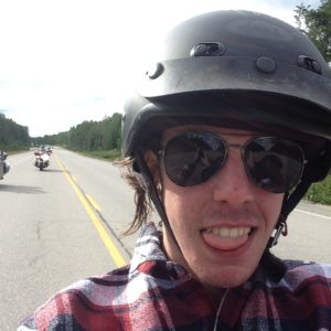
on August 7. As usual, I lead the way with Aric on the back seat of my Ultra, Rob on his Kawasaki Nomad and Bill on the BMW following. The day was a pleasant 25C and mostly sunny. I was determined not to take any major hiways and lead the gang up past Georgetown, out along Mayfield Road and thru Bolton to King City then north to Hwy40. Then along 47 to Goodwood and 21 to Port Perry. I followed hwy 7A to Blackstock then up 57 and over toward Omemee.

Just before Omemee I turned down Ski Hill  Road (rte 38); I wanted to show the guys the giant Buddha statue. We pulled onto the gravel driveway and parked in front of the chain link gates. 
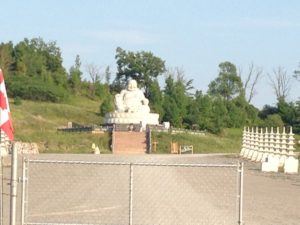
About 500 meters from the roadway a massive stone Buddha sits on the hillside surveying the driveway. I was telling the guys what I knew of the statue and the Buddhist temple being built in the valley beyond when a car pulled in and an Asian gentleman stepped out. He introduced himself as Michael, the gatekeeper. He had a very monk-like appearance even in t-shirt and blue jeans. He explained that the Buddha had been built in China from a single stone 
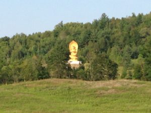
slab mined from a quarry owned by the Buddhists. It weighed over 75 tons and was shipped in 3 pieces to be reassembled on this hillside. The temple was being built in this valley chosen from several sites around the world for its beauty and serenity. The Buddhists hoped to make this a special, peace garden for all to enjoy. In fact, there will be a ceremony next Sunday to bless the placing of the final roof timber. Michael extended a personal invitation and told us to be here about 8:30 when he would open the gate. If we were here, he would personally escort us in. The ceremony was scheduled to start at 10am and would be attended by several thousand. Amazing.  We agreed to try to be there and left. I continued south down Rte 38 to Hwy 7a, onto hwy 115 and into Peterborough at the B-W about 7pm. A very pleasant afternoon’s ride.

The Otonabee Inn is at the east end of Peterborough on Hwy 7 and my wife and I have stayed there several times. It is situated on a branch of the Otonabee River within an easy walk to one of the famous 
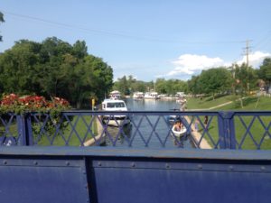
Trent-Severn lift locks. I asked for 2 rooms on the river side. These rooms have a walk-out to little decks over-looking the river. It is very picturesque and sitting on the deck you can pretend you are at someone’s cottage in the Kawartha’s. I rode over to the beer store, about 5 minutes west on hwy 7, returned, popped the beer into the fridge and lead the gang over to Marty Moos for dinner. Marty Moos is a local landmark and is famous for its comfort food at family prices. We returned to the room about 9pm just as the rain started. And it didn’t just rain, it was a torrential downpour. We heard the next morning that a few funnel clouds were spotted in the area. But it was all pleasant on our little deck as we enjoyed a couple of cold ones. Life is good.👌

Day 2

Over the standard free breakfast the next morning we surveyed the weather and maps. Not very promising. The severe weather was south of us, but not far, so we decided to head east and north. There are plenty of interesting roads in the area, so not a concern about that. I kept an eye on the clouds and tried unsuccessfully to avoid the rain. It was just a drizzle, but unrelenting. We rode around in circles for an hour or so, stopping at the Tim Hortons in Lakefield for coffee. Hmm, what now? I was hoping to ride the highlands today, but this drizzle was not going away, so let’s  go further north.

It was Bill’s turn to lead, maybe his GPS would lead us away from the rain. He headed south then east before turning north on Buckhorn Road. He turned left on 22 to later realize that it dead-ended at the Curve Lake Reserve. So much for following his GPS. I turned us around and back out to 23, right at Buckhorn, over to Burleigh Falls and left at hwy28. Then north on hwy 62 stopping for lunch at the SunRun Café in Maymooth. The small, old cafe was jammed full of  campers trying to get dry. Even with the cold and clouds, everyone was still smiling while enjoying their bowls of steamy corn chowder. Yummy with homemade sour dough bread.

We headed up 62 to Barrys Bay and across 60 then 41 to Pembroke and onto hwy 17 north. I circled off the hwy at Petawawa so the boys could get a quick peek at the barracks, etc. Somehow the sight of multiple uniformed soldiers doesn’t seem out of place here. They look at home strolling down the street. Duh.. it is their home, Petawawa being one of the largest armed forces bases in the country.

By 4pm it was sunny and warm so we stopped at the Canadian Tire in Deep River for gas and to peel off the rain gear. There was a Marks Work Wearhouse  attached to the store and Rob decided to buy a new pair of boots. The old boots he was wearing were not waterproof, he left a puddle on the road with every step. Squish, squish…. While Rob was shopping Bill and I searched the maps, weather network and hotels. We decided to head to North Bay and I booked a couple of rooms at the Best Western. Hwy 17 from Deep River to North Bay is one of the more scenic ‘highways’ in the area. Most of the way you have the Ottawa River on the east and rocky crags of the Canadian Shield on the west side of the roadway.

The clerk at the B-W reception gave us the special Harley discount rate, thanx; and booked us into the ‘motorcycle’ rooms. We could park our bikes in the small courtyard right outside our window. And there was a bucket, tap and a few old towels handy in case we wanted to wipe the road dirt off the bikes. I guess they get a few riders thru here.

There is a very nice Italian restaurant in the hotel and it was discount Wednesday, so Italian food it is. We each had one of the specials, about $10 each; all were very good. Back to the rooms, a cold beer and bed. Another good day on the road.

Day 3

Bill and I were up early and took a stroll along the shore of Lake Nippissing before heading back to clean some of that grime from our bikes. We managed to embarrass Rob sufficiently enough to get him to make a feeble attempt at cleaning. We even took a photo to send his wife. There is no free breakfast at this BW and we declined the menu presented in the restaurant. We decided to head down the road, stopping at the Tims a few blocks away. Over breakfast we again checked the maps and weather. It was going to be mostly sunny and cool today just about everywhere. Well, none of us had ever been to Val D’Or, so that’s where we headed.

Hwy 63 leaves North Bay, crosses the Ottawa River and runs up to hwy 101. We stopped at Temiscaming for a photo op and to gaze on the massive paper mill. Bill got out his new toy, a camera on a mount with remote control and took a group photo. The old rail station here is now a tourist shop and small museum. Very north-quaint. We continued up hwy 101 stopping at a small pull off in the National Park to stretch our legs. Bill parked his bike under a sign warning that this was Black Bear country so we didn’t wander away and didn’t stay long. 
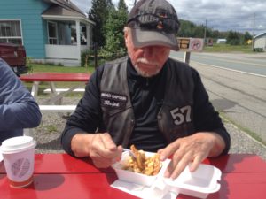
We turned onto hwy 382 at Ville Marie and over to Lorraineville where we stopped at a roadside take-out for lunch. We all ordered poutine, just because. It was OK, but not great. We turned onto 391 and headed up to Rouyn Noranda. 
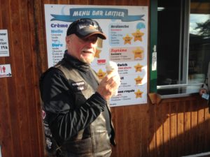
The town of Rouyn Noranda is surprisingly successful looking for a northern city, very shiny and clean, with congested traffic everywhere. I stopped at the Cdn Tire to get some Lucas Oil; the Harley was starting to make some strange engine noises again, sometimes this helps to quiet it down. We then rode around the corner to the local Harley dealer so I could by a T-shirt to prove I actually came here. This dealership also sells Hondas and snowmobiles. I guess you do what you have to do in a small centre.

Back onto hwy 117 and east to Val d’Or. I can’t say that the landscape is exciting, in fact it is km after km of the same old thing, rocks, trees and water; not many hills, so not very many vistas. And one thing about riding north, there aren’t many options for roads to travel. Val d’Or was a typical small city built on the promise of mining wealth. The gold rush is over and the forest industry is not exactly booming or exciting. Not much here to amuse us so we followed Hwy 117 as it swung south.

At Louvicourt we stopped at the Loriee d’Bois café for a second lunch. The café is a combination store, post office and poutinerie. The waitress was talking to another patron as we entered and with a casual wave invited us to sit at the counter. The café was just one long Formica topped counter with about a dozen blue Naugahyde stools lining it. The menu was written on a large white board on the wall, all in French. Our 15 year old high school student became our translator although we all knew what ‘Poutine’ meant. The man of the house came over and asked, in French,  if we wanted coffee, ‘yes please’. He immediately apologized and switched to broken English. His wife laughed and came over to assist. Her English was heavily accented but quite good and clear. Yes, poutine was their specialty, fresh cut fries with homemade gravy and local curds. 4 orders please. When Bill asked if the fries were really fresh cut he was invited to the back of the café where there was a bag of potatoes, a bucket and a knife. ‘If you want them fresher, you can cut them yourself’. We all laughed. Now this was real poutine, the way I remember from my first visits to Quebec many years ago. And the servings were immense, 2 orders to share would have sufficed, but we managed to polish them off with the bottomless coffee flowing. Very nice, Merci Beaucoup.

Back onto hwy 117, thru the National Park and onto hwy 105 south. We managed to find a gas station before Rob ran out of gas and stopped to look for a hotel. Rob found a listing on Hotels.com for an inn in Maniwacki. The Centre Chateau Logue is a modernized addition to the old mansion and out buildings of a man who made a small fortune on timber in the area. It is now a bar, inn, library, museum and conference centre. This was off season so we got very special rates. There is a pub attached to the conference centre which was not only handy but quite nice. The kitchen was closed when we arrived at 8pm, but they had sandwiches, a pool table and a very large selection of craft beers; and a very sweet young lady who spoke English. 
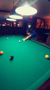
The desk clerk, hotel manager and bartender only spoke French and Aric’s high school language class wasn’t quite up to the local patois. 
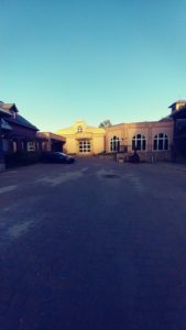
The pub was small with a large deck overlooking the Maniwacki River. Very scenic. We taught Aric how to play pool, imagine 15 years old and never held a pool cue; what is the youth of today coming to. I guess its up to Grandpa to educate the boy…..

Day 4

In the morning Bill and I decided to head out about 6:30am for a walk. These old bodies get a little stiff sitting on the bikes for 10 hours a day. There was a woodland pathway leading from the hotel, along the river, over a foot bridge and across the golf course to the town centre. We circled back up the roadway, thru a little quaint village area, an outdoor kids marine exhibit and back to the hotel. A very nice little town. We got Rob and Aric up and out. The hotel did not offer breakfast so it was over to the Tims for coffee.

A quick check of the maps suggested a south-westerly direction and off we went east on 107 and south on Chemin de Ste Therese du Gatineau.  
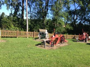
Just before the bridge was this curious display of farm equipment. The little park was well manicured, the equipment well tended, but there was no sign to say, why. We passed thru Nigger Falls, onto 105 then west on hwy 301 stopping at Otter Lake for lunch. As we made the turn over the river on Hwy 105, we passed thru a small town.  The Resto Rumours is a very small, hole in the wall café snuggled into the side of a mostly abandoned old factory building. We were surprised that everyone in the café spoke English, no accent. Apparently this whole area is Anglais, who knew. Rob ordered something called a breakfast poutine. It was a mass of home fries covered in gravy and cheese, topped with a fried egg. Oh my. He said it was good, I just had coffee and toast. The service and atmosphere were wonderful. A very pleasant surprise indeed.

Then it was down the 301 to Portage du Fort and across the Ottawa River. We made a quick photo stop on the causeway to snap a picture of the hydro dam, then out onto hwy 653 into Ontario. We managed to wander our way over to Calabogie and stopped at the Redneck Bistro for a snack. As we headed south on the infamous rte 511 a black bear ran across the road about 100 yards in front of me. 
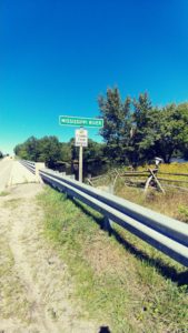
I turned around as quick as I could and stopped on the gravel shoulder to peer into the brush along the river’s edge. She was long gone. We continued down the ‘Calabogie’ into Perth and stopped at the Dairy Queen. It was about 25c and sunny, an ice cream was in order. Time to find lodging for the night. Nothing was available anywhere near here at a reasonable rate.

Rob managed to find a motel in Cloyne, about an hour away. No problem it was still only 4pm. So we decided to just wander around for a bit. The backroads of the Haliburton Highlands are amazing. We wandered down hwy 10 and up 36 thru Maberly and Snow Road Station. After we filled the tanks with gas I decided it was Rob’s turn to lead, he lead us down a sideroad that turned into dirt and ended at an RV park on a river where Rob narrowly missed a porcupine ambling across the road. Back onto hwy 506. The next road he ventured down was more successful, Myers Cave Road meandered thru the highlands and around several small lakes before emerging onto Wintergreen and over to Hwy 41. Imagine that,  The Mazinaw Residence Inn is on hwy 41 in Cloyne. Avoid it if you can. But there was no other accommodation available in the area, this is prime vacation season in one of the most popular vacation areas in Ontario. Oh well. There was a bar and a restaurant. The bar only served the standard commercial bottled beer, Bill and I ordered Corona’s and sat on the deck watching the holiday traffic. The restaurant served an offering of barely edible stuff. The whole place kinda reminded me of that old TV show ‘Faulty Towers’. The owner was the desk clerk, bar tender, cook and waiter. We ordered fish and chips. The fish tasted like Capt’n Highliner and the chips were obviously frozen and cooked in the oven next to the fish. However, there was a general store down the street about 100 yards that served real ice cream.

Day 5

The next morning we headed up 41. At Debigh Rob informed me that he was almost out of gas. There was a Shell station right across the road from the Mazinaw Inn, he forgot he needed gas when we were leaving. A quick check on the GPS showed that Bancroft was about 25kms away, he might make it. Luckily we found a noname gas bar about 10kms along hwy 28. Bill and I decided to wait til we got to Bancroft. In Bancroft, after filling the tanks, we found Dave’s Place, a spotless little café, for breakfast. Great food, good coffee and wonderful friendly service. We decided to just wander around the area for the rest of the day.

During our meandering we found ourselves on Hwy 60 and heading into Algonquin Park. The road was under construction and was probably the bumpiest 10kms I had ever ridden on a touring bike. We pulled into the Muskoka Grill for lunch and found about 50 motorcycles in the parking lot. A quick glance showed that many were wearing H-A patches. I took off my SCRC vest and we strolled in. The place was packed. It was obvious that we were not part of the party, we were not going to get served here. So we decided to head down hwy 31 and stopped in Dorset.

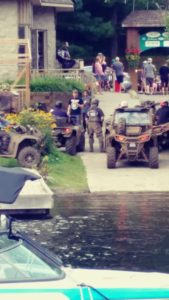
Dorset is one of those little villages that has become a very trendy tourist trap. There are a few restaurants, the old General store and of course the lift lock. We squeezed the bikes into the gravel parking lot and headed into the first café. They were closing the doors so they could clean up after the ATV crowd that was just leaving. The waitress was not pleased with all the mud tracked in. We walked out onto the street just as about 20 ATVs roared past. Across the bridge was another, larger bar with a guy playing guitar on the deck; but the lineup was out onto the street. Oh well, across the street to the bakery and a sandwich to go. We sat on a bench next to the river enjoying our lunch, the sunshine and the atmosphere.

I headed south on 35 and then east on 118 to sideroad 3. The stretch of #3 to Gooderham and then down 507 is one of my favourite rides in the Haliburtons. They curve and twist, up and down, roll and sweep over typical highland terrain for about 50kms. Very nice especially on a sunny day like this.

Aric is a budding rock n roll musician and wanted to visit the legendary ‘Hip’ locale, Bobcaygeon. No problem, a turn onto rte 36 and there we are. Bobcaygeon is one of those very picturesque little towns that has managed to survive long enough to become trendy. The 2 blocks of the main street are chock full of tourist shops and cafes. Bigley Shoes owns about half the stores downtown and sells everything from beach wear to ice cream. We parked, grabbed an ice cream and walked over to watch a few very expensive boats go thru the locks on the Trent Canal which bisects the town.

Mid afternoon; time to plan where to stay Its Saturday in tourist town and we wanted to be near Omemee so we could visit the Buddha in the morning. Rob found us a Knights Inn in Lindsay. Fine.

After settling into the rooms we headed downtown to find supper. We settled on the Olympia for Greek food. It was tasty and generous. The restaurant was crowded but the service was excellent and the craft beer was cold. Another great day with the boys.

Day 6

The following morning we headed out to find a quick bite before running over to the Buddha. The Harley barely turned over but did start. After coffee and a bagel at Tims I climbed on, hit the start button and got that dreaded click, click, click. Dead battery. Shit. Bill had his trusty little jumper cables; but we couldn’t get the Harley to bite. I called CAA and we waited for the truck. About 30 minutes later it arrived, he hooked up the cables and it started first try. By now it was too late to think about attending the temple ceremonies and I could not risk turning the Harley off. And its Sunday, so no where to stop to buy another battery. We’ll have to head home. Oh well.

I did manage to wander around the backroads and make a decent day of it on the way home. I’m sure the boys were disappointed about missing the special Buddha event, but they did not complain.

I parked the Harley in my driveway and called our neighbor Ben, a mechanic and avid bike rider. He is very proud of his 20 year old Yamaha Venture. I explained the issue and Ben hurried over with a battery tester as well as one of those mobile boosters similar to the ones used by CAA. ‘Yep, the battery is toast. This should get you going in the morning. Any problems, give me a shout’.

It started just fine in the morning and I took it into the dealer. Bill escorted me and gave me a ride home.

All in all, a very good trip with the boys; just over 3500 kms. Quite a nice little adventure and only one morning of rain. It was great to have Rob along for the ride again; Aric took about a thousand pictures and would have a few stories to tell his friends; Bill was hooked and looking forward to our next road trip. Yep, it’s a good life.

Eclipse tour 2017

‘Hey Ralphy, wanna go see the total eclipse?’ it was buddy Ken on the phone. ‘It’s gonna cross the Smokie Mountains not far from Maggie Valley. We can check out that museum and ride some great roads. Watcha think?’

That’s all it took. My arm was twisted far enough; The Wheels thru Time museum, some wonderful branded roads and a natural spectacle all in one road trip. ‘When do we leave?’ Our good friend Katrina heard of the expedition and decided to tag along.

We researched the event using the Nasa site. Lots of info there, including towns in the area with special Eclipse events, best locations to view and weather forecasts, as well as a whole lot of scientific facts. The eclipse was on Monday, August 21 and would cross the Cherahola Skyway about 1pm. We scored two pair of special viewing glasses from my wife’s eye doctor, packed our luggage and headed out Friday the 18th at 8am. Depending on our route it would be approximately 1600kms each way. But there was no way we were going to ride straight there and back. There were several outstanding roads to ride in West Virginia, Virginia, North Carolina and Tennessee.

We decided to ride hard and fast on day one so we could get to some bendy roads sooner. 11 hours and 900 kms later we arrived in Chapmanville, WV. It was a boring ride on 4 lane interstates but here we were in the mountains. Settling in to the Best Western, we spent a couple of hours with a six pack of Yingling,  realigning Ken’s GPS to make sure we stayed clear of as many 4 lanes as we could.

First destination, the Back of The Dragon. The ‘Back’ is on hwy 16 from Tazewell to Marion Va, but hwy 16 is just as fantastic further north, so we headed for Welch, WV on hwy 52 and turned south on 16. We immediately climbed a mountain, twisting and turning up and over. We pressed the Harleys hard, enjoying the thrill of riding as quick as we could with little or no traffic. After  the second mountain and valley we decided to stop in the town of War for a break. ‘The Coffee Shop’,  in the ancient downtown was the pride of Obri, a little old lady who regaled us with some of the history of this once booming coal town as she served her ‘famous’ coffee with sausgage gravy and biscuits. They may only be ‘famous’ as something to avoid; but the atmosphere and conversation was wonderful.

back of Dragon

Then back out and onto Hwy 16, twisting and turning over another mountain and down into Tazewell. If you have never ridden the ‘Back’, make sure you add it to your next trip. Absolutely marvelous roadway, sweeping turns, tight twisties and fantastic vistas. so, after a quick stop at the official ‘Back of the Dragon’ store, a chat with Danny, we were off to renew our acquaintance with this marvelous stretch of back road. 3 mountains and 32 miles later we arrived at Marion and the best ice cream stop in the area at the Park Place Drive In. The absolute tastiest ice cream is dark chocolate raspberry truffle. Worth the trip to Marion.

Our planned stop for the night was in Newport, NC. On our way I wanted to stop at Fox Creek Leathers in Independence, Va. I needed another pair of their fabulous deerskin cavalry gauntlets. I always buy the ones with the fringes, just because I like to make a fashion statement. This is my 3rd pair of these gloves. I get about 100,000 kms per set. They are cool enough to wear in summer and warm enough to wear well into late fall. The most comfortable gloves I have ever worn. I had ordered my previous pair online, but prefer to actually try them on first for that perfect fit.

Now off to Newport via the infamous ‘Snake’. Hwy 142 climbs steeply over a mountain, twists down the other side and across the Shady Valley. We made a quick stop at the General store for the mandatory patch, sticker and T-shirt then off over the next mountain. The Snake will remain as one of my favourite rides. It has plenty of challenge plus excellent scenery.

Next, out past Bristol then over to Hot Springs and down ‘Shiners Run’. After a quick stop at the Trust store for a cold drink and to buy a patch, we were off to finish the trail. The Shiners Run gets its name from the infamous moonshiners who used parts of this route to elude ‘revenuers’. It is another great ride and more than worth the trip. We arrived at the Best Western in Newport about 7pm having completed the first real day of back road riding, completing almost 600kms in 11 hours. 3 branded roads plus several other great rides. A very satisfying day.

The plan for Sunday would get us to Maggie and the museum. That would only be about 100kms if we went directly there, but that aint our style. So we headed out in the opposite direction, wound our way over to hwy 151 leading up to the Blue Ridge Parkway in the Pisgah Forest. This is one of those roads that you happen on once in a while just by chance. Ken and I had been riding the Blue Ridge in June this year and the traffic started to bog down, so Ken decided to get off the Parkway. It just happened to be onto hwy 151. What a wonderful, exhilarating set of switchbacks and elevation drops. So we just had to try the climb this trip. Just as much fun. A local told us that they call it the Devil’s Staircase if you are going up and the Devil’s Drop if you are going down. It is only about 10 miles long, but worth both names.

Next stop Maggie and the Wheels Thru Time museum. Ken and I had arrived here on our trip this past June on a Tuesday. They are closed Tuesday and Wednesday so we did not get to visit. This trip we made sure we got there on Sunday in plenty to time to leisurely explore the treasures within.  If you have never been, it is a must for all motorcycle enthusiasts. Dale has collected a vast assembly of bikes from the earliest Hendersons to the latest Harleys. Almost all of the bikes have been repaired and are in running order. Most displays have story boards depicting their history. We spent 3 hours and finally had to leave because our tiny brains were popping with new found amazement. We will be back.

The town of Maggie Valley is a hub for all motorcycling enthusiasts. It doesn’t matter which direction or what back road you head out on, they are all twisty and scenic. Part of the fun is the sheer excitement of discovery. And at each restaurant, each motel and each gas station you will find another enthusiast who will only be too happy to tell you of his latest find.

The next morning we headed out to find our special spot to watch the Eclipse. We headed west on hwy 19, thru Cherokee 
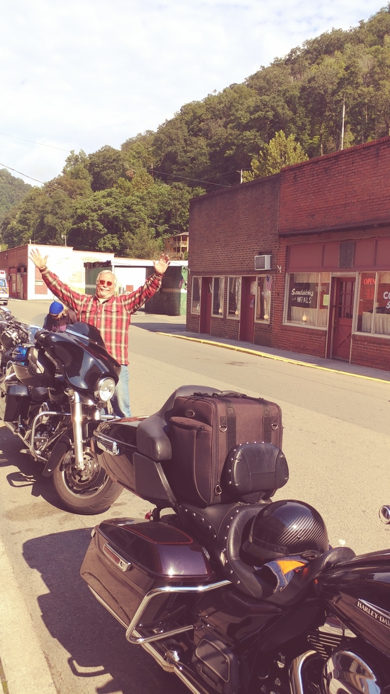
and Bryson City and onto hwy 28 (part of the Moonshiner) and across Sweetwater Road. We made a quick stop in Robbinsville to stock up with some lunch supplies and off along hwy 129 to the start of the Cherohala Skyway. It was a beautiful sunny and hot day. Clear skies and 28C. Then just as we started the climb up to the Skyway, the clouds rolled in. The traffic was thick and cars were parked all along the side of the roadway and even in the ditches. Hundreds of people with back packs and coolers were trudging up the shoulder heading to the top and that ‘perfect’ spot before anyone else could get there. The Nasa site had suggested that the best spot in the area was the Bald Hollow scenic pullover, the highest place you could drive at about 5400 feet. But the site did warn that several locals had been camping there for a couple of days to reserve the spots. It was so congested as we rode along the Skyway that we decided to settle for any spot we could squeeze the three bikes into. The first few pull-overs we tried were over packed and state troopers and park rangers were evicting cars that had wheels touching the pavement. Onward we went. Finally we found a spot on the lead-in to the driveway at a pull-over scenic area. The wheels were on the gravel shoulder, side cases were almost touching the guardrail and the kick stands were just touching the edge of the pavement, well inside the white marker line. Whew, we made it. And, when I walked up and looked up at the sign post, we were parked at the Bald Hollow scenic overlook. Perfect; except for the totally overcast sky. Oh well, lets make the best of it. It was almost 10am, three hours before the event was to start. Too late to search for another potential site with no guarantee to find sun or parking.

We spent the three hours walking up and down and talking to our new neighbours. The fellow next to us was an engineering professor with a Louisiana college, who just happen to be originally from Newfoundland. In the pull-off parking lot was a local family who had taken turns camping here for the past few days to reserve two parking spaces and a site for there portable gazebo and picnic tables. There was also a professional photographer with an amazing camera set up that was mounted on a huge tripod, a massive lense and a motorized assembly to track the sun. He also had three cameras on his little table and around his neck. Everyone was talkative and friendly. A real festive atmosphere.

         Tensions rose as the moment neared and the clouds still covered the sky. Someone yelled out ‘its started, I’m watching it online’. A collective moan echoed into the valley. Then, a small window appeared in the cloud cover, and grew and grew. The clouds parted around our mountain as if a biblical hand had parted the seas. The collective cheer was heard along the mountain roadway. We donned our special glasses and sat in awe as the moon slowly edged its way across the face of the sun. The big yellow PacMan appeared to be swallowing the smaller moon. Amazing. We sat with our backs against the guardrail like little kids watching a magic show.

Then came the big moment. The moon sat completely in front of the sun. An eerie calm came over the area; it was suddenly nighttime. The birds stopped singing, the friendly chatter stopped, traffic came to a halt, the temperature dropped; the earth stood still for several seconds. It was as if the sun had suddenly set, midnight was upon us; but dawn stretched all the way around, dawn on a 360 degrees horizon.

 Then someone whistled, loudly; spontaneously a cheer rose from the crowd, followed by laughter and applause. The magician had succeeded. Strangers hugged and congratulated each other as if they had somehow caused this to happen. Goosebumps ran up my arms, several times. The professor was on the roadway calling us over to look at something. ShadowSnakes. A phenomenon only seen during a total eclipse. It indeed looked like grey snakes were slinking up the roadway. He explained that because the sun radiates in an irregular pattern and the moon surface has many mountains and valleys, the effect is shadows that appear on light-coloured surfaces. And because both celestial bodies are moving, the shadows move. ShadowSnakes. Awesome.

We stood there in the middle of the road absorbing this awesome event. It felt much longer than the 2 minutes and 38 seconds and will leave an impression on our psyche for years. The three of us remarked on how this moment will be part of our collective memory for many years. A truly unforgettable moment shared with great friends.

It seemed almost like a let down as we decided to head off the Skyway and on to our next event; the Dragon’s Tail. Most would consider the Tail a hilite of any motorcycle trip, but to us it will always just be the thing we did after we watched the Total Eclipse of the Sun.

So, back along the Skyway toward Robbinsville and hwy 129 up to Deals Gap. We did the mandatory stop at the store, took photos, bought another patch and headed out to run the twistiest 11 miles most bikers will ever ride. Perhaps its because I have ridden the tail about 10 times already, or maybe it was just because it was following the Eclipse but most likely it was because I was following several cars who seemed to be having difficulty with the turns; but it was not an exciting ride.

At the north end of the Tail we turned onto the Foothills Parkway. The Foothills is one of the best scenic rides in the area with multiple pull off areas to allow you to take some pretty amazing photos. There are a few spots where you can see several states down along the valleys and mountain ridges. Beautiful.

We finished our evening at the Best Western in that hectic tourist town of Pigeon Forge, birthplace of Dolly Parton and home to DollyWorld. I grabbed a sixpack and we lounged at poolside before heading next door to the Texas Roadhouse for a lovely rib dinner. Quite the day. It will be hard to beat this one.

During breakfast we decided that the objective today was to see how far we could ride without hitting any major roads on our way north. Like I said, there are so many nice scenic, riding roads in the area, its hard to be disappointed. I don’t think any of us remember exactly which roads we took, Ken and I took turns leading, just trying to stay in a generally north and east direction. We stopped for gas just past Bristol and decided that the Back of the Dragon deserved one more ride, and an ice cream would not be turned down. So over to Marion, lunch at the Hardee’s burger joint and a stop at Park Place for ice cream. It was closed. So disappointed. Oh well, the Back was here to enjoy, so it was definitely not a waste of kms.

We topped the first mountain and were twisting our way into the valley when Ken pulled his Street Glide off in a parking area. The look on his face told me he was not happy. Apparently he had lost his front brakes coming down the mountain. We did a quick inspection but could not see anything obvious. We decided to take Danny up on his previous offer of any assistance when in the area. We rode to the Back of the Dragon store and luckily he was in the office. He called his friend at HawgPit cycles and off we went. HawgPit Cycles is primarily a custom shop and the showroom had several of their creations on display. Trevor took about half an hour to put new pads on Kens bike. The pads were worn but mostly just overheated. Now they were good as new and off we went, back over to hwy 16 and up to Welch. This is a great ride. If you are ever in the area you must ride from Welch to Marion, and back again. Marvelous views, mountains and valleys, more than enough tight twisties and plenty of sweeping curves. Love it.


We arrived in Beckley about 7pm just as it started to rain. Got rooms at the Marriott and headed to the OutBack for steak dinner. Tomorrow would be a long stretch of 4 lanes all the way home.


Now  that’s a marvelous 6 day adventure. Thanx Ken and Katrina. Biking buddies for life.


East Coast Tour, 2017, part 6, Fundy Shore

East Coast Tour, 2017, Part 6
Moncton to Bangor

What a glorious morning; 20C and nothing but sunshine at 8am on July 31. The forecast for today was a high of 26C and not a chance of rain. Life on the road doesn’t get much better than this.
Over breakfast at the A&W just down the road from the Sheraton, we discussed todays plan. Well actually, I told Roz what my plan was and she said, ‘Whatever’. I had booked us back into the Best Western in Bangor, Me for tonight. If we rode straight there, its only about 425 kms, allowing us about 175 kms of wandering to keep under my promised max each day of 600 kms. We had talked to fellow bikers at the bar last evening who were headed to Hopewell Rocks this am. Sounds like a destination.

We crossed the River via the Findlay Causeway and turned right onto hwy 114. Hillsborough Road follows the meandering river all the way to Hopewell Cape, passing thru many small villages. We pulled into the parking lot at Hopewell Rocks Park and were amazed at the number of cars and vastness of the parking lots. It was 10am on a Monday morning and there was a lineup of about 50 people to get thru the pedestrian gates. I managed to find a spot to squeeze the 2 bikes into about 100 yards from the entrance, left Roz there and went over to inquire about fees, walking distance, etc. At the booth a very friendly young lady explained that there was a shuttle to take us down to the lower level but of course it did not go out onto the beach area. The cost of admission was $15 per person and because Roz is a senior with a disability the shuttle was free. She did admit that the view of the famed Rocks was somewhat limited from the parking lot at the base of the cliff and that walking on the rocky beach might not be comfortable. Roz was not prepared to submit herself to the discomfort of a rocky walk and did not think it was worth the $15 to get a distant view of some crumbling old rocks. So, off down the road we went.

Not far down hwy 114 we came across a stretch of roadway near Hopewell Hill, with an incredible view of the Bay of Fundy and one of those iconic white churches. I had to stop and try to take in the spectacle. Amazing, and the view was free. Just a few miles further down the road we stopped at an old covered bridge that was protecting a roadway to nowhere. The newer road had bypassed the old bridge but the old covered bridge had been preserved. At the corner of rte 915 and hwy 114 sits the tiny hamlet of Riverside-Albert and at the edge of a large dirt parking area is a big billboard showing a very faded map of the area. Rte 915, stretching off to the left, was not well paved and in fact the centre-line was about as faded as the map on that billboard; but it appeared to head down toward the Bay. Roz was dubious, but I insisted that this was an adventure just waiting to be experienced, so off we went.

Rte 915 was all it promised; meandering, narrow and full of pot-holes. About 5 miles down the road was a sign pointing to a sideroad on the left; ‘Cape Enrage, 12kms’. I stopped and looked at Roz. How can you pass on an invitation like this. And that name ‘Cape Enrage’, now that’s intriguing. The narrow road immediately took a dive down into a valley, across a marsh area and then up an escarpment; thru a pine forest then down into another marshy valley. As the road turned at the head of the marsh we saw the most amazing little beach where a few cars had pulled over. The road was built onto the rocky berm separating the beach from the marsh and the beach was protected on both sides by cliffs of stratified rocks. Over the years the severe weather had obviously broken pieces of the strata off, littering the beach. Passersby had taken the task of erecting those flat rocks into hundreds of Inuksuk statues. The entire beach was a seashore village populated with various sizes of rock people. Amazing. How Canadian.

Just past the beach the roadway rose again over the cliff in two very sharp switchbacks then around a curve and directly into Cape Enrage Park. The park is stuck at the end of the northernmost spur in the Bay of Fundy and consisted of a lighthouse, small museum, a gravel parking lot and several hiking trails and boardwalks. A $5 fee was collected at the gate and we were directed to the handicap parking next to the museum. The café was closed but the gift shop sold softdrinks, etc. I walked out along the boardwalk, down one of the hiking trails, around the lighthouse and up the tower to the platform for the non-operational zip line. It is a fascinating place. One can only imagine the isolation of the lonely keeper and his family when this place was manned and the only access would have been up from the Bay.

We returned back out that twisty road and left onto rte 915. Just a few miles down the road we returned to hwy 114 and the village of Alma. Alma is one of those quaint little fishing villages that now derive most of its income from tourism. There are several motels, shops and cafes to wander thru and explore. And the Fundy National Park is just across the bridge with its hiking trails, campgrounds and golf course. We chose the Alma Boathouse restaurant for lunch simply because there was a parking spot right at the front door. Roz ordered the lunch special, fish and chips and I chose a bowl of fish chowder. Both were excellent. Roz sat to enjoy an extra cup of coffee and a chat with the very friendly waitress as I went for a stroll around town. At the Alpine Motel I stopped and talked with several bikers enjoying a cold one at the picnic area overlooking the harbor. They were from Quebec City and this was their first trip down this way. As I walked over toward the docks I noticed that there was no water in the harbor. A boat was sitting on the muddy seashore and a man on a ladder was attending to repairs. I quess this kind of thing must be fairly common during low tide, but as a landlubber, it sure looks strange to me. As I walked back along the sidewalk to where the bikes were parked I spotted 2 teenagers with their guitars in front of the pizza shop. They were very good and truly seemed to be enjoying themselves belting out local and popular east coast songs. I emptied the change from my pocket into the open guitar case as I skipped past.

We hopped back on the bikes and headed west on hwy 114 again and thru the Fundy National Park. Just past the park I spotted a sign for McCabe’s Ice Cream. It was about 27C and sunny and I just could not drive past. Mr McCabe greeted us in the small, rickety, old building that he called his ‘ice cream factory’. He explained why McCabe’s is the best ice cream ever made. He told a great story, but its still just ice cream. It was good, but I found the flavor a little lacking. But i guess on a hot day like this, any ice cream is good ice cream even if it was over priced. It was almost 3pm when we hit hwy 1 and we still had about 350 kms to travel today, so I decided that we should just hop on the hwy and head off to Bangor even though there are many great looking roads in the area that were begging me to explore. The ride back to Bangor was boring, and we had travelled this route in the other direction last week. We made one quick stop at the Irving for gas before turning onto Hwy 9 and west to Bangor.

We arrived at the Best Western, WhiteHouse inn just before 8pm and because it was a Monday, the bar in the basement was open. We were hot and thirsty and decided to take advantage of the free beverage that came with our room before deciding where to go for dinner. There were only about 6 people in the bar area which featured an old wooden bar that ran about 25 feet along one wall with perhaps a dozen stools. We plopped down at the two seats on the end of the bar and put our coupons on display. Karen, the bartender explained that the coupons were good for one small glass of local beer each, 3 to choose from. I took the IPA and Roz the lager. Both were excellent, but too small, we finished them and ordered large refills. Karen introduced us to the lady sitting a couple of seats away. She was a regular and came here every Monday, Wednesday and Friday for dinner. The bar did not actually have dinner, but Karen made her own dinner at home before coming to work and 3 days a week brought extra to share with Laura. Laura was a widowed, retired school teacher and had taught Karen and her kids. This was Karen’s way of returning the favour and maintaining Laura’s sense of community. We struck up a lively conversation with Laura about Bangor, Maine, local and national politics, etc. It was obvious that even though Laura had voted Republican most of her life, she did not care for Mr Trump. Karen asked that we keep our voices down, the patrons at the other end of the bar we red-neck Republicans well into their evening of drinks. Then Karen advised that even though the bar does not offer a menu, she could order from Dysart’s Truck stop next door and they would deliver, or she could toss a frozen pizza into the oven if we preferred. We opted for the pizza, we had experienced the truck stop food on our previous visit. Just as we were finishing the pizza and our beer we were joined by Doug, a truck driver who gets up this way a couple of times a week and stops over for a beer and a chat with Laura and Karen whenever he can. Karen said he was a Democrat, so it was ok for him to join us. Laughs all around. We ordered another beer each, stayed for about another half hour before heading up to our room.

Another great day; about 600 kms, wonderful roads, great vistas and fascinating people. I do love this life.

East Coast trip, part 4… Ingonish

Ingonish, Cape Breton

It was beautiful, sunshiny morning in Port Hawkesbury and after breakfast at the A&W, off we headed. I told Roz to take the lead and pointed north. We went thru town, past the Tim Horton’s then left past the Sobey’s. She almost got onto the hwy 104 but I told her to go straight up hwy 4. Route #104 heads toward Sydney, wrong direction for us today.  Roz says that I tend to lead even when I follow and I got her to turn left onto Riverside Road. This is one of those meandering semi-paved roads that seem to lead nowhere. I loved it but Roz kept stopping to ask if we were lost. ‘We are on holidays, we are riding the bikes in the sunshine, so how could we be lost. Just enjoy the road, it will be fine’. And yes it finally did come out to Hwy105 and off we went toward the Cabot Trail.

We have traveled this road many times and decided not to stop until we were up the Cabot Trail a ways. We rode past Whycocomagh and Baddeck, but if you are riding this way only once, make sure you stop for a day in Baddeck. Visit the Bell Museum, it’s a fascinating place. And there are many great little shops and cafes in this beautiful little town on the Bras D’or Lakes.

We decided not to wait for the Englishtown Ferry. The lineup extended all the way back to the intersection at St Anns. The ferry crossing will save you about 30 minutes, but only if there is no lineup. Besides, the road around Englishtown Bay is a wonderful, bendy-road ride. Because we have been up this road many times, we have our favourite places to stop. One of them is the Clucking Hen Bakery & Café just past Cabot Shores. They now have a new larger covered deck overlooking the ocean. The menu is limited depending on the time of day, but everything we have tried has been fresh and tasty. Tea and scones, sitting in the sunshine overlooking the ocean; welcome to Cape Breton indeed.

Just up the highway after Wreck Cove you get your first glimpse of Ole Smokey, one of the most photographed rock faces in Cape Breton. As you climb the escarpment you twist around the only true switchback on the island, followed by several quick turns that don’t allow you the time to look out over the spectacle of the Atlantic Ocean. There is a pull off area at the top but you have to walk about 500 meters to look over the edge and back down that iconic roadway. I think its worth the hike.

For the next several miles the road follows the coastline around a few bays and thru a few small villages. The village of Ingonish has a few stores, a couple of cafes, an Inn, a bank and the Beer Store. When you leave Ingonish you enter the Cape Breton Highlands National Park. There is an entrance fee that allows you to stop at any parking area in the park. The small park office here also has info on camping and hiking trails. We decided to ride thru to visit Hugh first.

We arrived at the hospital in Neil’s Harbour about 1pm to find out that Hugh and Margaret had left about an hour ago. Great; now back down to Ingonish. I guess the news that Roz and I were on our way was enough to get Hughie up off his ass. Hugh is now 90, Margaret is 83. They live in Burlington, spending summers in Ingonish. They have been our friends for almost 30 years and we have been fortunate enough to have visited their lovely cottage about 15 times.

The cottage is called ‘Happy Days’ and is on a small strip of property right on the Cabot Trail with a full ocean frontage. The cottage is really a glorified mobile home that has been jacked up and placed about 25 feet from a ten foot cliff on top of Ingonish Beach. The beach is a semi-circle of sand about 30 feet wide and 5 miles long stretching around Ingonish Bay. Hugh and Margaret have built a small deck that sits right on the edge of the cliff and a walkway leading to a larger deck that runs off the kitchen of the cottage. A few years ago they built a one room cabin about 20 feet north of the cottage for guests. The cabin is complete with a queen sized bed, a small table, a kitchenette and a ½ bath. The whole front wall is windowed and completes this perfect, picturesque locale. It aint fancy, just awesome.

When we arrived at Happy Days, Margaret ran out to greet us with lots of hugs and kisses and teary eyes. Hugh was sleeping but had been overjoyed to hear that we were on the way. Margaret was preparing lunch and could barely contain herself; Hugh has been a great challenge for her of late, she was looking forward to a long chat and perhaps a G&T or two.

Hughie had been acting his age lately, less energy, disinterest in anything, refusal to eat, disgruntled; then he caught a cold which turned into pneumonia. Hughie is a cancer survivor with several other problems associated with the elderly, but until recently had been quite active. I had played 9 holes of golf with him the previous summer and had difficulty beating him (I never beat him before he turned 80). The local doctors had informed them that Hugh should get back to Burlington as soon as possible to have the doctors have a look. Hugh was responding well to the anti-biotics but the doctors in Burlington would be better equipped to deal with the problems.

Margaret asked how long we could stay. She had phoned and had their return airfare tickets changed to a week tomorrow; that was the earliest flight they could arrange. Problem was they didn’t want to leave the cottage without cleaning things up a bit. They have a regular tenant that arrives September first each year and leaves at the end of June; a school teacher from Halifax. They wanted to make sure things were in order for her. Hugh usually spends all his spare time each summer repairing and cleaning, etc. This year he was unable to do anything.

As I said, we have visited here many times. We have been here more than any of their family or other friends. OK, we’ll stay for a few days and see what we can accomplish. We do love it here, the scenery is idyllic, the people fantastic and of course there is the Cabot Trail.

For the next 4 days I spent several hours each day painting, cutting grass, cleaning eaves, repairing lawn furniture and emptying ‘things’. I got up early every day, made a coffee and sat on the beach deck watching the sun rise. Absolutely awesome. After breakfast I got as much work done before noon as possible, then it was off to ride the Trail and hike the Highlands. In the evenings we drank beer and played cards or just sat and listened to the ocean. I love this place.

Quite a bit has changed in the 25 or so years since we first visited Cape Breton. Our favourite pub used to be the Thirsty Hiker in the basement of the GlenGorm Inn; but that is under new management and the pub is now closed. They used to have a one man band there every evening and the place was packed with fun loving tourists and locals all singing along with the ballads and shanties. We did manage to take Margaret to her favourite café, The SeaGull for lunch. They still have the best fish and chips in the area, but somehow not as good as I recall. The SeaGull is a very old family run restaurant with an enclosed (in plastic sheeting) patio overlooking Ingonish Bay. The place was packed and we stood in line for about 20 minutes before finding a table in the main room. The service was terrible, too many customers, not enough family.

Prior to leaving on this trip, Roz had made friends with a fellow Spyder rider on Facebook who lived in Ingonish. Mike and his wife had recently sold their home in Kitchener and purchased the Island Inn. Roz called Mike and he invited us over for a coffee. The inn was a beautiful old frame mansion on the hill in the middle of the little village of Ingonish. After coffee on the huge verandah and a very pleasant chat with Mike and Rhonda, Mike volunteered to lead us on a ride up the coast. Of course we had been on every road in this area many times, but it was a lovely day for a ride.

There is only one main road, the Cabot Trail, that winds its way up the coast. If you have never been to Cape Breton, go. The Cabot Trail is renowned worldwide as one of the premier motorcycle riding roads in the world. Some of the scenery is truly breathtaking. The problem is that it is a narrow 2 lane road and the traffic can be quite thick, especially on sunny weekends in July and August. This is further complicated by badly needed road construction. The main hiway past Neil’s Harbour is closed for the summer as they completely tear it out for a 5 mile stretch for widening and replacement. We seldom take the main hiway anyway preferring to ride the old hiway along the shoreline. Now all the traffic must go this route.

We travelled up the road, not bothering to explore the few sideroads. Mike stopped at Angie’s Family Restaurant for lunch. Service was slow, food was mediocre and prices were a little higher than would be expected for such a small, cozy place. We travelled back to Ingonish only stopping once at Broad Cove to admire the scenery.

On the third day at the cottage and after my choirs, I took off on my own to rediscover some of my favourite places. On the scenic road around Neil’s Harbour the first bay you come to is the little hamlet of New Haven. When I pulled over to take a photo of the view a young lad, Trevor, rode over to me on his bicycle to admire the Harley. We chatted for about 10 minutes, he was born here and had never been farther than Sydney. His dad was a fisherman and his mom worked at the hospital. One day he was going to buy a Harley and ride to Halifax or maybe Boston.

My next stop was the sideroad down to White Point. I love the short trip off the mountain down into this picturesque old fishing port. It is truly a different world. Next, back out onto the Cabot Trail then a ride out to Dingwall. Many of the roads around here wander along the coast or follow a river or some other natural flow of the land. Most are poorly paved and if you decide to leave the main road be prepared to encounter large potholes or gravel. If you do decide to be adventurous, use caution but you will be rewarded with some startling views and interesting non touristy locales. My favourite along this section of the Trail is Bay St Lawrence. The village has almost disappeared, populated now with only a couple of scattered shops and houses perched on the rocks around the Bay. Bay St Lawrence was apparently the first place John Cabot stopped when he visited this area over 400 years ago because it has a deep, accessible, natural harbor. If you are real adventurous, take the side road up to Meat Cove, but beware, the last section up the mountain is gravel and steep. There is a campground at Meat Cove with a spectacular view and a Chowder Hut. Check it out if you can.

The following day I decided I needed to go for a hike after several hours trying to be handy Andy. One of my favourite hiking trails in the area is Mount Franey, but that is at least a 4 hour hike and quite a climb and I am getting to old to jog around like I have in the past. My second favourite is MiddleHead. To get there you have to ride past the Keltic Lodge and the Highland Links Golf Club. The lodge is now an upscale inn and spa catering to those with lots of money. They do have an afternoon tea that is reasonably priced that will allow you to take in the old world atmosphere. Try it. And 25 years ago The Highland Links Golf Course was rated as the number one course in Canada. The first time I played there they did not have cart paths so you had to carry your clubs. Not a big deal until you consider that the tenth tee is about 1000 feet above sea level and the first few holes run along the coast and it is almost a kilometer between the 8th green and the 9th tee. Take the cart if you want to play this challenging and extremely scenic course. The course is remarkable in many ways, rough cut in the 1930’s by hand. There are only a few places on the course where you can even see another fairway. If your ball leaves your fairway it is lost in the bush, just drop another and take the penalty. The view from the 15th tee is unbelievable, almost 600 yards long, down a steep, bumpy hill with the iconic church steeple as a guide to the green and the Atlantic Ocean as a back drop. .

I parked in the lot just past the Inn and removed my chaps. I had come prepared, wearing shorts and hiking boots. The MiddleHead trail is an old cow path from the original farm settled here by a Scottish lord in the 1800’s. The ‘MiddleHead’ is a mountainous spit of land that juts out into the ocean for about a mile. The trail has many spots along the way where you can stop for great views of Ole Smokey across the Bay, but the real treat is the headland itself. The Trail ends at a cliff standing about 100 feet above the Atlantic Ocean. Sea birds flash the cliff edge to get a lift on the air flow rising off the sun drenched cliffs. And if you are extremely lucky you can perhaps catch site of a whale at sea or seals on the rocks at the foot of the cliff. Its a perfect spot to stop and enjoy a quick snack. The round trip takes about 90 minutes depending on how quick you walk and how often you stop to be amazed by the scenery.

Then it was back to the cottage and a quick dip in the ocean before dinner. Margaret’s homemade offering was capped by a spectacular evening sitting on the deck watching the ocean and sipping on a cold one.  Yep, a tranquility and peace that the rest of the world may never experience.

Tomorrow we continue the adventure.


East Coast tour, part 5, Ingonish to Moncton

East Coast Tour

Part 5

Ingonish to Moncton

The time had come for us to bid goodbye to our friends in Ingonish and their ‘Happy Days’ cottage. We will miss this place, but new adventures await down the road.

From Ingonish we headed north to complete the loop around the main island, following the Cabot Trail and stopped at the Bean Barn Café for breakfast. It’s a wonderful little spot with great coffee, friendly service and reasonable prices. The larger and more popular Coastal Waters restaurant further up the road, lacks the atmosphere and café style food for breakfast and is better suited for evenings.

This morning was very sunny and the views along the way were stunning so it is no wonder that the Cabot Trail attracts so many tourists every summer. At the north end of the island are the famous mountains forming the ‘highlands’ of Cape Breton. The road is under construction in a few places but because this was a Saturday, the crew was not on duty so we encountered no real delays. There are many spots to stop as you cross the mountains and you will recognize many of the scenes from the iconic Cape Breton postcards and calendar shots.

A stop at the Rusty Anchor restaurant for a snack is almost mandatory on every trip around the north shore. There were several bikes in the parking lot and quite a few cars. We decided to just grab a coffee and go and sit at one of the picnic tables. As we walked toward the tables a big biker spotted us and moved around the table to free up space. We sat at the space offered and struck up a conversation with him and his mates. This was their third trip in the past 5 years to Cape Breton from Woodstock, NB. And as always, it is amazing. They were on their second day on the island, travelling clockwise this trip. They had travelled counter-clockwise on their previous 2 trips and decided a change was in order. Like most frequent riders of the Trail, none can agree on which direction offers the best ride; its all good. They had stopped at Margaree Harbour last night staying at the same motel we had stayed on our previous trip in 2015.

A little further down the road is the town of Cheticamp. Most of the western shore of Cape Breton is French speaking, but they are still Cape Bretoners, happy and friendly. There are many small shops and curious places to stop along here but if you enjoy country music or just want to hear a sample of typical east coast music, stop at Charlie’s Country Music store. Their collection of local artists is awesome.

The cuisine is slightly different on this shore due to their French heritage and we decided to stop for a quick lunch. We picked Le Gabriel this trip, but almost any of the family run cafes and taverns would offer a similar menu. Le Gabriel is a rather large tavern that features a big stage with very lively entertainment each evening. Be prepared to enjoy yourself, ‘Coaster’ style if you are fortunate enough to find yourself within walking distance of this venue. And I mean walking distance, I have been told that the local constables look for out of town patrons leaving the establishment. On this trip we were here at lunch time, so just a cup of tea as we shared a chicken pot pie and poutine. Yummy. And apple pie for dessert. The best.

The next stretch of roadway is one where I always stop several times to take more than a few photos. It is just so East Coast with that magnificently meandering road along the ocean. Its an image you will want to add to your memory banks. We stayed on the main roadway, made the turn at Margaree Harbour, turned right at Margaree Forks and right again at West Margaree and then pulled into the park area in Inverness for a break.

Inverness is a beautiful vacation village with many shops and cafes and a long, sandy beach. There is a Links-style golf course here overlooking the ocean that is a small, tight course suitable for the average golfer, but watch out for the sand traps and tall fescue grasses. A sand dune and boardwalk separate the golf course from the ocean and on a nice sunny day like this the beach was full of sun seekers and families just enjoying the water and sand. I walked down to the other end of the beach where I found a small hut serving typical beach foods, hot dogs and ice cream, but there was a line up of anxious kids and I decided to pass. When I returned to the parking lot, Roz was engaged in a conversation with a couple that had parked their Harleys beside us. They were on their almost annual trip around Cape Breton from their home in Halifax. They were also travelling clockwise this time.

Back on Hwy 19 and south to Mabou, home to the Rankin family, the famous singing family who run the Red Shoe Café on main street. We were not hungry so didn’t go in, but an ice cream at ‘The Rolling Cones’ caravan across the street was just too much to pass on. After the ice cream we went exploring a little and found an absolutely fantastic old church on the hill around the corner. I am not a religious person but there is something magical about the architecture of an old church on a hill.

We continued on down Hwy 19 and into the old town of Port Hood. This is one of those places that looks like it was perhaps modelled after a Hollywood set of what someone thought an old port town should look like. Or perhaps this is the place that some set builder from Hollywood visited before they designed a slightly run down, once prosperous, main port and fishing village. Or maybe its just me, but that’s what I think everytime I pass thru.

Next stop, Port Hawksbury. This time we were lucky enough to book the Econo-Lodge, MacPuffin Inn. We have stayed here several times because it is a less expensive, small, clean, friendly and family run inn. They also own the restaurant and motel across the street (good for a $5 discount on breakfast). We took a quick dip in the indoor pool, went for dinner at Papa’s Pub in downtown Post Hawkesbury, then sat on the deck chatting with our neighbours. A fitting end to this beautiful day.

The next morning promised nothing but sunshine for the day and we decided to ride the Sunrise Trail enroute to Moncton. We had prebooked the Sheraton again on points, so all was good. The MacPuffin restaurant was packed, it was Sunday morning; so we settled for the A&W. They actually serve a very nice breakfast and its cheap.

We crossed the causeway and stayed on hwy 104 until Hwy 106 and then up to Pictou. If you have time, get off at Antigonish and take rte 337 up to Cape George then along the coastal hwy. Very beautiful. But we didn’t have time on this trip for both that and the Sunrise. Alternatively you could take the ferry from Pictou to PEI. But again no time on this trip.

After we crossed the causeway on hwy 106 into Pictou we grabbed rte 6 and headed off toward the cape region and the famed Sunrise Trail. Just a few miles outside Pictou, I spotted a roadside cafe that served ice cream. Gotta stop. It was one of those quaint little family run places with Grandpa behind the counter, Mom at the till and 2 teenagers waiting tables. We ordered ice cream and headed outside to join the locals at the picnic tables. And as happens all too often, the conversation was about Roz and her Spyder. ‘You rode that all the way from Toronto? Amazing’. We rarely ever get comments about my Harley Ultra. Hmmmm.

This roadway follows along the edge of the Northumberland Strait separating PEI from the mainland. If you like ocean views, small villages and rolling farmland; you will love this road. We stopped at the Chowder House on Main Street in Tatamagouche for lunch. The seafood chowder was quite tasty and with a fresh baked scone, very filling. This little town is the largest along this famed roadway and is quite picturesque.

We turned right onto Fox Harbour Road at Wallace. It is a smaller less travelled road but equally scenic. I pulled over at the Gulf Shores Camping ground for a break and walked down to the shore, took off my shoes and walked a bit in the cool waters. Very relaxing. Nice spot. We joined back up to rte 6 at Pugwash and stopped at the corner gas station to fuel up. A trio of bikers pulled in beside us and asked what was down that road. We were happy to tell them, more of the same with a wonderful little park.

Just past Port Howe we pulled onto rte 366 then around  a loop and onto Hwy 16 toward Moncton. We arrived at the Sheraton about 5pm and decided not to submit ourselves to the over-priced menu at the in-house restaurant. It was a beautiful evening and we decided to just head out see what we could find. We ended up in Shediac and a small Mexican place overlooking the local waterway. The owners were actually from South America and suggested an authentic fish dish. It was delicious. The DosEquus was cold and the atmosphere very pleasant.

We arrived back at the Sheridan about 9pm and took advantage of the free drink offered before heading up to our room.  Into bed by 10:30 after a very full day.


East Coast tour, Part 3, NH to Cape Breton

East Coast Tour

Part 3

Franconia to Port Hawkesbury

My morning walk took me out past the Dow Academy along the Gayle River and up Fox Hill hiking trail. One of the things about hiking in an area you have never visited before is to look at a map before you head out. I did not have a local map but luckily I found a posted hiking map at the junction of the river trail and Fox Hill. It promised a 3.2 mile loop hike. I suppose that the map was correct, the problem was the trail markings, there weren’t any. And there were many intersecting trails. Somehow I managed to get up the hill and back to the river in about 90 minutes. I have no idea if I was actually on Fox Hill but the hike was exhilarating and the view from the top almost worth the climb.

While I was cleaning and loading the bikes, the couple who had parked their Harleys next to us came out. They were from Montreal and quite often came here for the weekend. Franconia was a pleasant afternoon run down from Montreal and the roads here are great for exploring on bikes. I asked about a place for breakfast and they suggested the Pancake House only a few miles away.

Roz emerged about 10am and off we headed. The Pancake House was indeed only about 5 minutes away. The parking lot was packed and the line-up was out the door. Pass. We decided to head back to Bethlehem and the Maia Papaya.

After breakfast we headed east on hwy 302, north on hwy 3 and turned right onto #115. The Owl’s Head Hwy crosses over a couple of mountains and thru 2 spectacular valleys. It made me wish we had planned on spending more time in this area, there are so many more roads to explore. We turned east on Hwy 2 and made our way toward Bangor, Mn.

Hwy 2 is an old interstate hiway that is well travelled and passes thru many small towns. For the most part it is a pleasant 2 lane hiway past rolling farmlands and along beside rivers, great for just riding. We stopped at the McDonalds in Farmington for lunch because we couldn’t find anything else. A biker in the parking lot afterwards told me that we could have gone to the BrickYard Café back on the west end of town. Too late.

We pulled into Bangor about 4pm and decided to roll downtown before checking in to the BW. Oh look, a Tim Hortons. We had to stop. The Tims is located on the main street and overlooks a large park. There was a festival of some sort happening in the park and we sat on the patio outside Tims listening to the very loud rock music. It was so loud and distorted it was impossible to recognize any tunes or tell if it was any good.

Our BW was located back on the west end of Bangor just off interstate 95. The hotel is called The White House Inn. It is indeed a large white building with a small portico styled entrance. Inside the lobby was a life-sized cut out of President Trump. Apparently they keep a cut out of the current president in the lobby at all times. Roz had to have a picture with her favorite politician (not). Furthermore, the hallways are lined with official looking photos of all the past presidents. Our room was in between Nixon and Johnson.

The only convenient place for dinner is Dysart’s Truck stop next door. This is an older truck stop and is very popular with the locals. It was crowded. The service was friendly but very slow. The food was not good. I ordered the dinner special, hot turkey sandwich. The mashed potatoes were pasty and the gravy was too salty. Roz ordered the fish and chips; the batter was too thick, but the chips were hand cut. The BW does have a bar downstairs, but it was Sunday and it was closed.

On Monday am I packed up the bikes and joined Roz for the BW breakfast. It actually wasn’t as bad as most. The scrambled eggs tasted like real eggs. Amazing. Roz got into one of her political discussions with a couple from Connecticut. Roz is a liberal and big Bernie supporter. The couple from Connecticut were unapologetic Republicans. Oops.

We returned to downtown Bangor and headed east on Hwy 9. The weather was cool and overcast so we decided to just head straight for Moncton.  About 11am we found a quaint little restaurant called the Homespun Family Restaurant in the middle of Maine on Hwy 9. It was very nice and friendly. The only other couple in the place were locals and expressed their amazement that we had travelled all the way from Toronto on motorcycles. The homemade tomato soup and fresh baked bread were excellent.

The Hwy continued its meandering thru lush New England countryside until about 2 pm when we arrived at the intersection of hwy 9 and hwy 1. We needed gas and a coffee, so we stopped at the Irving Big Stop. We parked beside an older RT Spyder just as the rider emerged from the cafe. He was from Fredericton, travels this way often and always stops here. He was on vacation and headed to Boston to visit friends and take in a baseball game. He recommended the lemon meringue pie. He was right, it was very good.

The new border crossing at Calais (pronounced Kallaze by the locals), is now open but is primarily for commercial traffic. I decided to proceed to the old crossing at St Stephen. There was absolutely no line up and after a quick chat with the border guard, we sailed right thru. The main street in St Stephen is totally torn up and we were rerouted thru the parking lots behind the stores. The signage is down and I missed the turn to the hiway. We travelled a few miles along the coastline before I found a road leading back out to join hwy 1.

We pulled off at St John and found a Tim Hortons and a Petrocan. I called ahead to the Harley dealer in Moncton and made arrangements to have new tires put on the next day.  These tires had about 22,000kms and would probably do for another 3000 but we were headed for Cape Breton and into a few days of rain.

Our lodging this night was the new Four Points Sheraton in Moncton. Very nice and the right price (free with our Aeroplan points). I went out and toured around to find the Harley dealer and a beer store. It was raining when I returned to the hotel so I covered the bikes and we decided to eat at the in-house restaurant. It was expensive but the food was quite well prepared. Roz had a rib-eye and I had the chicken dinner. Both served with lightly sautéed veggies and baked potatoe. Yummy. Oh yeah, and a very hoppy local craft beer.

I was sitting at the Harley dealer by 8:30am, they didn’t open til 9am.  Promptly at 9 o’clock they wheeled in my bike and got right to work. I went for a walk and found a great hiking trail down and along the river. It went out across the marsh and along a dike. I walked part way with two ladies and their dogs. Very pleasant chat about this new walking trail and the plans to extent it along the river front for several miles. I was back at the Harley dealer by 10am, looked around the store and did not buy a t-shirt. Just as they were pulling the bike out the service door, my friend Roger showed up. I had emailed him yesterday and told him I would be here this morning. Roger is from Moncton and had lived in Oakville, Ontario for many years. We rode together many times when he was a member of the same riding club, SCRC57. Roger moved back to Moncton a couple of years ago after a bike accident forced him into early retirement. He is in a new relationship and is recently back riding for the first time since the accident. I excused myself and declined his offer of coffee, I had to get over to the hotel in time for the 11am check-out. Thank you to the guys at Toys for Big Boys and their excellent service.

It had started to rain and we chose to stick to the hiway and head straight for Port Hawkesbury. As is my custom, we went online the previous night after deciding where we would end up the following day, to book a room. We have been to Cape Breton many times and quite often stop at Port Hawkesbury before trekking up to our friends in Ingonish. I could not get a room at our preferred motel and had to settle for the Skye Lodge. It was cheap. Enough said. We phoned Margaret and Hugh last night and told them of our plan to be there Wednesday, simply stopping for lunch and carrying on. Margaret informed us that Hugh was in the hospital with complications from pneumonia. We offered not to come by if not convenient. On the contrary, she insisted that we get there asap and help cheer up Hughie. He was very ill and in a terrible mood. Please….. Ok, see you about noon tomorrow.

It did in fact rain all the way from Moncton to Port Hawkesbury. And the room at the Skye Lodge was not very nice, but its all we could find and this is part of any biking adventure. I rode in the rain to the beer store then across the street to the KFC and grabbed us some dinner. Yep, real classy.

Just after we finished our hi-class dinner, the rain stopped and I went out for a walk. The sky over the Canso Causeway was clearing and promised better days ahead. I believe that ‘Red Sky at Night, Sailors Delight’ is an apt saying.

East Coast, Part 2, New Hampshire

The East Coast trip

Part 2

New Hampshire

The White Mountain Inn is situated on a hill overlooking the small village of Franconia. It is an older Best Western and is showing its age, but our room was pleasant and conveniently located 2 doors from the lobby. The village is very small and only has one restaurant.

The Dutch Treat is about what you might expect for an older, small village in the mountains. I guessed that about half the patrons were from the Inn, not wanting to travel far after sitting in their cars all day. We ordered chicken wings and salad with beer. A safe choice. The food, when it finally arrived was quite good. The waitress helped us select from a long list of local craft beer. Mine was very hoppy, Roz chose a lighter lager. Both were excellent, but we were part way thru our second pints before the food arrived. The food was tasty and properly prepared, but the slow service and a few bratty, noisy kids kinda spoiled the ambiance. Rather than stay and chat with the other travellers, I grabbed a six pack of Ying Ling at the local Mac’s Market and headed back to our room.

The next morning I decided to go for a walk around the town before waking up Roz. A little way past the Dutch Treat on Main Street, there is a roadside pull-off with an historic plaque. The plague and accompanying story board outline the history of the stone furnace located on the opposite shore of Gale River. Apparently the early settlers built several of these large stone structures to assist in melting the ore found in the local hills and making steel. It is hard to imagine working at the site and enduring the intense heat that must have been necessary to forge.

I followed a hiking trail back in the opposite direction along the river and turned right on Easton Street. I was curious about a large yellow stone building I had spotted when we arrived. The Dow Academy boasted to provide the finest pre-college education and training to proper young men and women. The Academy was founded in 1884 by Moses Dow. The current structure was built in 1903 and included the sports field and track next to the river.

I returned to the Inn just as Roz was emerging from the room to go for breakfast. The breakfast area was small and crowded. The inadequate seating forced guests to sit in the lobby, perching their cereal bowls on their knees or on the coffee tables. The standard BW breakfast buffet was as disappointing as ever. We grabbed a coffee, a banana and a yogurt each and returned to our room. I don’t know why hotels even bother with this type of attempt at breakfast. I would prefer they reduced the price by $10 and offered nothing.

About 10am we hopped on the bikes and set off to explore the region. As I mentioned the Inn was situated in the White Mountains and we were hoping that the roads were worth the 2 days we had set aside here for exploring. We were not disappointed.

We went thru town and turned left on hwy 42; a nice relaxing back road thru forests and fields up to the town of Bethlehem. On hwy 302 I found a little café called The Maia Papaya. As we stood at the counter of this hippy-styled and rustic café searching the overhead chalkboard, an older gent in shorts and hiking boots came over and offered his assistance. He comes here almost everyday on his way home from his morning hike and highly recommends the dark roast coffee. There were 3 coffees in urns on the side table, all were organic and from fair practice central America plantations. And because we had passed on the BW breakfast we each ordered the egg sandwich special. Both the coffee and the sandwich were excellent as was the conversation. A nice find for sure. Outside I noticed a sculpture standing in front of a building a few doors up the road. I walked over and was totally amazed at the metal sculptures on display. The one that really caught my attention was one that looked like The Alien riding a motorcycle. All the separate pieces welded together looked like they were actually from motorcycles. For instance the tires were several rows of bike chains. Unfortunately the store was closed so I could not go in to explore the smaller objects inside or talk to the artist, but the half dozen large pieces outside were totally awesome.

We continued along hwy 302 and down thru Crawford Notch. This was definitely worth the ride. The notch follows the river most of the way thru the state park and is cut thru the granite in several places. It is an absolutely stunning ride with several spots to pull over and tak
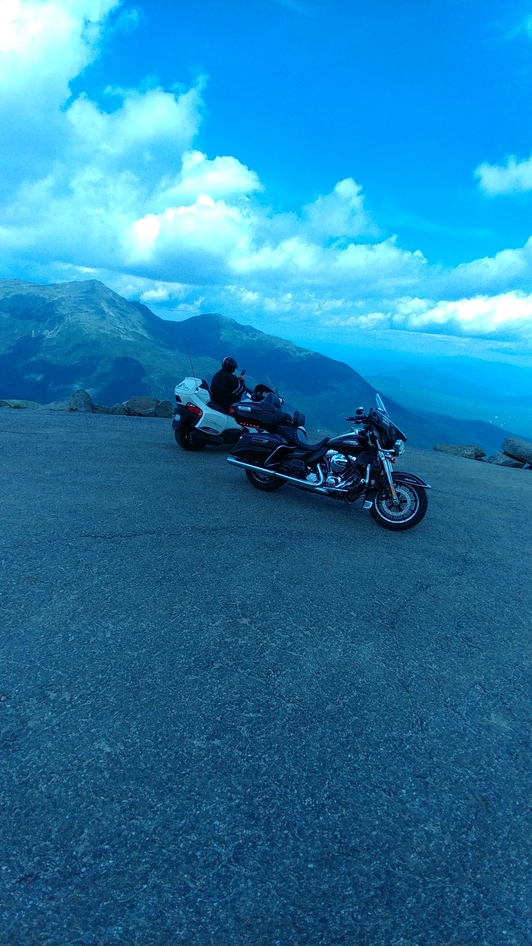
e those amazing scenic shots. But the destination today was really Mount Washington.

Mount Washington is located off hwy 16 about 15 miles north of hwy 302. The scenic road up the mountain claims to be the oldest amusement park in North America and the highest point you can drive a car (or motorcycle) east of the Rockies. I have tried on 2 other occasions to ride up this mountain but was disappointed because of the weather. Today it was bright and sunny 25C and virtually no wind. Perfect.

After paying our $17 each at the base of the mountain we noticed a very large sign warning us that the road is steep and twisty in areas and not always protected by barriers. If you suffer from vertigo or are afraid of heights, you are advised to park your vehicle and take the shuttle bus. Roz stopped and read the sign and asked if I was serious about this. I told her that we had come here specifically to ride this road, I was doing it; she could take the shuttle if she wanted. She followed, ‘But don’t go too fast’.

The road is 8 miles long and except for one small section is well paved. I did not find it all that twisty or steep and because we were on bikes, did not have to get too near any steep embankments when downward cars passed. We have been on much steeper and twistier roads on our travels but never anything this high into the sky. There are a few spots to pull over on the route but most are not well paved and one had fresh, deep gravel making it difficult to stop. At the top, 6400 feet, is a large graveled parking lot. Up a set up steps, about equal to 2 stories, is a large building with bathrooms, a small café and a gift shop. All were much too crowded to be bothered with, I was more interested in climbing the last 20 feet or so and standing at the cairn marking the highest point. Certainly an amazing and exhilarating sight. One of the things that struck me most was the wind. As calm and warm as it was down at the base, the wind at the top howled and it was necessary hang onto the railing to make sure you didn’t get blown over. And it was cold, only 12C according to the gauge on the Harley. I walked around soaking up the atmosphere, trekked over to the weather station with markers commemorating hikers and weathermen. Apparently the highest wind ever recorded was on this peak. Whew, that must have been a real scary day. I walked over to the railing and peered over the edge at Roz down there in the parking lot. Yep, well worth the trip; fascinating adventure.

On my way back down to the Harley, I passed a little sign with an arrow pointing to the way down via a hiking trail. I cant imagine walking all the way up, but just then a young guy emerged to greet his friend claiming that it only took six hours from his campsite. He would love to get a ride back down. Personally I would have taken the opposite tack. On the ride back down I told Roz to lead, I figured she could find her way. As we approached the small dirt section, we noticed a car pointed toward us but it was backing down the mountain. As we got closer we noticed a woman further down, in the middle of the roadway, with her cell phone to her ear and screaming. ‘I cant do this, I cant go any further. I cant, I cant’. Apparently she was the driver of the car now parked in the centre of the roadway and was talking to the driver of the car backing down the road. I guess she either did not see the sign at the base or had been talked into ignoring it. We squeezed past and wondered how they were going to resolve this problem; there were no pull off or turn around areas handy. But I’m sure the staff had seen this scene more than once.

We continued up hwy 16 to hwy 2, over to 115 and back down to Franconia. We had missed lunch so decided to simply revisit the Dutch Treat for an early dinner. We fell into bed early that evening convinced that the ride up Mt Washington would be the highlite of this trip.

Well maybe.


EastCoast tour 2017, Part 1

East coast tour 2017


Part one;

Burlington, Ont to Franconia, VT

I have been looking forward to having the time to do a real road trip. My semi-retirement was going just as planned. I still had about 100 hours of work to complete each month and with some shrewd scheduling I could get it done in two weeks. That left two whole weeks for road trips each month. And now  that Roz had a large touring trike, there was nothing to stop us from completing that longer tour. The trip to Drummondville (see ‘Spyder Homecoming’) had been a test ride of sorts. Now for the real thing; Cape Breton.

At 10am on July 19 we were all set and ready to roll. Even though it was sunny and warm, a quick check of the weather showed that a front was moving in and rain was expected by noon. This rain would last only for an hour or so then the sun would come out for most of the afternoon. So off we went.

At about 11:30am as we got close to Bownanville, we noticed the black cloud chasing us. Seemed like a good time to stop for lunch. The Toasted Walnut on King Street was the perfect spot. The rain started just as we got off the bikes and walked across the street. We had arrived just ahead of the lunch crowd and settled at a tiny table near the door. The Toasted Walnut is a small bakery-café with seating for perhaps 20 patrons. By 12 noon the line-up was out the door. Most were grabbing sandwiches and returning to their offices, some waited to get a table. We each ordered the soup, a hearty vegetable with ginger along with a chef salad. Absolutely delicious.When we had finished our lunch it was still raining quite heavily and we don’t usually have dessert at lunch time. We explained to the waitress that we were riding bikes and were in no hurry to get out until the rain stopped. ‘No problem, you can stay as long as you want’. We ordered another coffee each and a butter tart to share. The rain finally stopped just before 2pm and off we went.

Our first scheduled stop on this trip was to visit a longtime friend, Dimitri who had moved from Toronto 2 years ago into an old farm house nea
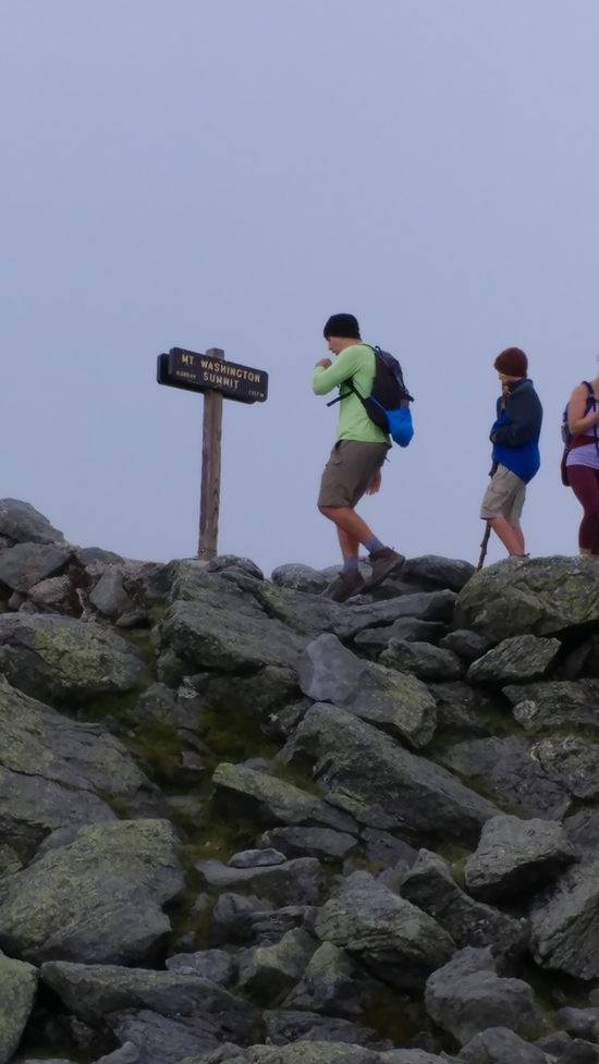
r Warkworth. The roads in that area are well worth the ride with lots of rolling hills, sweeping turns and beautiful farm lands. Dimitri’s farmhouse is an old, fieldstone structure that he has renovated to suit their needs. The renos included an art studio, a performance space and recording studio. In addition to being an architect, Dimitri is an artist (painter) and a musician. He has created an absolutely amazing place. And I loved the 20 meter by 3 meter inground pool hidden behind the house, perfect for doing lengths. After an hour or so of witty conversation, a house tour and a great cup of fresh ground coffee we were ready to leave. I asked Dimitri where the nearest gas station was located, my tank was nearing empty. The nearest station was about 25kms away. I should be OK, but Dimitri insisted I take some gas from his lawn mower’s supply. I took about a litre and off we went. It was after 4pm and we had to get to Cornwall for the night, about 300kms away. After a quick stop at the Shell station, it was onto that boring 401.

As with previous visits to the Cornwall area, I booked a room at the Best Western. We have been here enough times to get to know some of the staff, our favourite is Tanya, the waitress most evenings in the dining lounge. Tanya brought us each a local craft beer and made dinner suggestions. Tonight’s special was fish and chips which Roz ordered, I decided on the house burger with salad. There is something very comforting about being made to feel at home when you are away from home. About 10:30 we headed back to our room with a beer in hand as a nightcap. This certainly was a great start to our adventure.

This particular Best Western serves a very good hot buffet breakfast that is included in the room rate. At check-in they give you a voucher that is good for the buffet, but if you don’t see what you want there, you can order from the menu and take $5 off the price. Perhaps it is because we have been there a few times, or perhaps they do this for any guest, Roz always orders from the menu and they never charge us any extra. Like I said, the staff is special here and they know the meaning of service and make you feel special as their guest.

As part of my regular morning routine, I always check over the bikes and give them each a quick cleaning. I always take my own micro-fibre towels and a can of lemon Pledge. I wet one of the towels at the sink before I leave the room to blot down the worst smudges. The Pledge does a fantastic job on removing bug guts from the windshield and giving an acceptable shine to the metal parts. The can takes up very little space and replacement is available anywhere along the route.

As happens quite often lately, while I am cleaning the bikes and loading the luggage, someone stops to admire them. Then they ask about the Spyder. Most of the admirers are seniors and I can see the gleam in their eyes, they would love to just jump onboard and take off on an adventure. The attraction of the Spyder is obvious, it has 3 wheels, it just looks a lot safer and easier for a novice to ride. The fascination of a large touring motorcycle is equally obvious; dreams.

The plan for today was directly across the bridge at Cornwall into the states and secondary hiways all the way to our pre-booked hotel, the White Mountains Inn in Franconia, NH. I had booked 2 nights there to give us an opportunity to explore the area. The rest of our vacation would be more ad hoc, making plans no more than a day in advance depending on weather and what we found.

As soon as you cross the bridge into the USA route 37 ends at Hwy 11, we turned left and followed the meandering roadway for a few hours. We stopped in the town of Mooers for fuel and at Sandi’s Kountry Kitchen for lunch. The diner was old and was decorated in cheesy Adirondach antiques, including a ‘Muskoka’ chair, a butter churn, a set of broken skis on the wall and an old toboggan. There was only one other patron in the room and our waitress was eager to chat. She was a local, born only a few miles away. She had worked at the state prison about 20 miles down the hiway for 10 years. It was a well paid job but she preferred the restaurant. We ordered the burger and fries that she recommended. The fries were fresh cut and properly cooked, the burger pretty ordinary.

We continued along hwy 11 past Hiway 87, turning right onto Hwy 2 at Rouses Point. Hwy 2 travels down the Grand Island peninsula thru North and South Hero. In places the water of Lake Champlain is visible on both sides of the roadway. We decided to stay on hwy 2 and travel into Burlington. I made a quick stop at a park entrance to take a selfie of the sign over the entranceway, City of Burlington. Unfortunately hwy 2 winds its way thru the downtown core; it was 4:30pm, rush hour hit. We had intended to stop and wander around but could not find a parking space so continued on, settling for a McDonalds on the eastern edge of the city.

We decided that it was too late to stop by the Ben and Jerry factory if we were going to make it to our hotel at a reasonable hour. Hwy 2 parallels Hwy 87 until it gets to Montpleier where 87 dives south. The road meanders around the Green Mountains thru some fascinating scenery, but it is not a quick ride if you intend to get somewhere soon. We turned on Hiway 93 at St Johnsbury for the last leg of our trip today.

We arrived at the Best Western in Franconia about 6pm.